Saint-Leger-aux-Bois nr. Foucarmont / Saint-Léger-aux-Bois
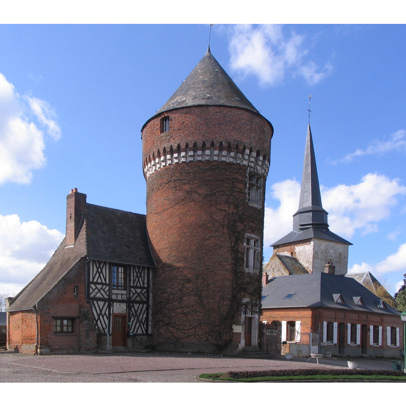
Image copyright © Brunodesacacias, 2010
GFDL / CC-BY-SA-3.0,2.5,2.0,1.0
Results: 1 records
view of church exterior in context
Scene Description: the church is partailly visible behind La tour du Duc de Mailly, to the right
Copyright Statement: Image copyright © Brunodesacacias, 2010
Image Source: edited detail of a digital photograph taken 1 April 2010 by Brunodesacacias [https://commons.wikimedia.org/wiki/File:2010_Bray_014.jpg] [accessed 23 July 2016]
Copyright Instructions: GFDL / CC-BY-SA-3.0,2.5,2.0,1.0
INFORMATION
Font ID: 20674LEG
Object Type: Baptismal Font1
Font Century and Period/Style: 16th century
Church / Chapel Name: Église paroissiale Saint-Léger à Saint-Léger-aux-Bois
Font Location in Church: [cf. FontNotes]
Church Patron Saint(s): St. Leger [aka Ledger, Léger, Leodegar, Leodegarius]
Church Notes: church here dated 16thC -- listed in Mérimée [ref.: IA00057356 ]: "Eglise 1ère moitié 16e siècle ; la chapelle actuellement sacristie, aurait été construite en 1510 pour Jacques de Mailly, daté par source ; restaurations importantes 18e siècle, date de 1751 sur le berceau lambrissé non repérée ; date de 1819 gravée dernière travée, mur nord de la nef ; restaurations des couvertures de la nef et du transept et du décor en 1868 après incendie et en 1899".
Church Address: Rue du Bourg, 76340 Saint-Léger-aux-Bois, France -- Tel.: +33 2 35 93 50 75
Site Location: Seine-Maritime, Normandie, France, Europe
Directions to Site: Located off the D-920, 4-5 km SE of Foucarmont, halfway [ca. 40 km?] between Dieppe (WNW) and Amiens (NNE)
Ecclesiastic Region: Diocèse d'Amiens
Historical Region: Haute-Normandie
Font Notes:
Click to view
[NB: we have no information on the font here]
COORDINATES
UTM: 31U 400050 5521016
Latitude & Longitude (Decimal): 49.8344, 1.6117
Latitude & Longitude (DMS): 49° 50′ 3.84″ N, 1° 36′ 42.12″ E