Cuellar No. 9 / Cuéllar
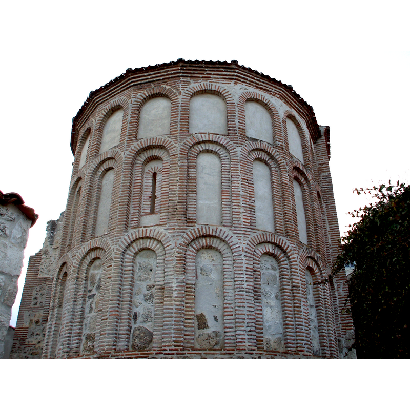
Image copyright © [in the public domain]
CC-Zero
Results: 4 records
view of church exterior - apse
Copyright Statement: Image copyright © [in the public domain]
Image Source: digital photograph taken 30 October 2008 by Romerin [https://commons.wikimedia.org/wiki/File:AbsideSantiago2Cuellar.jpg] [accessed 15 July 2016]
Copyright Instructions: CC-Zero
view of church exterior - southeast end
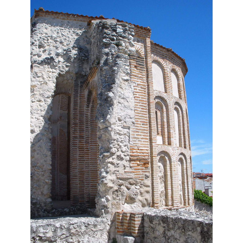
Copyright Statement: Image copyright © [in the public domain]
Image Source: digital photograph taken 5 July 2016 by Zarateman [https://commons.wikimedia.org/wiki/File:Cuéllar_-_Ábside_de_la_Iglesia_de_Santiago_1.jpg] [accessed 15 July 2016]
Copyright Instructions: CC-Zero
view of church interior - apse
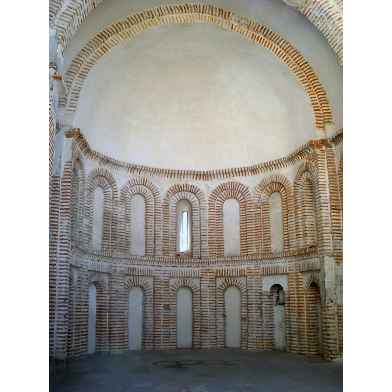
Copyright Statement: Image copyright © [in the public domain]
Image Source: digital photograph taken 7 November 2009 by Zarateman [https://commons.wikimedia.org/wiki/File:Cuellar_-_Abside_de_Santiago_2.JPG] [accessed 15 July 2016]
Copyright Instructions: CC-Zero
view of church interior - nave - looking east
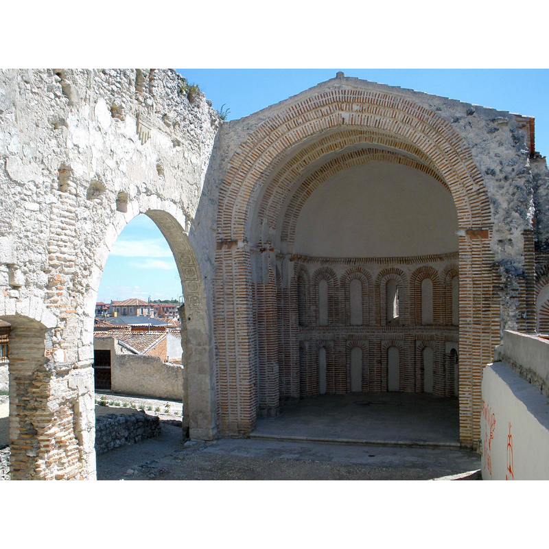
Scene Description: Source caption: "Ábside mudéjar-románico de la Iglesia de Santiago, en Cuéllar"
Copyright Statement: Image copyright © [in the public domain]
Image Source: digital photograph taken 3 November 2009 by Zarateman [https://commons.wikimedia.org/wiki/File:Cuellar_-_Abside_de_Santiago_1.JPG] [accessed 15 July 2016]
Copyright Instructions: CC-Zero
INFORMATION
Font ID: 20667CUE
Object Type: Baptismal Font1?
Font Century and Period/Style: 13th century (mid?), Late Romanesque / Early Gothic?
Church / Chapel Name: Iglesia de Santiago [ruins only]
Font Location in Church: [disappeared]
Church Patron Saint(s): St. James the Greater [aka James the Great, James the Elder]
Church Notes: Mudejar church here documented 1244; collapsed early-20thC;
Church Address: 40200 Cuéllar, Segovia, Spain
Site Location: Segovia, Castilla y León, Spain, Europe
Directions to Site: Located off the C-112, S of the A-610, 50 km SE of Valladolid, 60 NNW of Segovia capital -- the ruins of this church are located on the upper area of town
Ecclesiastic Region: [Diócesis de Segovia]
Historical Region: Tierra de Pinares
Additional Comments: disappeared font? (the one from the mid-13thC church here)
Font Notes:
Click to view
[NB: we have no information on the font of the mid-13th century church here]
COORDINATES
UTM: 30T 390046 4584058
Latitude & Longitude (Decimal): 41.400552, -4.315374
Latitude & Longitude (DMS): 41° 24′ 1.99″ N, 4° 18′ 55.34″ W