Rocquigny nr. Rubigny
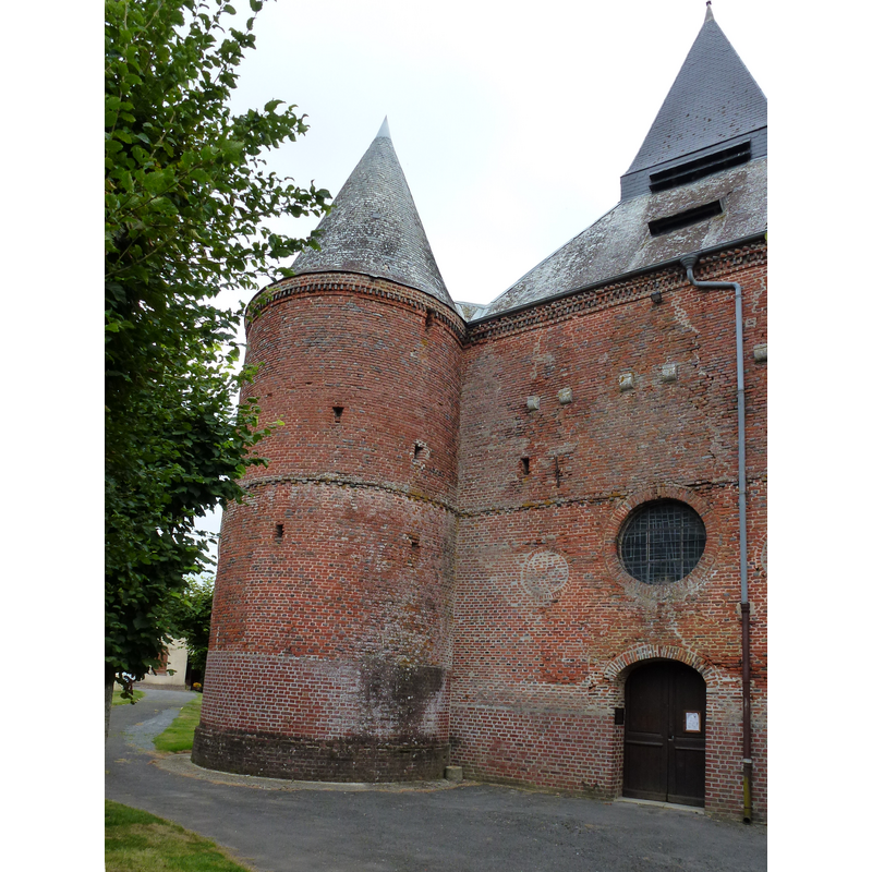
Image copyright © [in the public domain]
CC-Zero
Results: 2 records
view of church exterior - west end
Scene Description: Source caption: "Rocquigny (Ardennes) église St.Christophe, tour à gauche de l'entrée"
Copyright Statement: Image copyright © [in the public domain]
Image Source: digital photograph taken 24 August 2012 by Havang(nl) [https://commons.wikimedia.org/wiki/File:Rocquigny_(Ardennes)_église,_tour_gauche.JPG] [accessed 11 June 2016]
Copyright Instructions: CC-Zero
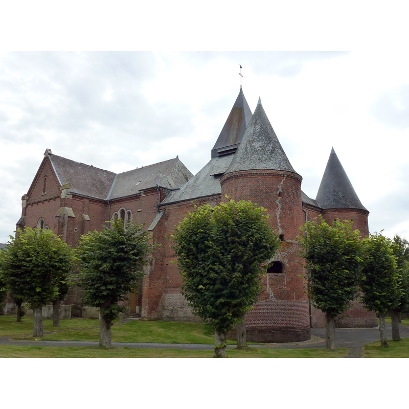
view of church exterior - northwest view
Copyright Statement: Image copyright © [in the public domain]
Image Source: digital photograph taken 24 August 2012 by Havang(nl) [https://commons.wikimedia.org/wiki/File:Rocquigny_(Ardennes)_église_St.Christophe_(1).JPG] [accessed 11 June 2016]
Copyright Instructions: CC-Zero
INFORMATION
Font ID: 20607ROC
Object Type: Baptismal Font1?
Font Century and Period/Style: Medieval
Church / Chapel Name: Église Saint-Christophe de Rocquigny
Font Location in Church: [disappeared]
Church Patron Saint(s): St. Christopher
Church Notes: earlier church fortified in the 16thC
Church Address: 15 Place Jean Mermoz, 08220 Rocquigny, France
Site Location: Ardennes, Grand Est, France, Europe
Directions to Site: Located off the D14-D36 crossroads, between Rubigny (W) and Montmeillant (E), halfway between Laon (WSW) and Charleville-Mézières (ENE)
Ecclesiastic Region: Diocèse of Reims
Historical Region: Crêtes Préardennaises, Thiérache
Additional Comments: disappeared font? (the one from the medieval church here)
Font Notes:
Click to view
[NB: we have no information on the font of the original church here]
COORDINATES
UTM: 31U 589979 5504842
Latitude & Longitude (Decimal): 49.689375, 4.247506
Latitude & Longitude (DMS): 49° 41′ 21.75″ N, 4° 14′ 51.02″ E