Maisoncelle in Maisoncelle-et-Villers
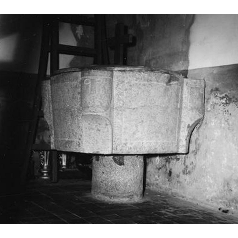
Image copyright © Ministère de la Culture (France), Médiathèque de l'architecture et du patrimoine (objets mobiliers), 2016
CC-BY-SA-NC-ND 4.0 = Licence Ouverte / CC-BY-SA-4.0
Results: 3 records
view of font and cover
Copyright Statement: Image copyright © Ministère de la Culture (France), Médiathèque de l'architecture et du patrimoine (objets mobiliers), 2016
Image Source: digital image of an undated B&W photograph in Mémoire [ref.: AP08W00501] [www.culture.gouv.fr/Wave/image/memoire/1373/sap83_08w00501_p.jpg] [accessed 10 June 2016]
Copyright Instructions: CC-BY-SA-NC-ND 4.0 = Licence Ouverte / CC-BY-SA-4.0
human figure - head - 4
Copyright Statement: Image copyright © Ministère de la Culture (France), Médiathèque de l'architecture et du patrimoine (objets mobiliers), 2016
Image Source: digital image of an undated B&W photograph in Mémoire [ref.: AP08W00501] [www.culture.gouv.fr/Wave/image/memoire/1373/sap83_08w00501_p.jpg] [accessed 10 June 2016]
Copyright Instructions: CC-BY-SA-NC-ND 4.0 = Licence Ouverte / CC-BY-SA-4.0
view of church exterior - north view
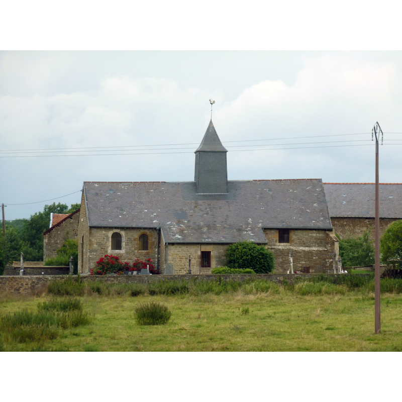
Scene Description: Source caption: "Vue de l'église de Maisoncelle-et-Villers depuis la route de la Raminoise"
Copyright Statement: Image copyright © Francis08, 2011
Image Source: digital photograph taken 19 July 2011 by Francis08 [https://commons.wikimedia.org/wiki/File:Eglise_Sainte-Geneviève_de_Maisoncelle-et-Villers.jpg] [accessed 10 June 2016]
Copyright Instructions: CC-BY-SA-3.0
INFORMATION
Font ID: 20604MAI
Object Type: Baptismal Font1
Font Century and Period/Style: 12th - 13th century, Late Romanesque
Church / Chapel Name: Église paroissiale Sainte-Geneviève à Maisoncelle
Font Location in Church: Inside the church
Church Patron Saint(s): St. Genevieve [aka Genofeva, Genoveva]
Church Address: 08450 Maisoncelle-et-Villers, France
Site Location: Ardennes, Grand Est, France, Europe
Directions to Site: Maisoncelle was merged with Villers-devant-Raucourt in 1828 forming the new commune of Maisoncelle-et-Villers. It is located off the D27, between Chémery-sur-Bar (W) and Raucourt-et-Flaba (E), 12 km S of Sedan, SE of of Charleville-Mézières
Ecclesiastic Region: Diocèse of Reims
Historical Region: Les Trois Cantons
Font Notes:
Click to view
Limestone [cf. Palissy infra] baptismal font consisting of a roughly cylindrical basin decorated with four large human heads protruding at 90-degree angles, with a leaf-like motif below the heads; on a short cylindrical pedestal base. Wooden font cover, round and flat; date unknown. Listed and illustrated in Palissy [ref.: PM08000305]: "Cuve baptismale romane à paroi verticale, cylindrique, cantonnée de quatre têtes d'angle de type cylindrique, toutes semblables les unes aux autres [...] 12e siècle [...] pierre de Givet".
COORDINATES
UTM: 31U 638062 5495667
Latitude & Longitude (Decimal): 49.5978, 4.9106
Latitude & Longitude (DMS): 49° 35′ 52.08″ N, 4° 54′ 38.16″ E
MEDIUM AND MEASUREMENTS
Material: stone, limestone (pierre de Givet)
Font Shape: cylindrical, mounted
Basin Interior Shape: round
Basin Exterior Shape: round
Diameter (includes rim): 83-105 cm*
Basin Total Height: 45 cm*
Font Height (less Plinth): 78 cm*
Notes on Measurements: * Palissy [ref.: PM08000305]
LID INFORMATION
Material: wood
Apparatus: no
Notes: [cf. FontNotes]
REFERENCES
- France, Ministère de la culture, Inventaire Général, Mémoire / POP : la plateforme ouverte du patrimoine (Ministère de la culture, Inventaire Général), 2024. URL: https://www.pop.culture.gouv.fr/search/mosaic?base=%5B%22Photographies%20%28M%C3%A9moire%29%22%5D.
- France, Ministère de la culture, Inventaire Général, Palissy (France, Ministère de la culture), France, Ministère de la culture. URL: http://www.culture.fr/public/mistral/palissy.