Armedilla / La Armedilla, nr. Cogeces del Monte, Monasterio de Santa María de la Armedilla
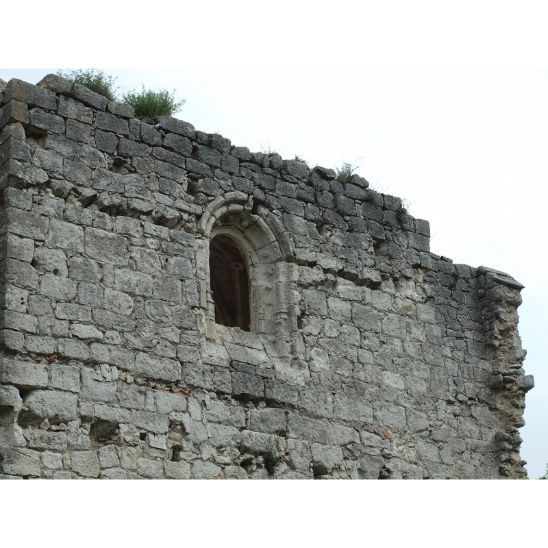
Image copyright © Mikel Unanue, 2016
Image and permission received (e-mail of 25 May 2016
Results: 10 records
view of church exterior - detail
Copyright Statement: Image copyright © Mikel Unanue, 2016
Image Source: digital image taken 2 May 2015 by Mikel Unanue
Copyright Instructions: Image and permission received (e-mail of 25 May 2016
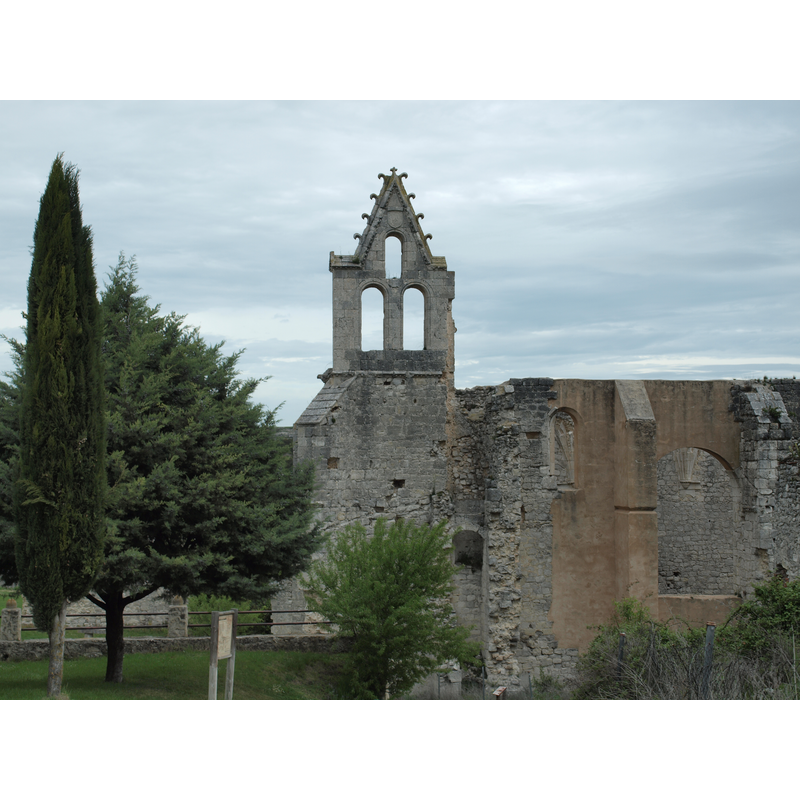
view of church exterior - southwest end
Copyright Statement: Image copyright © Mikel Unanue, 2016
Image Source: digital image taken 2 May 2015 by Mikel Unanue
Copyright Instructions: Image and permission received (e-mail of 25 May 2016
view of church exterior - south view
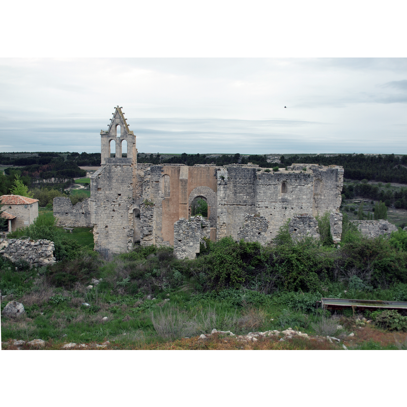
Scene Description: the ruins of the early-15thC monastery, built over an earlier church of the 12thC
Copyright Statement: Image copyright © Mikel Unanue, 2016
Image Source: digital image taken 2 May 2015 by Mikel Unanue
Copyright Instructions: Image and permission received (e-mail of 25 May 2016
view of church exterior - southwest end
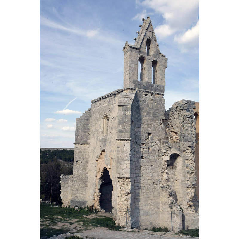
Scene Description: the ruins of the early-15thC monastery, built over an earlier church of the 12thC
Copyright Statement: Image copyright © Patronato de Turismo, Diputación de Valladolid, 2016
Image Source: digital image in the Patronato de Turismo, Diputación de Valladolid [www.provinciadevalladolid.com/es/cogeces-monte] [accessed 24 May 2016]
Copyright Instructions: No known copyright restriction / Fair Dealing
view of church interior - chancel - apse
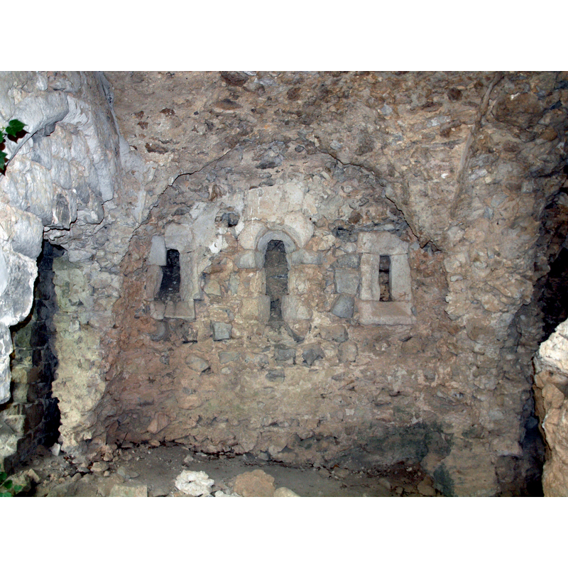
Copyright Statement: Image copyright © Mikel Unanue, 2016
Image Source: digital image taken 2 May 2015 by Mikel Unanue
Copyright Instructions: Image and permission received (e-mail of 25 May 2016
view of church interior - nave - looking west?
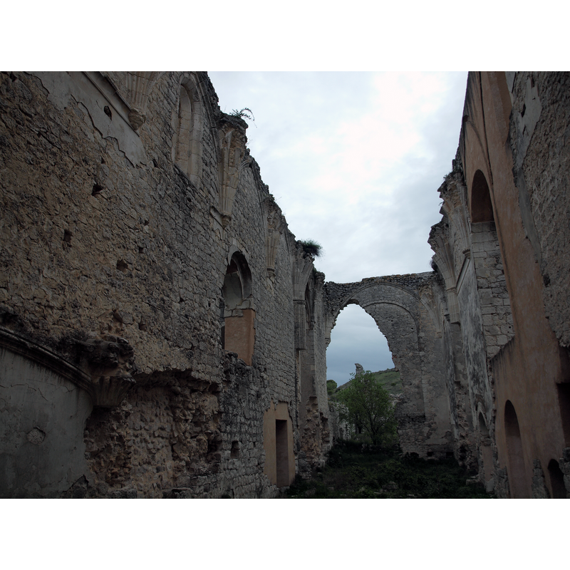
Copyright Statement: Image copyright © Mikel Unanue, 2016
Image Source: digital image taken 2 May 2015 by Mikel Unanue
Copyright Instructions: Image and permission received (e-mail of 25 May 2016
view of church interior - statue - Madonna and Child
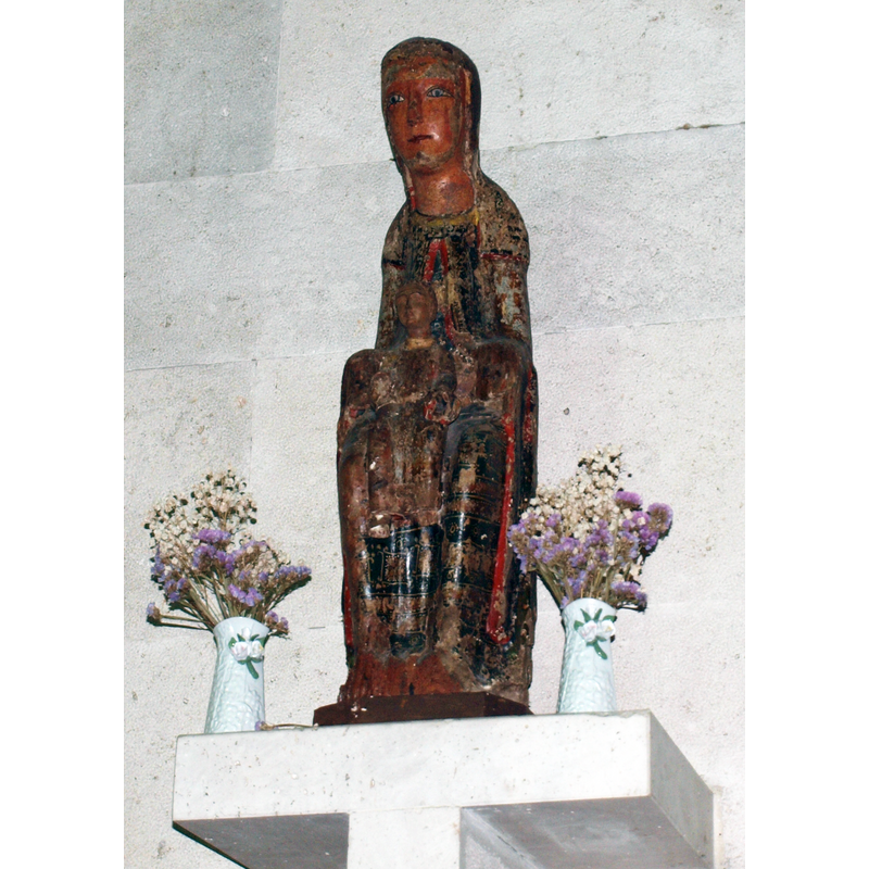
Scene Description: 12thC Madonna and Child originally from the iglesia del Monasterio de Santa María de la Armedilla, now in ruins; the statue is now at the nearby parish church of Cogeces del Monte
view of church exterior in context
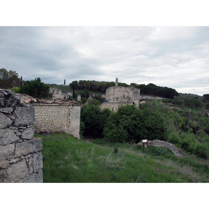
Scene Description: the ruins of the monastery
Copyright Statement: Image copyright © Mikel Unanue, 2016
Image Source: digital image taken 2 May 2015 by Mikel Unanue
Copyright Instructions: Image and permission received (e-mail of 25 May 2016
information
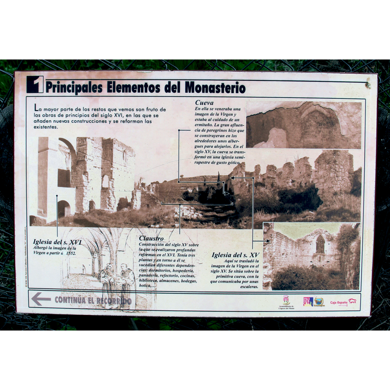
Copyright Statement: Image copyright © Mikel Unanue, 2016
Image Source: digital image taken 2 May 2015 by Mikel Unanue
Copyright Instructions: Image and permission received (e-mail of 25 May 2016
information
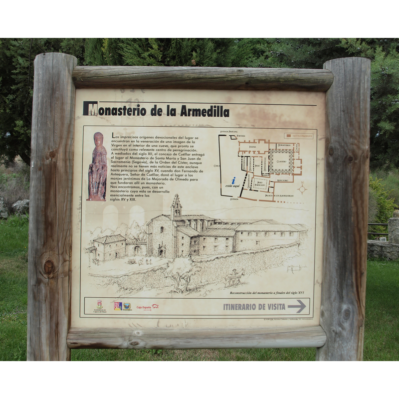
Copyright Statement: Image copyright © Mikel Unanue, 2016
Image Source: digital image taken 2 May 2015 by Mikel Unanue
Copyright Instructions: Image and permission received (e-mail of 25 May 2016
INFORMATION
Font ID: 20574COG
Object Type: Baptismal Font1?
Font Century and Period/Style: 12th century, Romanesque
Church / Chapel Name: Iglesia del Monasterio de Santa María de la Armedilla [in ruins]
Font Location in Church: [disappeared]
Church Patron Saint(s): St. Mary the Virgin
Church Notes: original 12thC church of a possible Cistercian monastery; later, ca.1400, given to the Orden de San Jerónimo [Ordo Sancti Hieronymi]; modified 16thC
Church Address: VA-203, 20, 47313 Cogeces del Monte, Valladolid, Spain
Site Location: Valladolid, Castilla y León, Spain, Europe
Directions to Site: Located off the VA-203, 4 km from Cogeces del Monte, 45 km E of Valladolid capital
Historical Region: Campo de Peñafiel, Tierra de Pinares
Additional Comments: disappeared font? (the one from the 12thC monastery church here)
Font Notes:
Click to view
[NB: we have no information on the font of the 12th-century ruined monastery church]
COORDINATES
UTM: 30T 388088 4599543
Latitude & Longitude (Decimal): 41.539722, -4.341667
Latitude & Longitude (DMS): 41° 32′ 23″ N, 4° 20′ 30″ W