Corbie No. 2 / Corbeia
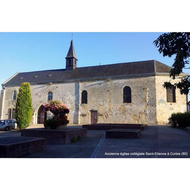
Image copyright © Antoine Gerald, 2013
CC-BY-SA-3.0
Results: 3 records
view of church exterior - south view
Scene Description: a much-reduced version of the parish church in the 21stC; the church had lost the transepts and other parts by the end of the 18thC
Copyright Statement: Image copyright © Antoine Gerald, 2013
Image Source: digital photograph taken 5 September 2013 by Antoine Gerald [https://commons.wikimedia.org/wiki/File:Ancienne_église_collégiale_Saint-Etienne_à_Corbie_(80800).jpg] [accessed 8 May 2016]
Copyright Instructions: CC-BY-SA-3.0
view of church exterior and interior
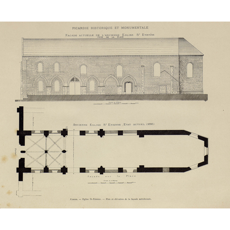
Scene Description: top: elevation of the south side -- bottom: interior plan
Copyright Statement: Image copyright © [in the public domain]
Image Source: edited detail of a héliogravure by P. Dujardin in Brutails (1893-1899)
Copyright Instructions: PD
view of church exterior - south view
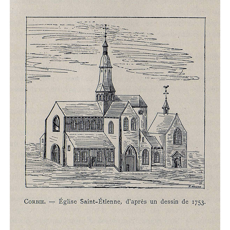
Scene Description: a mid-18thC artist's rendering of the collegiate church
Copyright Statement: Image copyright © [in the public domain]
Image Source: digital image of an engraving by H. Wagon of a 1753 drawing, in Brutalis (1893-1890)
Copyright Instructions: PD
INFORMATION
Font ID: 20540COR
Object Type: Baptismal Font1?
Font Century and Period/Style: 11th - 12th century, Romanesque
Church / Chapel Name: Église paroissiale [ancienne collégiale] Saint-Etienne [aka Notre-Dame]
Font Location in Church: [cf. FontNotes]
Church Patron Saint(s): St. Stephen or St. Mary
Church Notes: church noted in Brutalis (1893-1899: 450) as established by a bull from Clement III in May 1188 on an earlier church or chapel existing since 1072 -- listed in Mérimée [ref.: PA00116124]
Church Address: 2 Place Jean Catelas, 80800 Corbie, France
Site Location: Somme, Hauts-de-France, France, Europe
Directions to Site: Located 15 km E of Amiens
Ecclesiastic Region: Diocèse d'Amiens
Additional Comments: disappeared font? (the one from the 11th-12thC church here)
Font Notes:
Click to view
The entry for Corbie in the second volume of Expilly's Dictionnaire (1764) reports three "basiliques ou églises" in Corbie: the first dedicated to St. Peter & St. Paul, the second to St. John the Evangelist and the third to St. Stephen. Brutalis (1893-1899) reports the loss of the transepts, the reduction of the chancel with the loss of the additional chapels, and other parts of the church by the end of the 18th century, when if was turned into a barn, later an 'orphelinat'; there is mention of a font in the entry for this 11th-12th century church. [NB: we have no information on the font from the original church here].
COORDINATES
UTM: 31U 464753 5528683
Latitude & Longitude (Decimal): 49.909492, 2.509099
Latitude & Longitude (DMS): 49° 54′ 34.17″ N, 2° 30′ 32.75″ E
REFERENCES
- Brutails, Jean-Auguste, La Picardie historique et monumentale, Amiens: Société des antiquaires de Picardie. Fondation Edmond Soyez / Imprimerie Yvert et Tellier, 1893-1899, vol. 6: 449-450
- Expilly, Jean-Joseph, abbé, Dictionnaire géographique, historique et politique des Gaules et de la France, Avignon [etc.]: Desaint et Saillant [etc.], 1763-1770, vol. 2: 469