Beauchamps No. 2 / Beauchamp / Beauchamps nr. Abbeville / Lieu-Dieu-en-Ponthieu
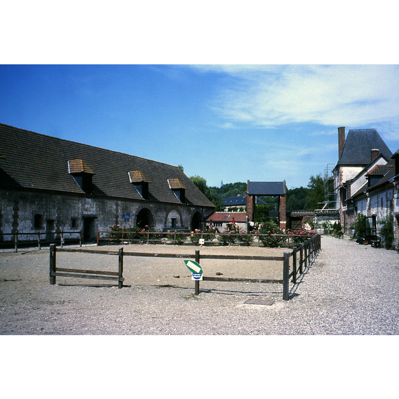
Image copyright © Certosa di Firenze, 2016
No known copyright restriction / Fair Dealing
Results: 2 records
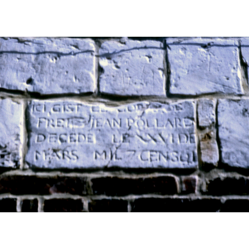
view of church exterior - detail
Scene Description: an inscribed stone perhaps from the disappeared abbey
Copyright Statement: Image copyright © Certosa di Firenze, 2016
Image Source: digital image of a photograph taken by Stephen Tobin [www.cistercensi.info/abbazie/abbazie.php?ab=739] [accessed 1 May 2016]
Copyright Instructions: No known copyright restriction / Fair Dealing
view of context
Scene Description: the grounds of the former abbey, later a farm, a "centre équestre' since 1986
Copyright Statement: Image copyright © Certosa di Firenze, 2016
Image Source: digital image of a photograph taken by Stephen Tobin [www.cistercensi.info/abbazie/abbazie.php?ab=739] [accessed 1 May 2016]
Copyright Instructions: No known copyright restriction / Fair Dealing
INFORMATION
Font ID: 20520BEA
Object Type: Baptismal Font1?
Font Century and Period/Style: 12th century (late?), Romanesque
Church / Chapel Name: Église de l'Abbaye du Lieu-Dieu [disappeared]
Font Location in Church: [disappeared]
Church Notes: Cistercian abbey church built on a former Galo-Roman site; documented 1191 [source: Daniel François & Pascale Touzet, 'Découvertes archéologiques à Beauchamps (Somme), Abbaye du Lieu-Dieu' ( Cahiers archéologiques de Picardie, 1978, vol. 5, no. 1 (255-261 ) [www.persee.fr/doc/pica_0398-3064_1978_num_5_1_1272] [accessed 1 May 2016]] -- abbey church destroyed during the Revolution
Church Address: [abbey ruins were located to the north of the parish church at Beauchamps]
Site Location: Somme, Hauts-de-France, France, Europe
Directions to Site: The former abbey became a hamlet [farm?] of Beauchamps, Somme, located to the SE of the village, between the D1015 (N) and the D49 (S)
Additional Comments: disappeared font? (the one from the late-12thC disappeared abbey church here)
Font Notes:
Click to view
[NB: we have no information on the font of the avvey church here]
COORDINATES
Latitude & Longitude (Decimal): 50.00564, 1.52016
Latitude & Longitude (DMS): 50° 0′ 20.3″ N, 1° 31′ 12.58″ E