Vaison-la-Romaine No. 2 / Vaison / Vasio Vocontiorum / Veisoun
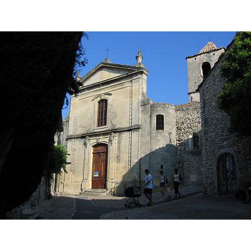
Image copyright © Marc Baronnet, 2004
GFDL / CC-BY-SA-3.0,2.5,2.0,1.0
Results: 2 records
view of church exterior - southwest end
Copyright Statement: Image copyright © Marc Baronnet, 2004
Image Source: digital photograph taken 24 July 2004 by Marc Baronnet [https://commons.wikimedia.org/wiki/File:Vaison_cathedrale.jpg] [accessed 2 April 2016]
Copyright Instructions: GFDL / CC-BY-SA-3.0,2.5,2.0,1.0
view of church exterior in context - north view
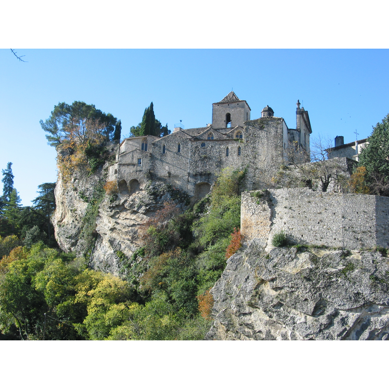
Scene Description: Source caption: "Église Sainte Marie de l'Assomption, dite Cathédrale-Haute, située dans la cité médiévale de Vaison-la-Romaine. Vue "côté Ouvèze"."
Copyright Statement: Image copyright © Pr. Mumu, 2015
Image Source: digital photograph taken 5 November 2015 by Pr. Mumu [https://commons.wikimedia.org/wiki/File:Cathédrale_de_la_Haute_Ville_Sainte_Marie_de_l'Assomption.jpg] [accessed 2 April 2016]
Copyright Instructions: CC-BY-SA-4.0
INFORMATION
Font ID: 20485VAI
Object Type: Baptismal Font1
Font Century and Period/Style: 17th century, Renaissance
Church / Chapel Name: Cathédrale Sainte-Marie-de-l'Assomption de Vaison-la-Romaine [aka cathédrale de la ville haute]
Font Location in Church: Inside the church
Church Patron Saint(s): St. Mary the Virgin
Church Notes: original church 12thC; re-built 1464; modified 17th and 18thC; became parochial 1897; was disused and closed for 25 years; restored in 2015 -- listed in Mérimée [ref.: PA00082183]
Church Address: 84110 Vaison-la-Romaine, France
Site Location: Vaucluse, Provence-Alpes-Côte d'Azur, France, Europe
Directions to Site: Located off the D977, betwen Villedieu (N) and Crestet (S), S of Enclave des Papes, NNE of Gigondas and Vacqueyras, N of Carpentras, 50 km from Avignon
Ecclesiastic Region: Diocèse d'Avignon [formerly in the Diocèse de Vaison, abolished in 1801]
Historical Region: Pays Voconce / Pays Vaison Ventoux -- Provence
Additional Comments: disappeared font(s)? (the one from the original 12thC chapel and the one from the 15thC re-built church)
Font Notes:
Click to view
Listed in Palissy [ref.: PM84000580] as a stone baptismal font of the 17th century.
COORDINATES
Latitude & Longitude (Decimal): 44.2382, 5.0746
Latitude & Longitude (DMS): 44° 14′ 17.52″ N, 5° 4′ 28.56″ E
REFERENCES
- France, Ministère de la culture, Inventaire Général, Palissy (France, Ministère de la culture), France, Ministère de la culture. URL: http://www.culture.fr/public/mistral/palissy.