Tandridge / Tenrige
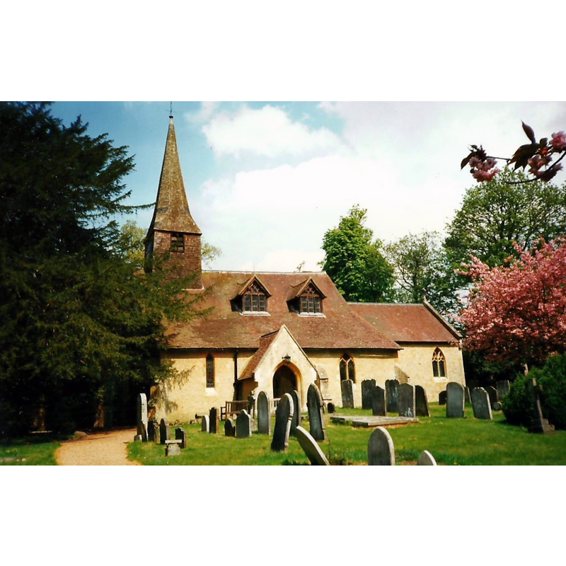
Image copyright © Roger Smith, 2010
CC-BY-SA-2.0
Results: 2 records
view of church exterior - south view
Scene Description: "At the west end is one of the largest and most ancient yews in England, almost as large as the better known Crowhurst yew. Though quite hollow, it is full of life."[www.british-history.ac.uk/vch/surrey/vol4/pp321-326] [accessed 28 March 2016]
Copyright Statement: Image copyright © Roger Smith, 2010
Image Source: photograph taken 13 May 1996 by Roger Smith [www.geograph.org.uk/photo/2205557] [accessed 28 March 2016]
Copyright Instructions: CC-BY-SA-2.0
view of church exterior - southeast view
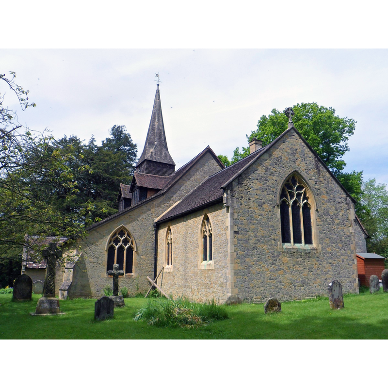
Copyright Statement: Image copyright © The Voice of Hassocks, 2013
Image Source: digital photograph taken 1 June 2013 by The Voice of Hassocks [whttps://commons.wikimedia.org/wiki/File:St_Peter's_Church,_Tandridge_Lane,_Tandridge_(NHLE_Code_1189811).JPG] [accessed 28 March 2016]
Copyright Instructions: CC-BY-SA-3.0
INFORMATION
Font ID: 20474TAN
Object Type: Baptismal Font1?
Font Century and Period/Style: 11th century, Pre-Conquest? / Norman
Church / Chapel Name: Parish Church of St. Peter
Church Patron Saint(s): St. Peter
Church Address: Tandridge Lane, Tandridge, Surrey RH7 6LL
Site Location: Surrey, South East, England, United Kingdom
Directions to Site: Located off (E) the A22, 3 km ESE of Godstone, SSE of Croydon
Ecclesiastic Region: Diocese of Southwark
Historical Region: Hundred of Tandridge
Additional Comments: disappeared font? (the one from the 11thC church here)
Font Notes:
Click to view
There is an entry for Tandridge [variant spelling] in the Domesday survey [http://opendomesday.org/place/TQ3750/tandridge/] [accessed 28 March 2016], but it mentions neither cleric nor church in it. The Victoria County History (Surrey, vol. 4, 1912) notes: "A church standing on the manor of Tillingdon is mentioned in the Domesday Survey. [...] Tandridge Church (if this is the same) afterwards belonged to Tandridge Priory, [...] being possibly given to that house by Odo de Dammartin, the founder. [...] 11th-century nave, about 40 ft. by 25 ft.; chancel, dating originally from the same period, 27 ft. by 20 ft. A south aisle was added to the nave in 1844, together with a porch, and a north aisle, from Sir Gilbert Scott's designs, in 1874 [...] The font, of white stone, with green marble shafts, is modern".
COORDINATES
UTM: 30U 707177 5681051
Latitude & Longitude (Decimal): 51.243144, -0.031649
Latitude & Longitude (DMS): 51° 14′ 35.32″ N, 0° 1′ 53.93″ W
REFERENCES
- Victoria County History [online], University of London, 1993-. URL: https://www.british-history.ac.uk.