Southwark No. 5 / Southwerk / Sudgeweork / Sudwerca / Sudwerche / Suthringa geweorc / Suthwerk / Suwerc
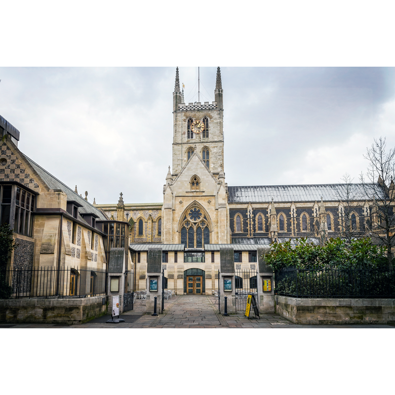
Image copyright © Garry Knight, 2013
CC-BY-SA-2.0
Results: 4 records
view of church exterior
Copyright Statement: Image copyright © Garry Knight, 2013
Image Source: digital photograph taken 23 February 2023 by Garry Knight [www.flickr.com/photos/8176740@N05/8569427445] [accessed 15 March 2016]
Copyright Instructions: CC-BY-SA-2.0
view of church exterior
![Source caption: "Detail from en:Image:Panorama of London by Claes Van Visscher, 1616.jpg, made in 1616 by Claes Van Visscher. It shows Old London Bridge in 1616, with Southwark Cathedral in the foreground. The spiked heads of executed criminals can be seen above the Southwark gatehouse." [NB: "This file has been extracted from another file: Panorama of London by Claes Van Visscher, 1616.jpg"]](/static-50478a99ec6f36a15d6234548c59f63da52304e5/compressed/0160318025_compressed.png)
Scene Description: Source caption: "Detail from en:Image:Panorama of London by Claes Van Visscher, 1616.jpg, made in 1616 by Claes Van Visscher. It shows Old London Bridge in 1616, with Southwark Cathedral in the foreground. The spiked heads of executed criminals can be seen above the Southwark gatehouse." [NB: "This file has been extracted from another file: Panorama of London by Claes Van Visscher, 1616.jpg"]
Copyright Statement: Image copyright © [in the public domain]
Image Source: detail from a 1616 engraving by Claes van Visscher by Angr [https://commons.wikimedia.org/wiki/File:London_Bridge_(1616)_by_Claes_Van_Visscher.jpg] [accessed 15 March 2016]
Copyright Instructions: PD
view of church interior - nave - looking west
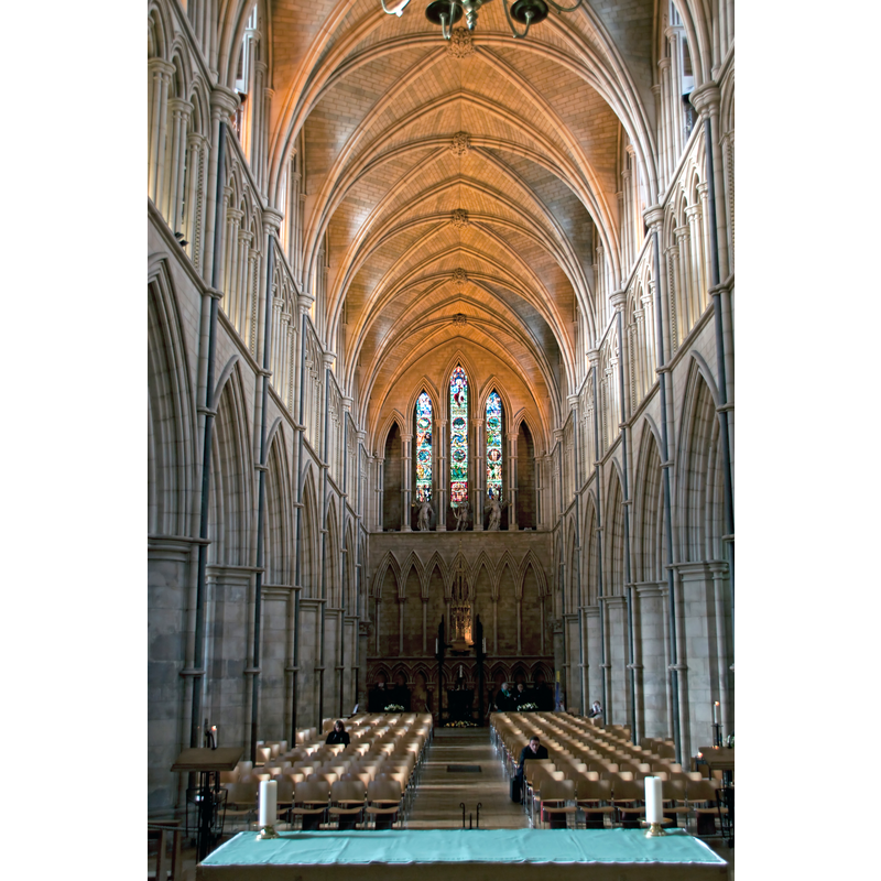
Copyright Statement: Image copyright © Tony Hispett, 2010
Image Source: digital photograph taken 27 October 2010 by Tony Hisgett [www.flickr.com/photos/hisgett/5137507970/] [accessed 15 March 2016]
Copyright Instructions: CC-BY-SA-2.0
view of church interior - nave - looking east
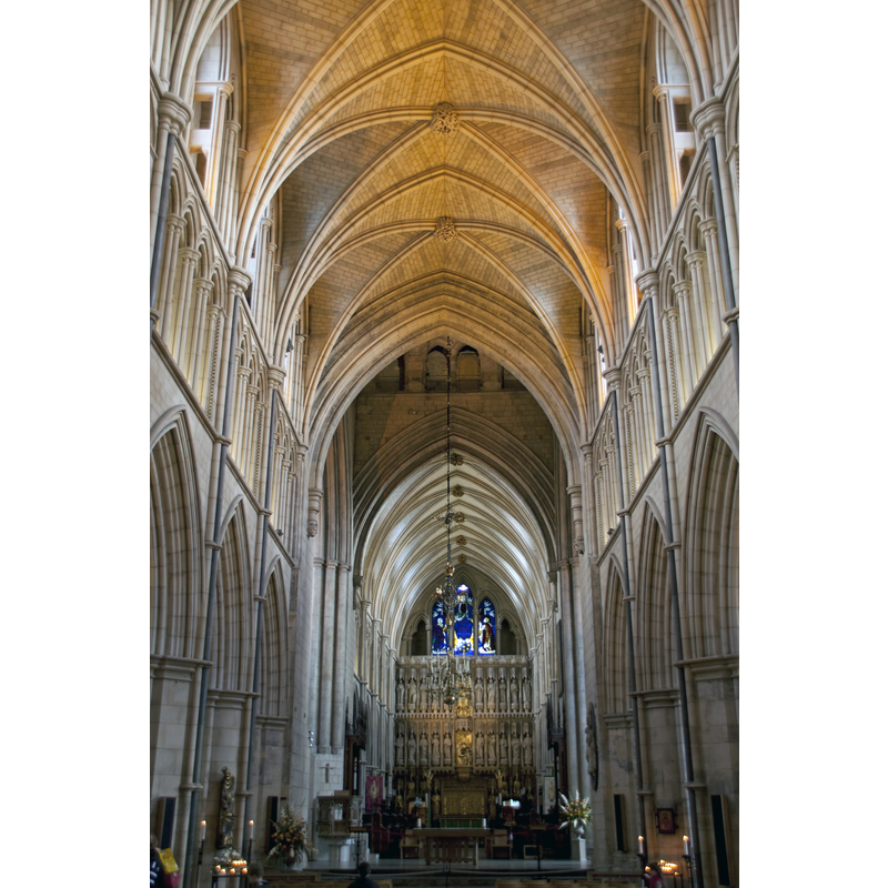
Copyright Statement: Image copyright © Tony Hispett, 2010
Image Source: digital photograph taken 27 October 2010 by Tony Hisgett [www.flickr.com/photos/hisgett/5136913089/] [accessed 15 March 2016]
Copyright Instructions: CC-BY-SA-2.0
INFORMATION
Font ID: 20435SOU
Object Type: Baptismal Font1?
Font Date: ca. 1106?
Font Century and Period/Style: 12th century (early?), Late Norman
Church / Chapel Name: Cathedral and Collegiate Church of St Saviour and St Mary Overie [formerly priory Church of St Mary Overy]
Church Patron Saint(s): Jesus Christ
Church Notes: Augustinian priory of 1106; present building 13th-15thC, with major 19thC re-building
Site Location: Greater London, South East, England, United Kingdom
Directions to Site: Located N of Borough Market, on the S bank of the River Thames, by the London Bridge
Ecclesiastic Region: Diocese of Southwark [formerly in the dioceses of Winchester and Rochester]
Historical Region: Hundred of Brixton -- formerly in Surrey
Additional Comments: disappeared font? (the one from the early-12thC church here)
Font Notes:
Click to view
The Victoria County History (Surrey, vol. 4, 1912) notes: "The church stands on the west side of the Borough, immediately to the south of London Bridge. Although there appears to have been a religious house on this site from a remote period, the first certain statement that can be made with regard to the present church is that in 1106 William Pont de l'Arche and William Dauncey refounded the priory for canons regular of the Augustinian order and that Bishop Giffard was associated with them, building the nave after 1107, when he returned from exile. Of this early work there are a few remnants [...] In 1207 the church was almost wholly destroyed by fire." The church was re-built and later remodelled through the centuries; the VCH mentions no font in it. There is no mention of a font here in Edward Walford, 'Southwark: St Saviour's Church', in Old and New London: Volume 6 (London, 1878), pp. 16-29 [www.british-history.ac.uk/old-new-london/vol6/pp16-29] [accessed 14 March 2016].
COORDINATES
UTM: 30U 701964 5710125
Latitude & Longitude (Decimal): 51.506111, -0.089722
Latitude & Longitude (DMS): 51° 30′ 22″ N, 0° 5′ 23″ W
REFERENCES
- Victoria County History [online], University of London, 1993-. URL: https://www.british-history.ac.uk.