Wimbledon / Wimbledone / Wimbleton / Wimmeldon / Wymbeldon / Wymelton / Wymmeldon
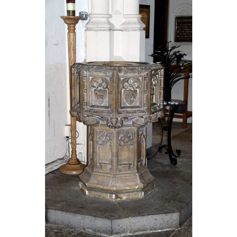
Image copyright © John Salmon, 2015
CC-BY-SA-2.0
Results: 4 records
view of font
Scene Description: the modern font
Copyright Statement: Image copyright © John Salmon, 2015
Image Source: digital photograph taken 11 March 2015 by John Salmon [www.geograph.org.uk/photo/4383995] [accessed 14 March 2016]
Copyright Instructions: CC-BY-SA-2.0
view of church exterior - southwest view
![EXT SW digital photograph taken 11 March 2015 by John Salmon [www.geograph.org.uk/photo/4383911] [accessed 14 March 2016]
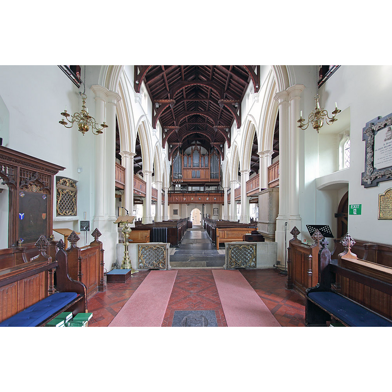
INT E digital photograph taken 11 March 2015 by John Salmon [www.geograph.org.uk/photo/4383916] [accessed 14 March 2016]
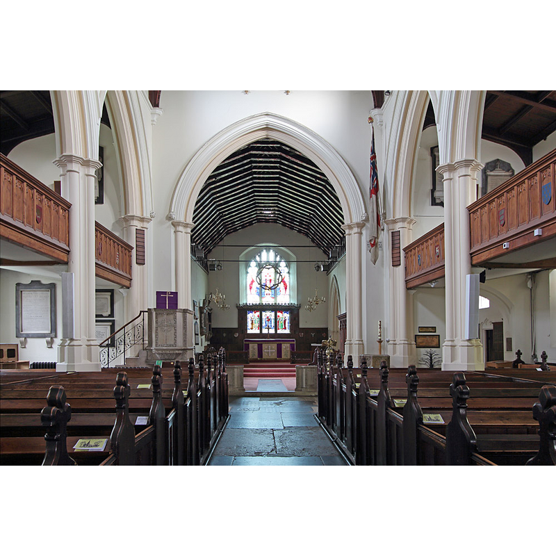
INT W digital photograph taken 11 March 2015 by John Salmon [www.geograph.org.uk/photo/4383921] [accessed 14 March 2016]
MOD FONT digital photograph taken 11 March 2015 by John Salmon [www.geograph.org.uk/photo/4383995] [accessed 14 March 2016]](/static-50478a99ec6f36a15d6234548c59f63da52304e5/compressed/1160319005_compressed.png)
Scene Description: EXT SW digital photograph taken 11 March 2015 by John Salmon [www.geograph.org.uk/photo/4383911] [accessed 14 March 2016]
INT E digital photograph taken 11 March 2015 by John Salmon [www.geograph.org.uk/photo/4383916] [accessed 14 March 2016]
INT W digital photograph taken 11 March 2015 by John Salmon [www.geograph.org.uk/photo/4383921] [accessed 14 March 2016]
MOD FONT digital photograph taken 11 March 2015 by John Salmon [www.geograph.org.uk/photo/4383995] [accessed 14 March 2016]
Copyright Statement: Image copyright © John Salmon, 2015
Image Source: digital photograph taken 11 March 2015 by John Salmon [www.geograph.org.uk/photo/4383911] [accessed 14 March 2016]
Copyright Instructions: CC-BY-SA-2.0
view of church interior - nave - looking west
Copyright Statement: Image copyright © John Salmon, 2015
Image Source: digital photograph taken 11 March 2015 by John Salmon [www.geograph.org.uk/photo/4383921] [accessed 14 March 2016]
Copyright Instructions: CC-BY-SA-2.0
view of church interior - nave - looking east
Copyright Statement: Image copyright © John Salmon, 2015
Image Source: digital photograph taken 11 March 2015 by John Salmon [www.geograph.org.uk/photo/4383916] [accessed 14 March 2016]
Copyright Instructions: CC-BY-SA-2.0
INFORMATION
Font ID: 20430WIM
Object Type: Baptismal Font1?
Font Century and Period/Style: 11th century, Pre-Conquest? / Norman
Church / Chapel Name: Parish Church of St. Mary
Church Patron Saint(s): St. Mary the Virgin
Church Address: 30 St Mary's Rd, London SW19 7BP, United Kingdom -- Tel.: +44 20 8946 2605
Site Location: Greater London, South East, England, United Kingdom
Ecclesiastic Region: Diocese of Southwark
Historical Region: [Hundred of Mortlake? in Domesday] -- Hundred of Brixton -- formerly in Surrey
Additional Comments: disappeared font? (the one from the Domesday-time church here)
Font Notes:
Click to view
No individual entry for Wimbledon found in the Domesday survey. The Victoria County History (Surrey, vol. 4, 1912) notes: "The church which at the time of the Domesday Survey was said to belong to the manor of Mortlake [...] and must have been the church of 'Murtelac' which was seized by Odo, Bishop of Bayeux, but was restored to Lanfranc in 1070, was undoubtedly Wimbledon Church, as there was no church actually situated in the present parish of Mortlake, then part of Wimbledon, until 1348, [...] while Wimbledon Church was called the parish church at least as early as 1286. [...] The church of ST. MARY, standing to the north-west of the town, consists of chancel, south chapel and vestry, nave, north and south aisles, west tower and south porch. The south chapel dates from before the middle of the 17th century; all the structural details of the chancel are modern, and the rest of the church was rebuilt in 1843"; no font mentioned in the VCH entry. The present font is modern.
COORDINATES
UTM: 30U 693914 5701182
Latitude & Longitude (Decimal): 51.428614, -0.210472
Latitude & Longitude (DMS): 51° 25′ 43.01″ N, 0° 12′ 37.7″ W