Lurais / Ludriacum / Luriacum
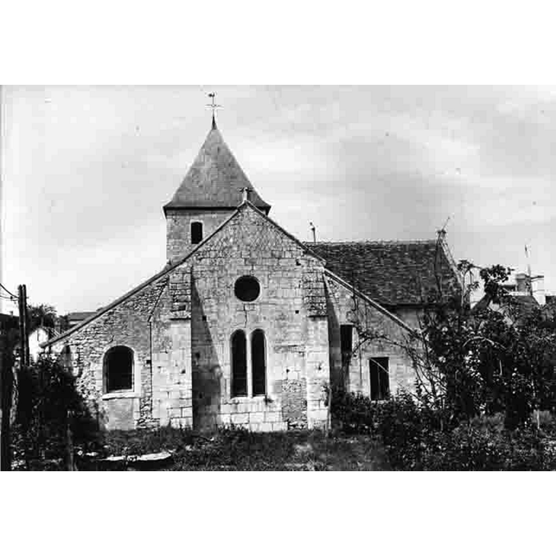
Image copyright © Remi Mathis, 2009
GFDL / CC-BY-SA-3.0,2.5,2.0,1.0
Results: 8 records
view of church exterior - east view
Scene Description: the former priory church, parochial since the 17thC
Copyright Statement: Image copyright © Remi Mathis, 2009
Image Source: image created 1 February 2008 by Remi Mathis [original source not given] [https://commons.wikimedia.org/wiki/File:Église_de_Lurais_vue_du_chevet.jpg] [accessed 13 March 2016]
Copyright Instructions: GFDL / CC-BY-SA-3.0,2.5,2.0,1.0
view of church exterior - northeast end
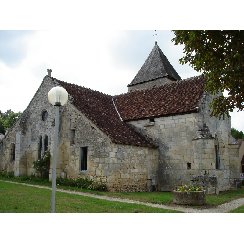
Scene Description: the former priory church, parochial since the 17thC
Copyright Statement: Image copyright © Parisdreux, 2011
Image Source: digital photograph taken 3 August 2011 by Parisdreux [https://commons.wikimedia.org/wiki/File:Lurais_(36)_-_Église_Saint-Jean_-_vue_arrière.jpg] [accessed 13 March 2016]
Copyright Instructions: CC-BY-SA-3.0
view of church exterior - southwest end
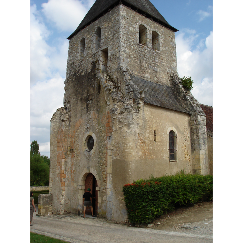
Scene Description: the former priory church, parochial since the 17thC
Copyright Statement: Image copyright © Parisdreux, 2011
Image Source: digital photograph taken 3 August 2011 by Parisdreux [https://commons.wikimedia.org/wiki/File:Lurais_(36)_-_Église_Saint-Jean_-_vue_avant.jpg] [accessed 13 March 2016]
Copyright Instructions: CC-BY-SA-3.0
view of church exterior - south view
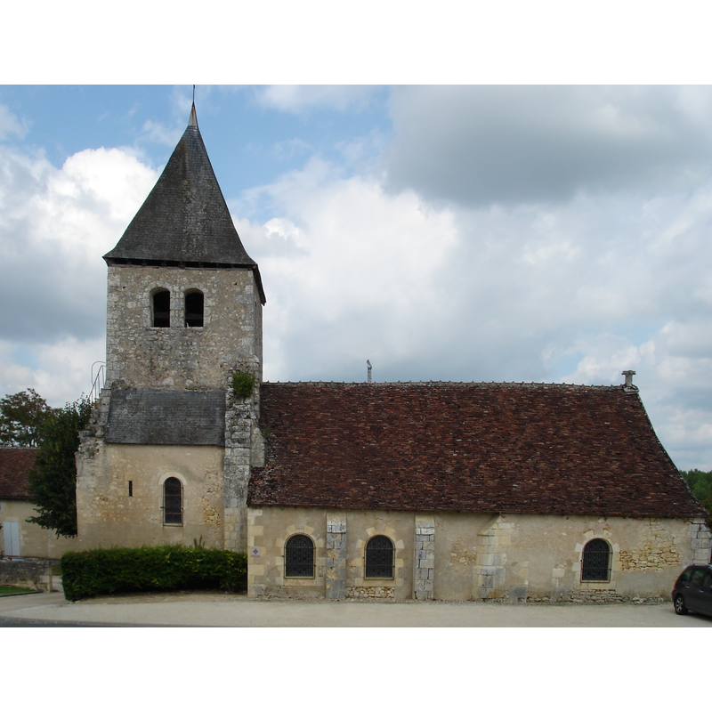
Scene Description: the former priory church, parochial since the 17thC
Copyright Statement: Image copyright © Parisdreux, 2011
Image Source: edited detail of a digital photograph taken 3 August 2011 by Parisdreux [https://commons.wikimedia.org/wiki/File:Lurais_(36)_-_Église_Saint-Jean_-_vue_de_coté.jpg] [accessed 13 March 2016]
Copyright Instructions: CC-BY-SA-3.0
view of church exterior in context
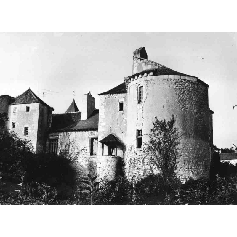
Scene Description: Source caption: "Prieuré de Lurais - façade sur la Creuse" -- the remains of the priory buildings were built into the château, later a farm. The priory church itself became parochial in the 17thC; the top of its tower can be seen in the background here
Copyright Statement: Image copyright © Remi Mathis, 2009
Image Source: image created 1 February 2008 by Remi Mathis [original source not given] [https://fr.wikipedia.org/wiki/Lurais#/media/File:Prieuré_de_Lurais_-_façade_sur_la_Creuse.jpg] [accessed 13 March 2016]
Copyright Instructions: GFDL / CC-BY-SA-3.0,2.5,2.0,1.0
view of church interior - nave - looking east
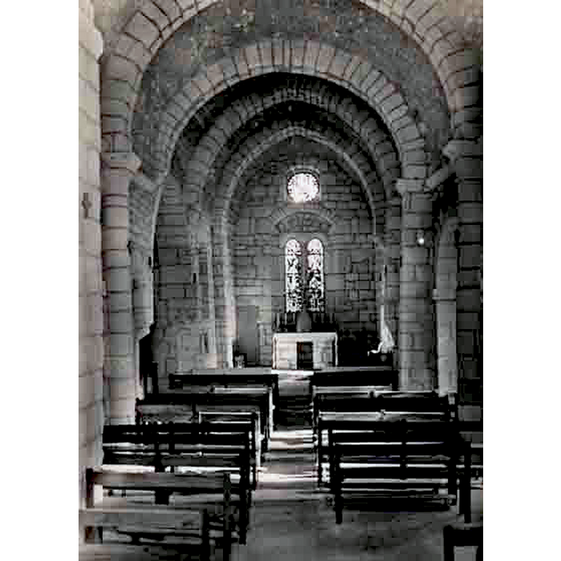
Scene Description: the former priory church, parochial since the 17thC
Copyright Statement: Image copyright © Remi Mathis, 2009
Image Source: image created 1 February 2008 by Remi Mathis [original source not given] [https://commons.wikimedia.org/wiki/File:Église_de_Lurais_-_la_nef.jpg] [accessed 13 March 2016]
Copyright Instructions: GFDL / CC-BY-SA-3.0,2.5,2.0,1.0
animal - fabulous animal or monster - unidentified
![[cf. FontNotes]](/static-50478a99ec6f36a15d6234548c59f63da52304e5/others/image_not_available.jpg)
Scene Description: [cf. FontNotes]
![[cf. FontNotes]](/static-50478a99ec6f36a15d6234548c59f63da52304e5/bsi-testing-site/others/image_not_available.jpg)
design element - patterns - fluted
Scene Description: [cf. FontNotes]
INFORMATION
Font ID: 20424LUR
Object Type: Baptismal Font1
Object Details: capital
Font Century and Period/Style: 12th century, Romanesque
Church / Chapel Name: Église paroissiale Saint-Jean [ancienne prieurale Sainte-Fercinte]
Font Location in Church: Inside the church
Church Patron Saint(s): St. John [formerly dedicated to St. Fercinte [8theC]]
Church Notes: 11th-12thC priory church here documented by 1217; fortified towers of the 14th-15thC; disappeared early-17thC -- lested in Mérimée [ref.: PA00097383]: the priory church became redundant (?) in the early 17thC and became part of the château, later a farm and finally parceled up in the 19thC
Church Address: rue de l'Eglise, 36220 Lurais, France
Site Location: Indre-et-Loire, Centre-Val de Loire, France, Europe
Directions to Site: Located on the D50, 2 km from Preuilly-la-Ville, 5 km from Néons-sur-Creuse, in Boischaut Nord, parc naturel régional de la Brenne, in Brenne Val de Creuse
Ecclesiastic Region: Archidiocèse de Bourges
Additional Comments: present 'font' sounds suspiciously like a composite object (re-used capital on unrelated base) -- disappeared font? (the one of the 11th-12thC priory church here)
Font Notes:
Click to view
Listed in Palissy [ref.: PM36000141]: "fonts baptismaux [...] pierre [...] Sur une colonne cannelée est une cuve en forme de chapiteau ornée de moulures et de sculptures avec des animaux fantastiques [...] 12e siècle."
COORDINATES
UTM: 31T 343406 5174396
Latitude & Longitude (Decimal): 46.704777, 0.951473
Latitude & Longitude (DMS): 46° 42′ 17.2″ N, 0° 57′ 5.3″ E
MEDIUM AND MEASUREMENTS
Material: stone
Font Shape: capital
Diameter (includes rim): 40 cm* ["Diamètre du chapiteau"]*
Font Height (less Plinth): 88 cm*
Notes on Measurements: * Palissy [ref.: PM36000141]
REFERENCES
- France, Ministère de la culture, Inventaire Général, Palissy (France, Ministère de la culture), France, Ministère de la culture. URL: http://www.culture.fr/public/mistral/palissy.