Putney / Potenhith / Potney / Pottenhith / Pottnie / Poultenheth / Putelei / Putenega / Putneythe / Puttney / Pultynghyde
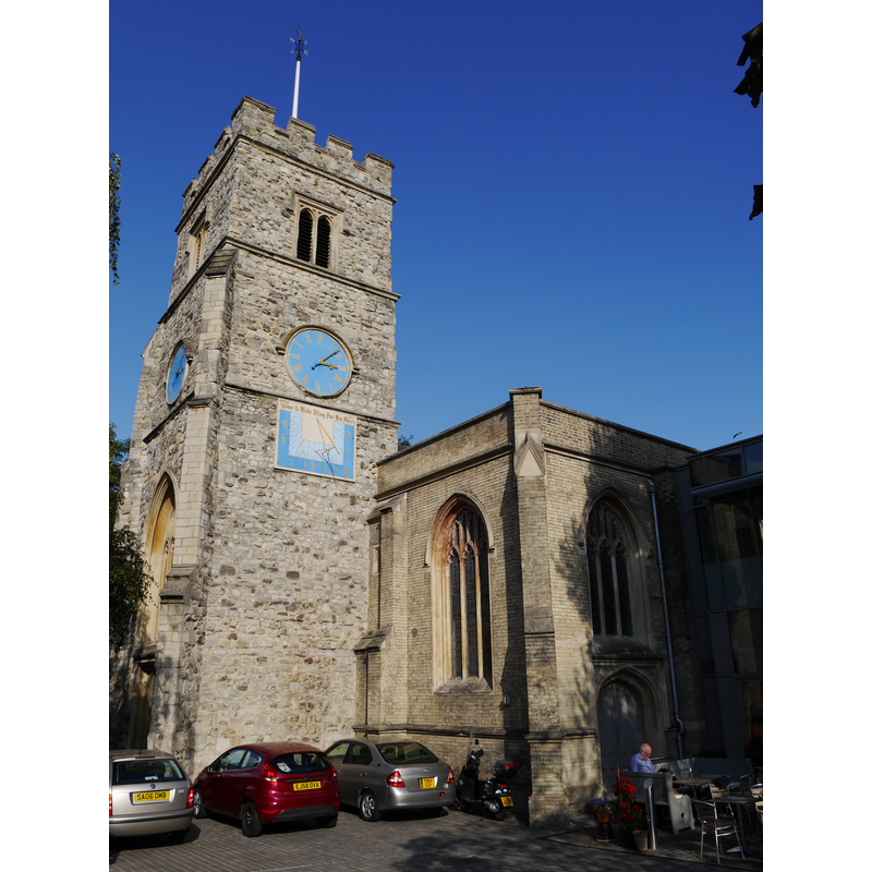
Image copyright © Edwardx, 2014
CC-BY-SA-3.0
Results: 2 records
view of church exterior
Copyright Statement: Image copyright © Edwardx, 2014
Image Source: digital photograph taken 30 September 2014 by Edwardx [https://commons.wikimedia.org/wiki/File:St_Mary%27s,_Putney_01.JPG] [accessed 9 March 2016]
Copyright Instructions: CC-BY-SA-3.0
view of church interior
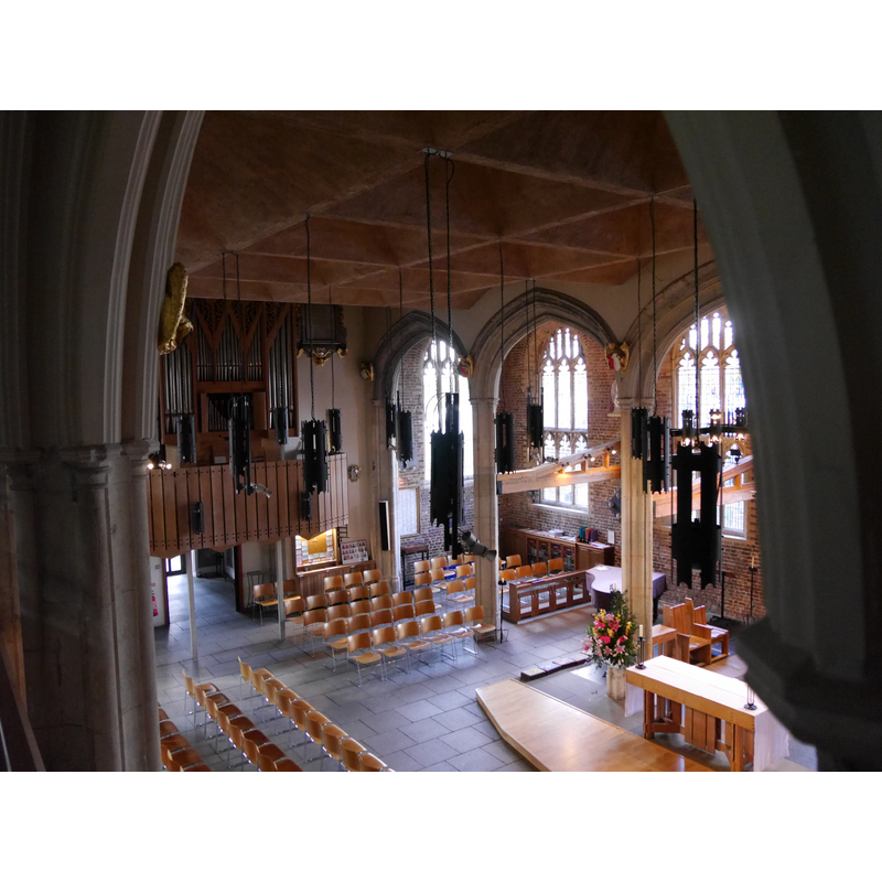
Copyright Statement: Image copyright © Edwardx, 2014
Image Source: digital photograph taken 30 September 2014 by Edwardx [https://commons.wikimedia.org/wiki/File:St_Mary%27s,_Putney_39.JPG] [accessed 9 March 2016]
Copyright Instructions: CC-BY-SA-3.0
INFORMATION
Font ID: 20416PUT
Object Type: Baptismal Font1?
Font Century and Period/Style: Medieval
Church / Chapel Name: Parish Church of St. Mary
Church Patron Saint(s): St. Mary the Virgin
Church Address: High Street, Putney, London, SW15 1SN United Kingdom -- Tel.: +44 20 8788 4414
Site Location: Greater London, South East, England, United Kingdom
Directions to Site: Located near the Putney Bridge [Putney High Street], on the S banks of the Thames
Ecclesiastic Region: Diocese of Southwark [formerly in the diocese of Rochester; originally in the diocese of Winchester]
Historical Region: Hundred of Brixton -- formerly in Surrey
Additional Comments: disappeared font? (the one from the medieval church here)
Font Notes:
Click to view
No individual entry for Putman found in the Domesday survey. The Victoria County History (Surrey, vol. 4, 1912) notes: "No date can be assigned to the first erection of a chapel at Putney. It is asserted by Lysons [...] to have been older than Mortlake Church, as Archbishop Winchelsey held a public ordination in it in 1302, but no verification for this has been found. It was originally a chapel of ease to Wimbledon [...] The church of ST. MARY was rebuilt in the year 1836, the 15th-century tower and 16th-century chapel built by Nicholas West, Bishop of Ely from 1515 to 1533, being the only portions surviving of the original fabric"; no font mentioned in the VCH entry,
COORDINATES
UTM: 30U 693525 5705291
Latitude & Longitude (Decimal): 51.465653, -0.213817
Latitude & Longitude (DMS): 51° 27′ 56.35″ N, 0° 12′ 49.74″ W
REFERENCES
- Victoria County History [online], University of London, 1993-. URL: https://www.british-history.ac.uk.