Clapham nr. London / Clopeham / Clopham / Cloppaham / Cloppeham
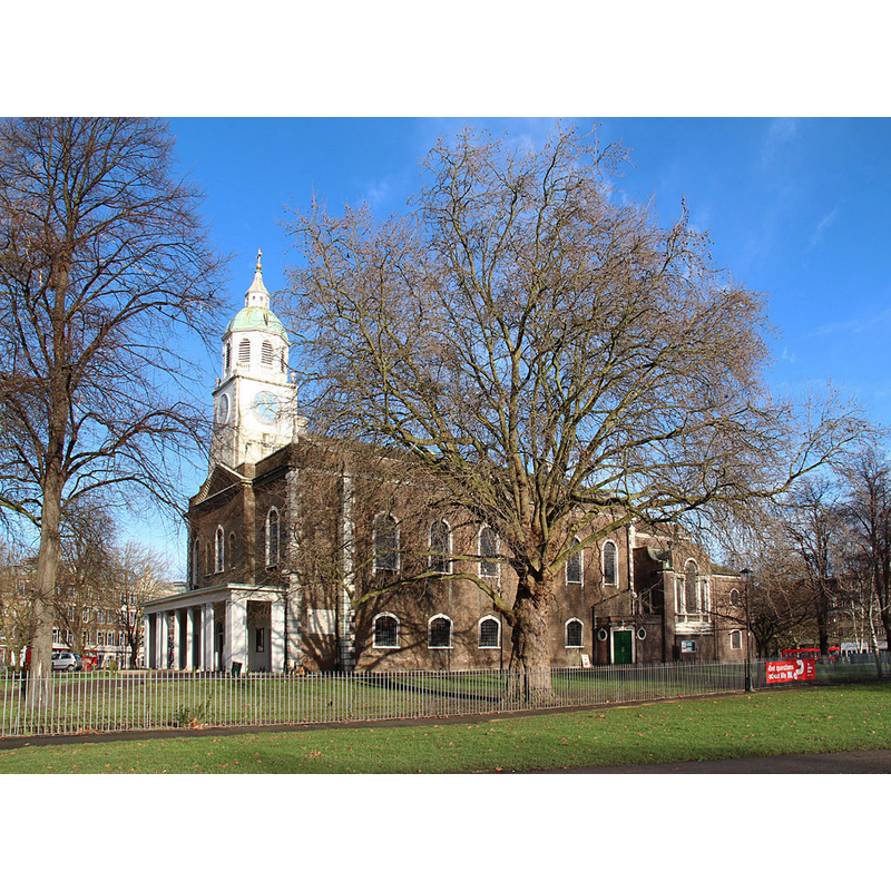
Image copyright © John Salmon, 2015
CC-BY-SA-2.0
Results: 3 records
view of church exterior - southwest view
Copyright Statement: Image copyright © John Salmon, 2015
Image Source: digital photograph taken January 2015 by John Salmon [www.geograph.org.uk/photo/4308638] [accessed 8 March 2016]
Copyright Instructions: CC-BY-SA-2.0
view of church interior - nave - looking west
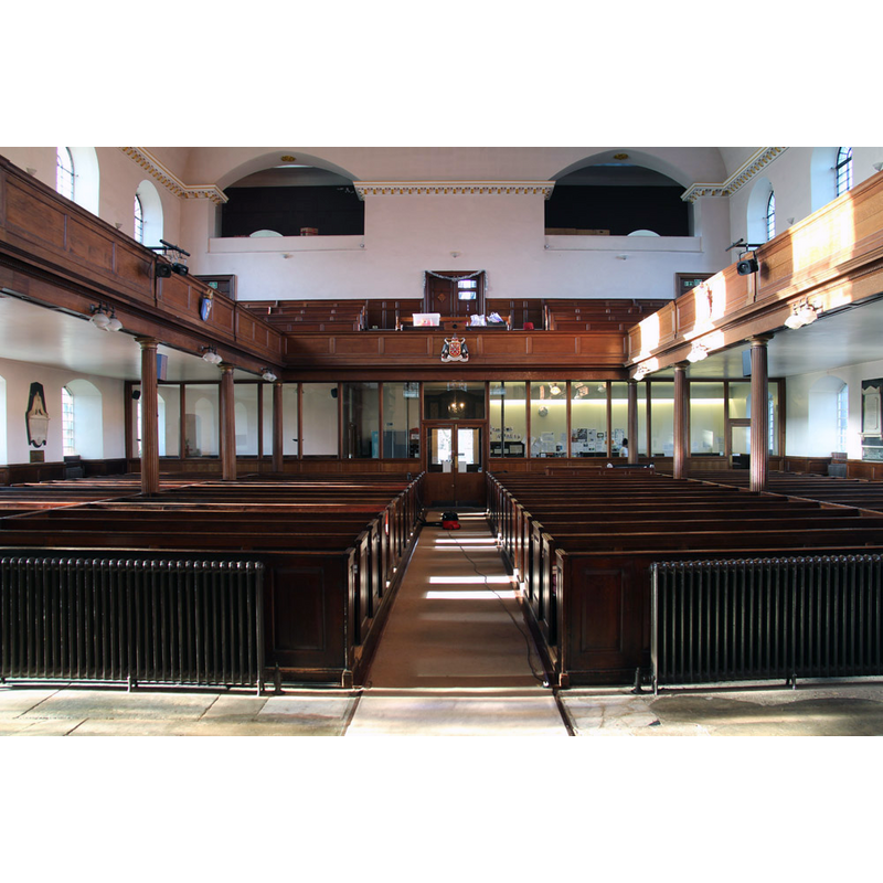
Copyright Statement: Image copyright © John Salmon, 2015
Image Source: digital photograph taken January 2015 by John Salmon [www.geograph.org.uk/photo/4308601] [accessed 8 March 2016]
Copyright Instructions: CC-BY-SA-2.0
view of church interior - nave - looking east
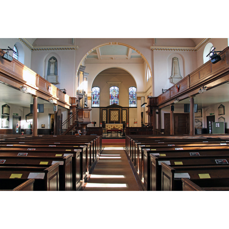
Copyright Statement: Image copyright © John Salmon, 2015
Image Source: digital photograph taken January 2015 by John Salmon [www.geograph.org.uk/photo/4308635] [accessed 8 March 2016]
Copyright Instructions: CC-BY-SA-2.0
INFORMATION
Font ID: 20412CLA
Object Type: Baptismal Font1?
Font Date: ca. 1285?
Font Century and Period/Style: 13th century (late?), Medieval
Church / Chapel Name: Parish Church of the Holy Trinity
Church Patron Saint(s): The Holy Trinity
Church Address: Clapham Common North Side, London SW4 0QZ, United Kingdom -- Tel.: +44 20 7627 0941
Site Location: Greater London, South East, England, United Kingdom
Directions to Site: Located off the A24, E of Battersea
Ecclesiastic Region: Diocese of Southwark
Historical Region: Hundred of Brixton -- formerly in Surrey
Additional Comments: disappeared font? (the one from the 13thC (?) church here)
Font Notes:
Click to view
There is an entry for this Clapham [variant spelling] in the Domesday survey [http://opendomesday.org/place/TQ2975/clapham/] [accessed 8 March 2016], but it mentions neither cleric not church in it. The Victoria County History (Surrey, vol. 4, 1912) notes: "The earliest known reference to the old parish church of the Holy Trinity is the presentation of an incumbent in 1285. [...] In pursuance of an Act of Parliament of 1774 the old church of HOLY TRINITY was taken down except the north aisle, which was pulled down in 1814, and the new parish church of HOLY TRINITY was built on another site in 1775"; the baptismal registers of the parish start in 1555. [NB: we have no information on the font of the medieval church here].
COORDINATES
UTM: 30U 698516 5705111
Latitude & Longitude (Decimal): 51.462305, -0.142153
Latitude & Longitude (DMS): 51° 27′ 44.3″ N, 0° 8′ 31.75″ W
REFERENCES
- Victoria County History [online], University of London, 1993-. URL: https://www.british-history.ac.uk.