Trumilly No. 3 / Trameilliacum / Tramillyacum / Tremelliacum / Tremiliacum / Tremilliivilla / Tremilly / Trimilly / Trumeilly / Trumelly / Trumiliacum / Trumilli
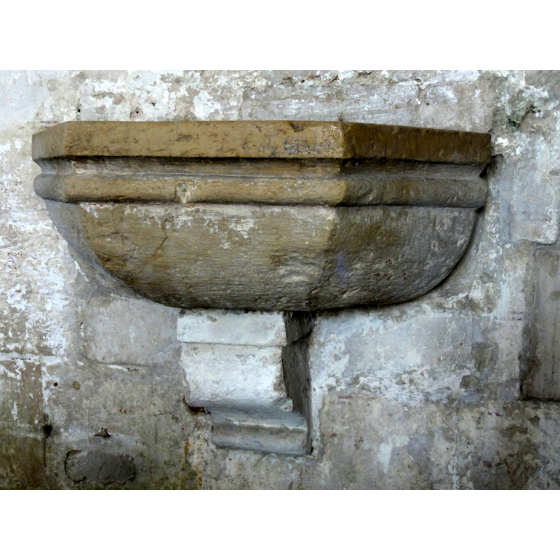
Image copyright © P.poschadel, 2013
GFDL / CC-BY-SA-3.0,2.5,2.0,1.0
Results: 1 records
view of stoup
Copyright Statement: Image copyright © P.poschadel, 2013
Image Source: digital photograph taken 4 September 2013 by P.poschadel [https://commons.wikimedia.org/wiki/File:Trumilly_(60),_église_Notre-Dame,_nef,_bénitier.JPG] [accessed 6 March 2016]
Copyright Instructions: GFDL / CC-BY-SA-3.0,2.5,2.0,1.0
INFORMATION
Font ID: 20403TRU
Object Type: Stoup
Font Century and Period/Style: 13th - 15th century, Medieval
Church / Chapel Name: Église paroissiale Notre-Dame-de-l'Assomption
Font Location in Church: Wall-mounted at the W entranceway
Church Patron Saint(s): The Assumption of St. Mary
Church Address: 60800 Trumilly, France
Site Location: Oise, Hauts-de-France, France, Europe
Directions to Site: Located off the RD98, between Néry (N) and Auger-Saint-Vincent (S), just E of Rully, in the municipality of Crépy-en-Valois, arrondissement de Senlis, about 20 km SSE of Compiègne
Ecclesiastic Region: Diocèse de Pontoise
Historical Region: pays de Valois, Picardie
Font Notes:
Click to view
Polygonal holy-water stoup wall-mounted in the west portal; decorated with double moulding all around.
COORDINATES
Latitude & Longitude (Decimal): 49.242403, 2.800934
Latitude & Longitude (DMS): 49° 14′ 32.65″ N, 2° 48′ 3.36″ E
MEDIUM AND MEASUREMENTS
Material: stone, limestone
Font Shape: polygonal, wall mounted
Basin Exterior Shape: polygonal