Hillborough nr. Reculver
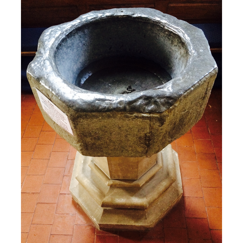
Image copyright © Nortonius, 2015
CC-BY-SA-4.0
Results: 6 records
view of font
Scene Description: Source caption: "Baptismal font in the church of St Mary the Virgin, Hillborough, Reculver parish, Kent: probably from the former chapel of All Saints at Shuart, St Nicholas-at-Wade, Isle of Thanet. The font is lined with lead, and contains water used in a baptism immediately prior to being photographed. The plinth is 19th-century work" [i.e., the plain stem and moulded lower base are modern replacements].
Copyright Statement: Image copyright © Nortonius, 2015
Image Source: digital photograph taken 21 June 2015 by Nortonius [https://commons.wikimedia.org/wiki/File:All_Saints_font.jpg] [accessed 22 February 2016]
Copyright Instructions: CC-BY-SA-4.0
view of church exterior - northwest view
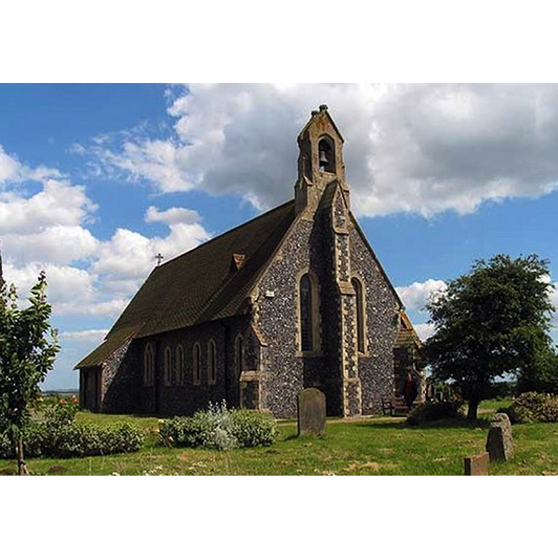
Scene Description: the church of Hillborough St Mary's, built in 1876
Copyright Statement: Image copyright © John Salmon, 2008
Image Source: digital photograph taken 19 June 2008 by John Salmon [www.geograph.org.uk/photo/858211] [accessed 22 February 2016]
Copyright Instructions: CC-BY-SA-2.0
view of church exterior - south view
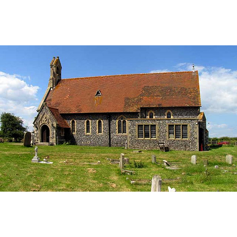
Scene Description: the church of Hillborough St Mary's, built in 1876
Copyright Statement: Image copyright © John Salmon, 2008
Image Source: digital photograph taken 19 June 2008 by John Salmon [www.geograph.org.uk/photo/858209] [accessed 22 February 2016]
Copyright Instructions: CC-BY-SA-2.0
view of church exterior in context
![the building labelled Om[n]u[m] S[an]c[t]orum, at the bottm left of the old map, to the right of the mother church of Reculver, is the All Saints' Chapel at Shuart -- Source caption: "Map of the Isle of Thanet in the early 15th century, based on a map in Thomas Elmham's Historia Monasterii S Augustini Cantuariensis; for a photographic reproduction of the original map, see Rollason, D.W. (1982), The Mildrith Legend A Study in Early Medieval Hagiography in England, p. 10"](/static-50478a99ec6f36a15d6234548c59f63da52304e5/compressed/0160222008_compressed.png)
Scene Description: the building labelled Om[n]u[m] S[an]c[t]orum, at the bottm left of the old map, to the right of the mother church of Reculver, is the All Saints' Chapel at Shuart -- Source caption: "Map of the Isle of Thanet in the early 15th century, based on a map in Thomas Elmham's Historia Monasterii S Augustini Cantuariensis; for a photographic reproduction of the original map, see Rollason, D.W. (1982), The Mildrith Legend A Study in Early Medieval Hagiography in England, p. 10"
Copyright Statement: Image copyright © Nortonius, 2012
Image Source: reproduction of map in John Lewis' The History and Antiquities Ecclesiastical and Civil of the Isle of Tenet in Kent (1773: 27) by Nortonius [https://commons.wikimedia.org/wiki/File:Mappa_Thaneti_Insule.jpg] [accessed 22 February 2016]
Copyright Instructions: CC-PD-Mark / PD-Art (PD-old-100)
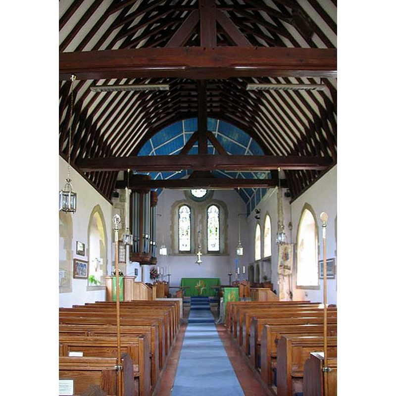
view of church interior - nave - looking east
Copyright Statement: Image copyright © John Salmon, 2008
Image Source: digital photograph taken 19 June 2008 by John Salmon [www.geograph.org.uk/photo/858204] [accessed 22 February 2016]
Copyright Instructions: CC-BY-SA-2.0
view of church interior - detail
![the church of Hillborough St Mary's, built in 1876 -- Source caption: "Ecclesiastical recycling. Stone re-used from the church of St Mary, Reculver, [...] in the church of St Mary, Hillborough."](/static-50478a99ec6f36a15d6234548c59f63da52304e5/compressed/1160222005_compressed.png)
Scene Description: the church of Hillborough St Mary's, built in 1876 -- Source caption: "Ecclesiastical recycling. Stone re-used from the church of St Mary, Reculver, [...] in the church of St Mary, Hillborough."
Copyright Statement: Image copyright © Penny Mayes, 2003
Image Source: digital photograph taken 2 November 2003 by Penny Mayes [www.geograph.org.uk/photo/341514] [accessed 22 February 2016]
Copyright Instructions: CC-BY-SA-2.0
INFORMATION
Font ID: 20376HIL
Object Type: Baptismal Font1
Font Century and Period/Style: 14th - 15th century [basin only] [composite font], Medieval [composite]
Church / Chapel Name: Parish Church of St. Mary the Virgin [originally from Shuart's All Saints chapel?]
Font Location in Church: [cf. FontNotes]
Church Notes: the chapel of All Saints in Shuart was established between the 7th and the 10thC as a chapel of ease for the parish of St Mary's Church, Reculver; it was demolished in the 17thC -- Hillborough St Mary's was built 1876
Site Location: Kent, South East, England, United Kingdom
Directions to Site: Hillborough is located near Herne Bay and Reculver, which is 5 km E of Herne Bay itself -- Shuart is located in the NW of the Isle of Thanet, Kent
Ecclesiastic Region: Diocese of Canterbury
Historical Region: Hundred of Reculver
Additional Comments: re-cycled font (originally from the chapel at Shuart; now in the 19thC church at Hillbrough) -- disappeared font? (the one from the original 10thC chapel at Shuart)
Font Notes:
Click to view
Baptismal font consisting of an octagonal basin with plain tapering sides; lead-lined interior; raised on a plain octagonal pedestal base and a moulded octagonal lower base, both modern replacements. The old basin is said to be originally from the Chapel of All Saints at nearby Shuart, demolished in the 17th century [NB: the medieval island of Thanet shows in a 15thC map as having a mother church at Reculver, and 12 chapels-of-ease]
COORDINATES
UTM: 31U 373072 5692342
Latitude & Longitude (Decimal): 51.368136, 1.176594
Latitude & Longitude (DMS): 51° 22′ 5.29″ N, 1° 10′ 35.74″ E
MEDIUM AND MEASUREMENTS
Material: stone
Font Shape: octagonal, mounted
Basin Interior Shape: round
Basin Exterior Shape: octagonal
Drainage System: centre hole in basin
Drainage Notes: lead-lined