Winchester No. 10 / Venta Belgarum / Wintanceaster / Yenta Belgaruan
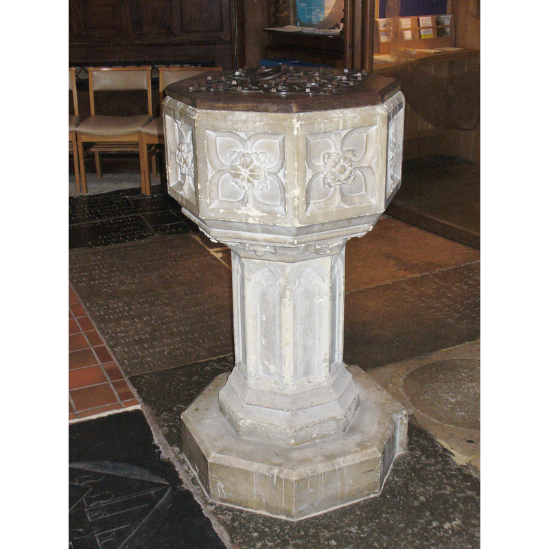
Image copyright © Colin Smith, 2016
Image and permission received (e-mail of 10 January 2016)
Results: 4 records
view of font and cover
Scene Description: the modern font [cf. FontNotes]
Copyright Statement: Image copyright © Colin Smith, 2016
Image Source: digital photograph taken 18 December 2015 by Colin Smith
Copyright Instructions: Image and permission received (e-mail of 10 January 2016)
view of basin - detail
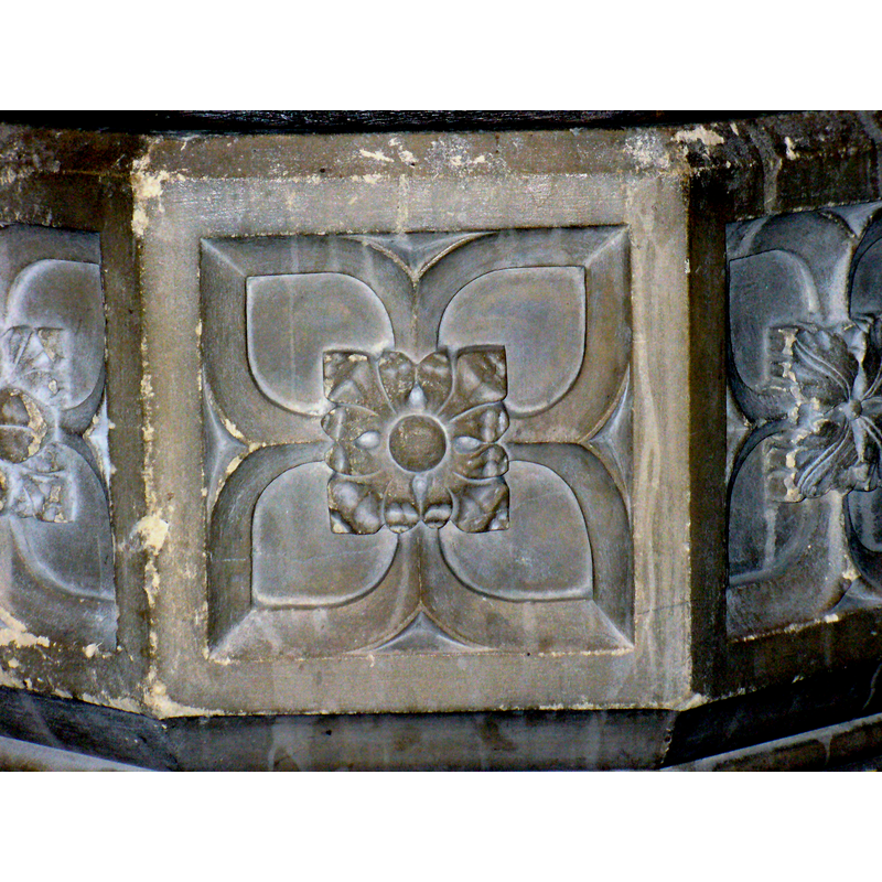
Copyright Statement: Image copyright © Colin Smith, 2016
Image Source: digital photograph taken 18 December 2015 by Colin Smith
Copyright Instructions: Image and permission received (e-mail of 10 January 2016)
view of basin and cover
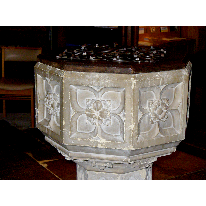
Copyright Statement: Image copyright © Colin Smith, 2016
Image Source: digital photograph taken 18 December 2015 by Colin Smith
Copyright Instructions: Image and permission received (e-mail of 10 January 2016)
view of font in context
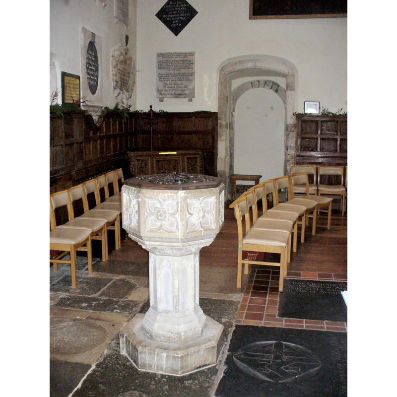
Scene Description: the modern font and cover in the context of the west end of the nave
Copyright Statement: Image copyright © Colin Smith, 2016
Image Source: digital photograph taken 18 December 2015 by Colin Smith
Copyright Instructions: Image and permission received (e-mail of 10 January 2016)
INFORMATION
Font ID: 20337WIN
Object Type: Baptismal Font1?
Font Century and Period/Style: Medieval
Church / Chapel Name: Parish Church of St. Lawrence
Church Patron Saint(s): St. Lawrence [aka Laurence]
Church Notes: said to be Norman in origin, the chapel of the castle that William I built ca. 1069-70, destroyed in the Great Fire of 1141; chapel itself became parish church; restored in 1475-7, 1672, 1847-8, 1881; damaged by fire 19878; restored 1979-80
Church Address: High St, Winchester SO23 8RG, United Kingdom -- Tel.: +44 1962 849434
Site Location: Hampshire, South East, England, United Kingdom
Directions to Site: Located off Hight St., not far from the Cathedral
Ecclesiastic Region: Diocese of Winchester
Additional Comments: disappeared font? (the font from the medieval church here)
Font Notes:
Click to view
The entry for this church in the Victoria County History (Hampshire, vol. 5, 1912) notes: "The CHURCH OF ST LAWRENCE [...] appears to be for the most part of the 15th century. There are, however, a number of re-used 12th-century stones and one fragment of detail, a small lion's-head corbel inserted in the west wall high up, but these may have come from another building. There is also a door on the north, now blocked up, with shafted jambs of late 13th or early 14th-century date, now much defaced and only visible in a back room of some adjoining premises. The tower is an addition of 15th-century date, but has been partly rebuilt"; it mentions no font in it. The entry in English Heritage [Bldg. no. 144853] notes: "1860 Caen stone font with carved octagonal stone bowl with fleurons carved under the bowl and an octagonal stem." Present font is located at the west end of the nave, on the north side of the entranceway.
Credit and Acknowledgements: We are grateful to Colin Smith for his photographs of this church and modern font
COORDINATES
UTM: 30U 618080 5658126
Latitude & Longitude (Decimal): 51.0625, -1.3149
Latitude & Longitude (DMS): 51° 3′ 45″ N, 1° 18′ 53.64″ W
REFERENCES
- Victoria County History [online], University of London, 1993-. URL: https://www.british-history.ac.uk.