Dreumel No. 2 / Tremele
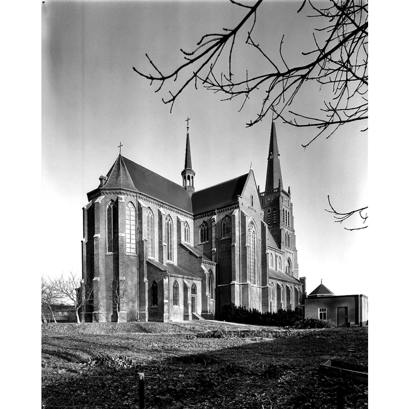
Image copyright © Rijksdienst voor het Cultureel Erfgoed, 2015
CC-BY-SA-3.0-NL
Results: 2 records
view of church exterior - northeast view
Scene Description: the 19th-century Sint-Barbarakerk
Copyright Statement: Image copyright © Rijksdienst voor het Cultureel Erfgoed, 2015
Image Source: B&W photograph taken March 1978 by A.J. (Ton) van der Wal, in the Rijksdienst voor het Cultureel Erfgoed [https://commons.wikimedia.org/wiki/File:Noord-oost_gevel_exterieur_-_Dreumel_-_20063806_-_RCE.jpg] [accessed 22 December 2015]
Copyright Instructions: CC-BY-SA-3.0-NL
view of font - fragment?
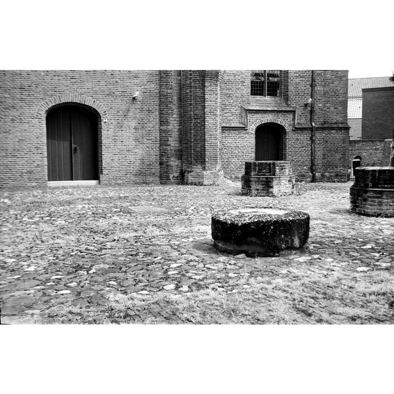
Scene Description: the large round (?) stone in the foreground, in what was originally the nave of the medieval church, as seen in May 1974 -- is it what remains of the early font here?
INFORMATION
Font ID: 20244DRE
Object Type: Baptismal Font1, fragment
Font Date: ca. 1117?
Font Century and Period/Style: 12th century (early?), Romanesque
Church / Chapel Name: Nederlands Hervormde St. Victorkerk
Font Location in Church: [cf. FontNotes]
Church Patron Saint(s): St. Victor
Church Notes: original church may have here by 900; church dedicated to St. Victor documented 1117
Church Address: Rooijsestraat 77, Dreumel 6621, Netherlands
Site Location: Gelderland, Netherlands, Europe
Directions to Site: Located between Wamel and Heerewaarden, in the municipality of in Land van Maas en Waal
Additional Comments: disappeared font? (is the fragment in the former nave what is left of this font?)
Font Notes:
Click to view
Schulte (1986) [www.dbnl.org/tekst/schu211land02_01/schu211land02_01_0011.php] [accessed 22 December 2015] reports a badly eroded fragment of a sandstone font as having found buried in the nave, near the chancel; no other particulars given of this fragment. [NB: a May 1974 photograph [cf. Images Area] shows a round block of stone in what was the nave of the medieval church; is this the fragment of sandstone font referred to in Schilte above?] A communication from Pol Herman to BSI (e-mail of 8 January 2022) informs: "this is a fragment of a badly weathered sandstone basin. It is outside, in the demolished nave of the church. No further information found".
Credit and Acknowledgements: We are grateful to Pol Herman for his help in documenting this fragment
COORDINATES
UTM: 31U 667408 5747147
Latitude & Longitude (Decimal): 51.849991, 5.430608
Latitude & Longitude (DMS): 51° 50′ 59.97″ N, 5° 25′ 50.19″ E
MEDIUM AND MEASUREMENTS
Material: stone, sandstone
REFERENCES
- Schulte, A.G., Het Land van Maas en Waal, Den Haag: Rijksdienst voor de Monumentenzorg, 1986, p. 221ff