Richmond nr. London Bridge / Richemount / Rychemonde / Scenes / Senes, Shene / Shenes / Shine / Syenes / West Shene
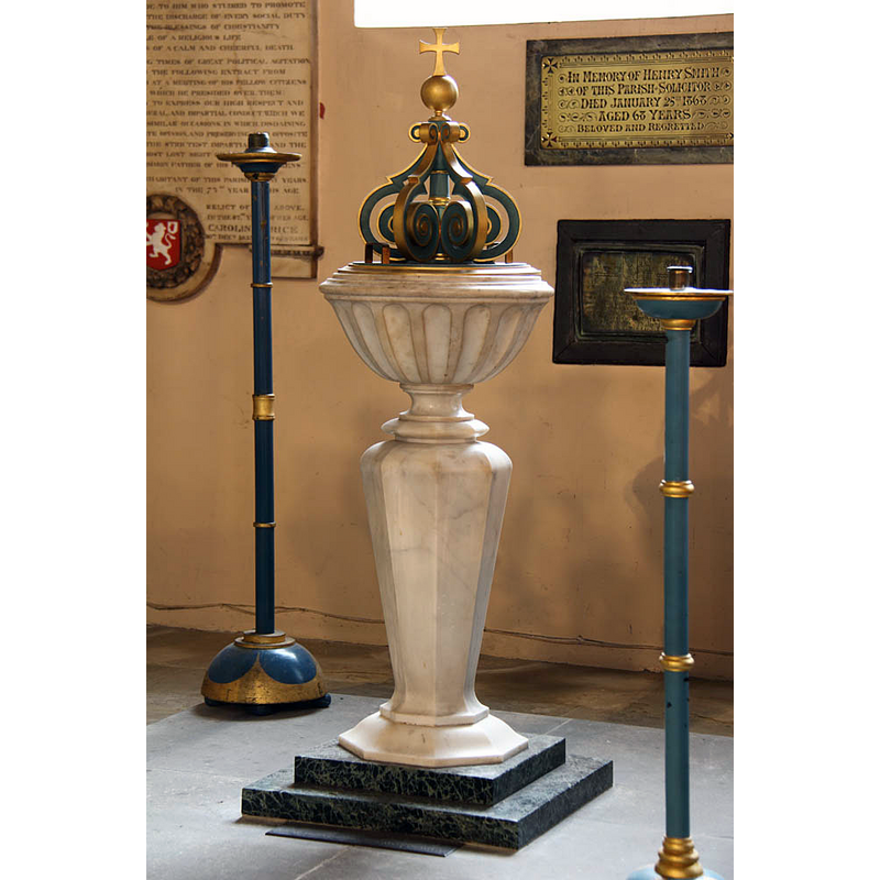
Image copyright © John Salmon, 2012
CC-BY-SA-3.0
Results: 3 records
view of font and cover
Scene Description: the modern font
Copyright Statement: Image copyright © John Salmon, 2012
Image Source: digital photograph taken 28 November 2012 by John Salmon [www.geograph.org.uk/photo/3244471] [accessed 22 December 2015]
Copyright Instructions: CC-BY-SA-3.0
view of church exterior
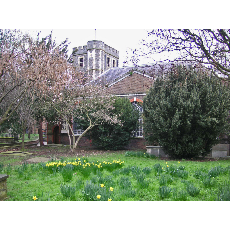
Copyright Statement: Image copyright © Amandajm, 2007
Image Source: digital photograph taken 4 March 2007 by Amandajm [https://commons.wikimedia.org/wiki/File:Richmond_St_Mary_Magdalene's_Church_002.jpg] [accessed 22 December 2015]
Copyright Instructions: CC-BY-SA-3.0
view of church interior - nave - looking east
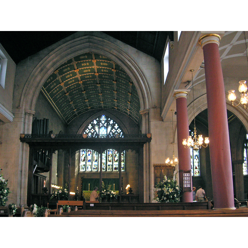
Copyright Statement: Image copyright © Amandajm, 2006
Image Source: digital photograph taken 27 August 2006 by Amandajm [https://commons.wikimedia.org/wiki/File:Richmond_St_Mary_Magdalene's_Church_004_chancel.JPG] [accessed 22 December 2015]
Copyright Instructions: CC-BY-SA-3.0
INFORMATION
Font ID: 20239RIC
Object Type: Baptismal Font1?
Font Century and Period/Style: 12th century (early?), Norman
Church / Chapel Name: Parish Church of St. Mary Magdalene
Church Patron Saint(s): St. Mary Magdalene
Church Address: Paradise Road, Richmond, Surrey, TW9 1SN
Site Location: Surrey, South East, England, United Kingdom
Directions to Site: Located 25 km N of London Bridge
Ecclesiastic Region: Diocese of Southwark
Historical Region: Hundred of Kingston
Additional Comments: disappeared font? (the one from the early-12thC church here?)
Font Notes:
Click to view
No entry found for this Richmond in the Domesday survey. The Victoria County History (Surrey, vol. 3, 1911) notes: "A chapel at Richmond is mentioned in the reign of Henry I when Gilbert the Norman founded Merton Abbey [i.e., 1114], giving it the advowson of Kingston and the four chapels of Petersham, Sheen (now Richmond), East Molesey, and Thames Ditton. [...] The font is modern."
COORDINATES
Latitude & Longitude (Decimal): 52.7923, 0.058
Latitude & Longitude (DMS): 52° 47′ 32″ N, 0° 3′ 28″ E
REFERENCES
- Victoria County History [online], University of London, 1993-. URL: https://www.british-history.ac.uk.