Odijk No. 1
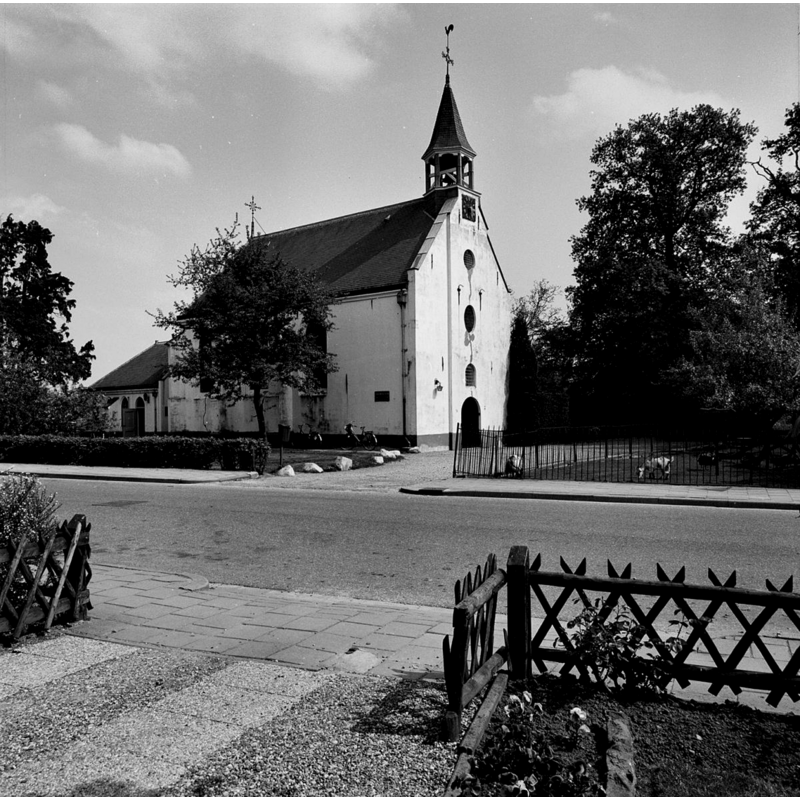
Image copyright © Rijksdienst voor het Cultureel Erfgoed, 2015
CC-BY-SA-3.0-NL
Results: 3 records
view of church exterior - northwest view
Copyright Statement: Image copyright © Rijksdienst voor het Cultureel Erfgoed, 2015
Image Source: B&W photograph taken March 1981 by A.H.C. Schollen, in Rijksdienst voor het Cultureel Erfgoed [https://commons.wikimedia.org/wiki/File:Exterieur_noord-west_gevel_-_Odijk_-_20170675_-_RCE.jpg] [accessed 27 November 2015]
Copyright Instructions: CC-BY-SA-3.0-NL
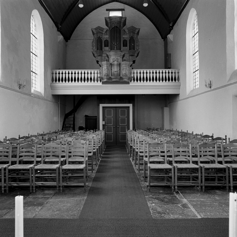
view of church interior - nave - looking west
Copyright Statement: Image copyright © Rijksdienst voor het Cultureel Erfgoed, 2015
Image Source: B&W photograph taken March 1981 by A.H.C. Schollen, in Rijksdienst voor het Cultureel Erfgoed [https://commons.wikimedia.org/wiki/File:Interieur_naar_het_westen_-_Odijk_-_20170680_-_RCE.jpg] [accessed 27 November 2015]
Copyright Instructions: CC-BY-SA-3.0-NL
view of church interior - nave - looking east
![the font, a former converted stoup, is partially visible at the east end, to the right [south] of the altar](/static-50478a99ec6f36a15d6234548c59f63da52304e5/compressed/1151127002_compressed.png)
Scene Description: the font, a former converted stoup, is partially visible at the east end, to the right [south] of the altar
Copyright Statement: Image copyright © Rijksdienst voor het Cultureel Erfgoed, 2015
Image Source: B&W photograph taken March 1981 by A.H.C. Schollen, in Rijksdienst voor het Cultureel Erfgoed [https://commons.wikimedia.org/wiki/File:Interieur_naar_het_oosten_-_Odijk_-_20170679_-_RCE.jpg] [accessed 27 November 2015]
Copyright Instructions: CC-BY-SA-3.0-NL
INFORMATION
Font ID: 20157ODI
Object Type: Baptismal Font1?
Font Date: ca. 1230?
Font Century and Period/Style: 13th century, Late Romanesque
Church / Chapel Name: Nederlands Hervormde Sint-Heribertkerk / Dorpskerk Sint-Heribert [aka Witte Kerkje]
Font Location in Church: [disappeared]
Church Patron Saint(s): St. Heribert of Cologne
Church Notes: original church here 1230, but there may have been an earlier church or chapel in the same place; re-built 1547 [source: Protestantse Gemeente Odijk [www.pknodijk.nl/gebouw.php] [accessed 27 November 2015]
Church Address: Zeisterweg 34, 3984 NL Odijk, Netherlands -- Tel.: +31 30 878 0698
Site Location: Utrecht, Netherlands, Europe
Directions to Site: Located off (E) the N229, S of the A12, in the municipality and 2-3 km SE of Bunnik, 6-7 km SE of Utrecht
Ecclesiastic Region: Diocese of Utrecht
Additional Comments: disappeared font? (the one from the ca.1230 church here)
Font Notes:
Click to view
[NB: we have no information on the font of the original ca.1230 church here] [cf. Index entry for Odijk No. 2 for a late-medieval holy water stoup converted for use as baptismal font in 1967].
COORDINATES
UTM: 31U 653195 5768858
Latitude & Longitude (Decimal): 52.049131, 5.234106
Latitude & Longitude (DMS): 52° 2′ 56.87″ N, 5° 14′ 2.78″ E