Fordongianus No. 2 / Fordongiani
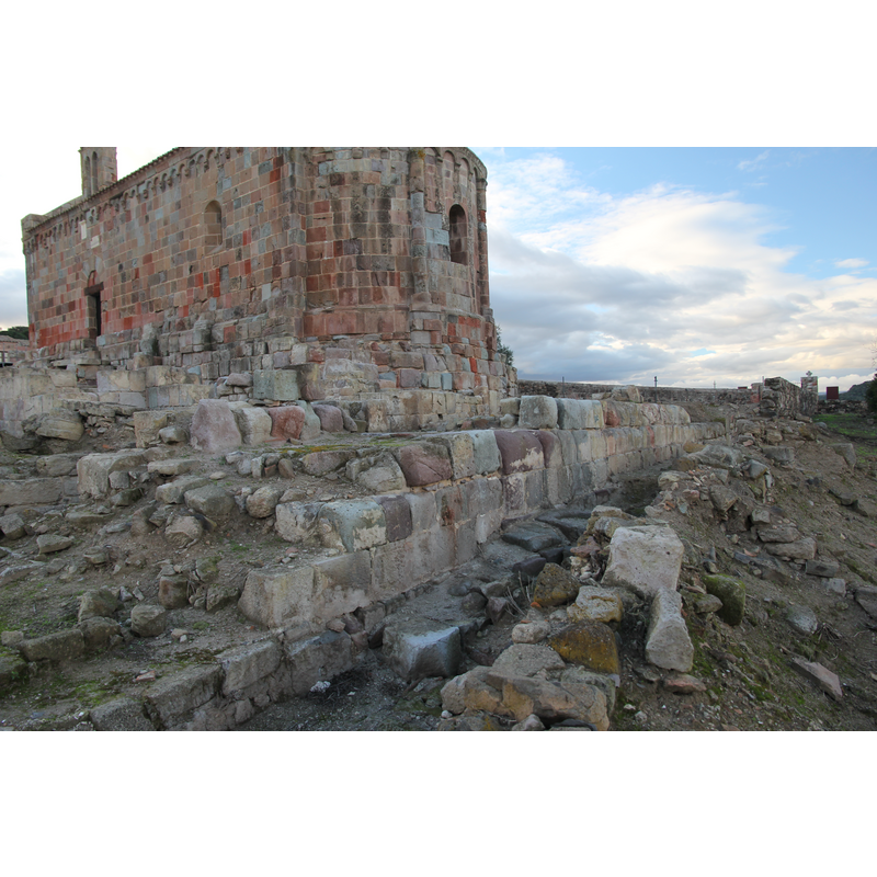
Image copyright © Gianni Careddu, 2014
CC-BY-SA-3.0
Results: 1 records
view of church exterior in context
Scene Description: the ruins of the 7thC Byzantine church are excavated at the foot of the Romanesque building [cf. FontNotes]
Copyright Statement: Image copyright © Gianni Careddu, 2014
Image Source: digital photograph taken 2 December 2014 by Gianni Careddu [https://commons.wikimedia.org/wiki/File:Fordongianus_-_Chiesa_di_San_Lussorio_(31).JPG] [accessed 17 November 2015]
Copyright Instructions: CC-BY-SA-3.0
INFORMATION
Font ID: 20131FOR
Object Type: Baptismal Font1
Font Century and Period/Style: 7th century(mid?), Byzantine
Church / Chapel Name: [Byzantine 7thC church]
Font Location in Church: [cf. FontNotes]
Church Patron Saint(s): St. Luxorius [aka Lussorio, Luxurius. Rossore]
Church Address: Strada Statale 388 del Tirso e del Mandrolisai, 09083 Fordongianus OR, Italy -- Tel.: +39 0783 60157
Site Location: Oristano, Sardegna, Italy, Europe
Directions to Site: Located off the SS388, 25 km NE of Oristano, 90 km NW of Cagliari
Ecclesiastic Region: Diocesi di Santa Giusta [formerly Diocesi di Fordongianus]
Font Notes:
Click to view
The web site Sardegna Cultura [ww.sardegnacultura.it/j/v/253?s=17880&v=2&c=2488&c1=2125&t=1] [accessed 17 November 2015] mentions a baptismal font likely from the mid-7th century baptistery of a Byzantine church here ["Nella prima metà del VII secolo, l'impianto cadde in rovina e, nella fase di ristrutturazione, venne edificata una nuova aula di culto, a cui sarebbe pertinente anche una vasca battesimale, attribuibile forse ad un piccolo battistero. È possibile scorgere ancora sotto il pavimento della chiesa romanica i resti di questo edificio bizantino."]
COORDINATES
UTM: 32T 482764 442664
Latitude & Longitude (Decimal): 39.989758, 8.798112
Latitude & Longitude (DMS): 39° 59′ 23.13″ N, 8° 47′ 53.2″ E