Sopeira No. 3 / Santa Maria de Alaón / Santa Maria d'Alaó
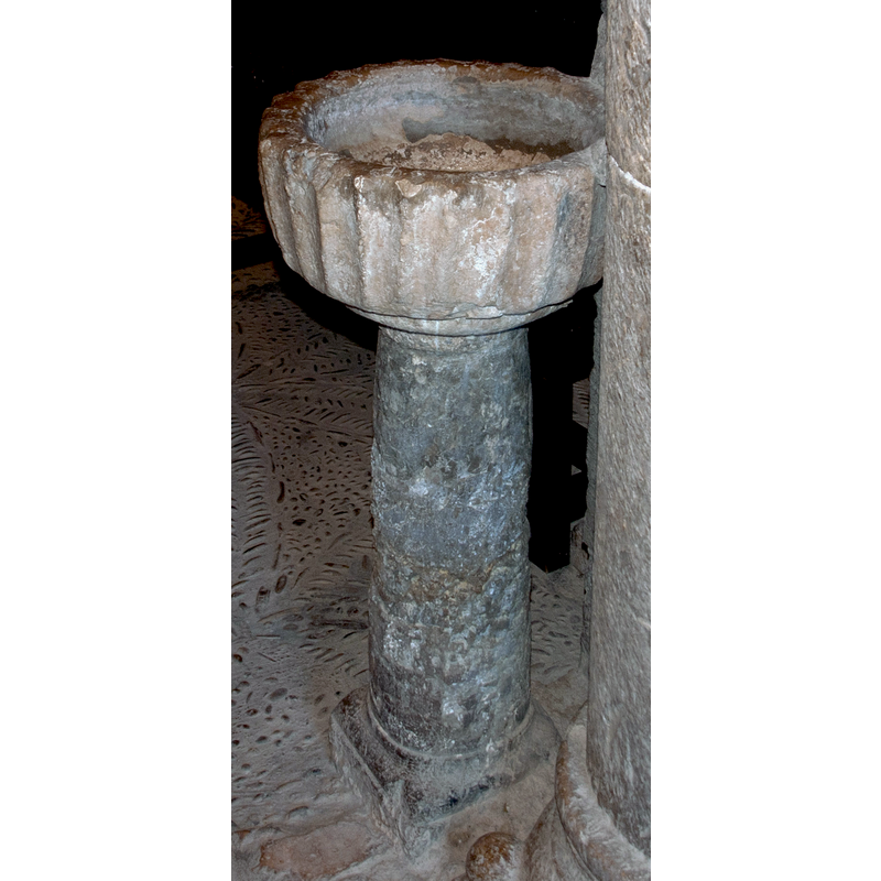
Image copyright © Mikel Unanue, 2015
Image and permission received (e-mail of 13 October 2015)
Results: 3 records
design element - patterns - fluted
Scene Description: all around
Copyright Statement: Image copyright © Mikel Unanue, 2015
Image Source: detail of a digital photograph taken 20 September 2015 by Mikel Unanue
Copyright Instructions: Image and permission received (e-mail of 13 October 2015)
view of stoup in context
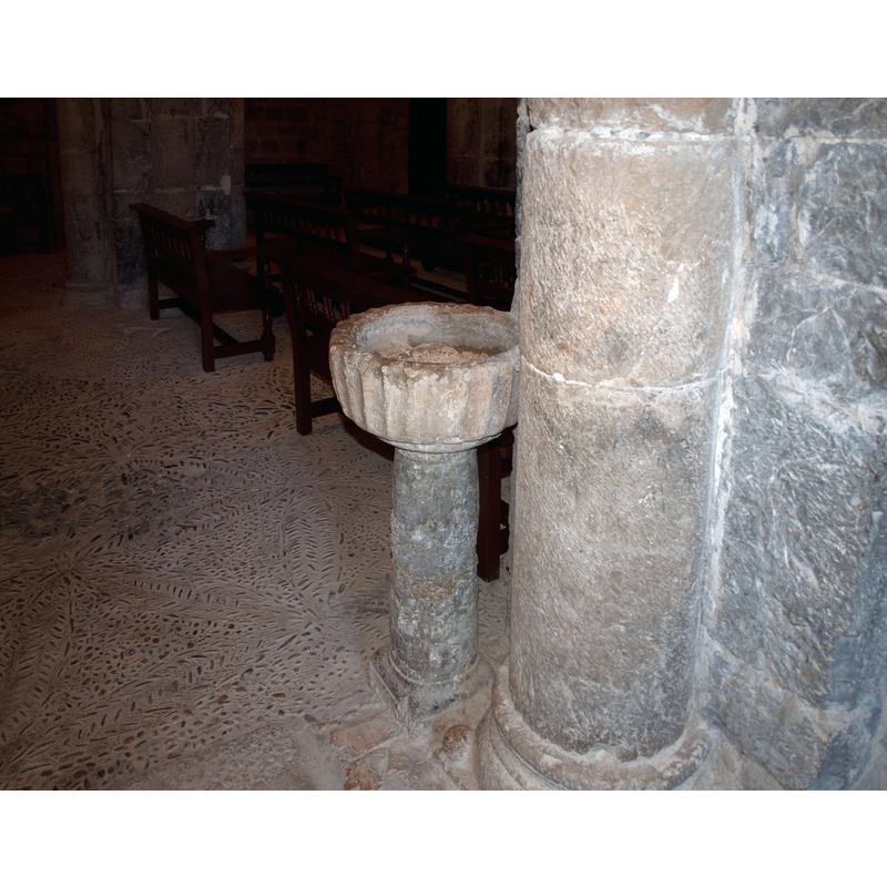
Scene Description: partly attached to the westmost pillar of the south arcade
Copyright Statement: Image copyright © Mikel Unanue, 2015
Image Source: digital photograph taken 20 September 2015 by Mikel Unanue
Copyright Instructions: Image and permission received (e-mail of 13 October 2015)
view of stoup
Copyright Statement: Image copyright © Mikel Unanue, 2015
Image Source: detail of a digital photograph taken 20 September 2015 by Mikel Unanue
Copyright Instructions: Image and permission received (e-mail of 13 October 2015)
INFORMATION
Font ID: 20068SOP
Object Type: Stoup
Font Century and Period/Style: Medieval
Church / Chapel Name: Iglesia Parroquial de Santa Maria de Alaón [formerly Monasterio de Santa María de Alaón / Monestir de Santa Maria d'Alaó]
Font Location in Church: Inside the church, by a column of the S arcade of the nave, W end
Church Patron Saint(s): St. Mary the Virgin [and St. Peter]
Church Address: C. la Iglesia, 22583 Sopeira, Huesca, Spain -- Tel.: +34 974 54 22 29
Site Location: Huesca, Aragón, Spain, Europe
Directions to Site: Located off the N-230, 10 km S of El Pont de Suert [NB: located between the village and the reservoir - not to be mistaken with Sapeira, located a few kms SE, in the province of Lerida/Lleida]
Ecclesiastic Region: Diócesis de Barbastro-Monzón [formerly / originally in the diocese of Urgel]
Historical Region: Ribagorza / Ribagorça -- Franja de Ponent
Additional Comments: disused stoup
Font Notes:
Click to view
Holy-water stoup by the westmost pillar of the south arcade of the nave; it consists of a roughly cylindrical basin with fluted sides, raised on a round pedestal base and a round to square lower base. It appears disused, the basin full of debris at the time.
Credit and Acknowledgements: We are grateful to Mikel Unanue for his photographs of this stoup
COORDINATES
UTM: 31T 314564 4687553
Latitude & Longitude (Decimal): 42.31815, 0.749722
Latitude & Longitude (DMS): 42° 19′ 5.34″ N, 0° 44′ 59″ E
MEDIUM AND MEASUREMENTS
Material: stone, limestone?
Font Shape: cylindrical, mounted
Basin Interior Shape: round
Basin Exterior Shape: round
Drainage Notes: no lining