Heath and Reach nr. Leighton Buzzard / Heath & Reach
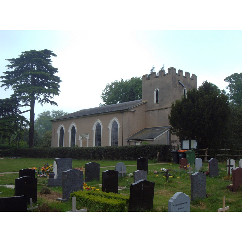
Image copyright © Mr Biz, 2011
CC-BY-SA-2.0
Results: 2 records
view of church exterior - northwest view
Copyright Statement: Image copyright © Mr Biz, 2011
Image Source: digital photograph taken 29 April 2011 by Mr Biz [www.geograph.org.uk/photo/2383298] [accessed 22 September 2015]
Copyright Instructions: CC-BY-SA-2.0
view of font and cover in context
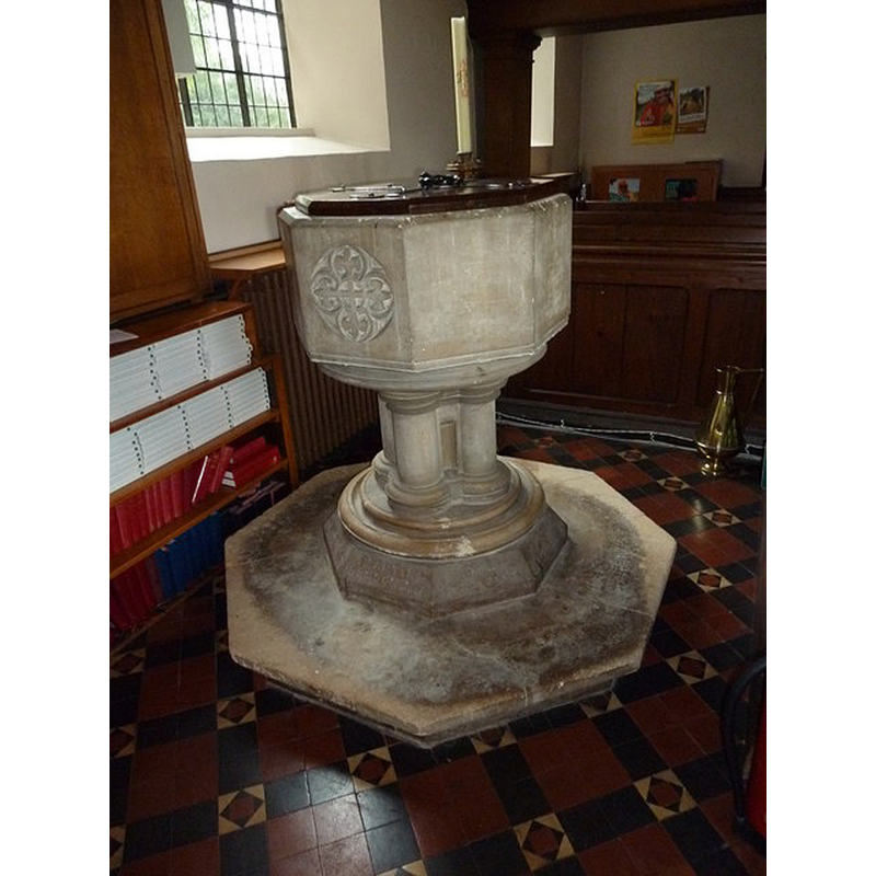
Scene Description: the modern font
Copyright Statement: Image copyright © Basher Eyre, 2011
Image Source: digital photograph taken 6 September 2011 by Basher Eyre [www.geograph.org.uk/photo/2594123] [accessed 22 September 2015]
Copyright Instructions: CC-BY-SA-2.0
INFORMATION
Font ID: 20046HEA
Object Type: Baptismal Font1?
Font Century and Period/Style: 16th century(late?), Elizabethan
Church / Chapel Name: Parish Church of St. Leonard
Church Patron Saint(s): St. Leonard
Church Address: Leighton Road, Heath & Reach, Bedfordshire, LU7 0AA, United Kingdom
Site Location: Bedfordshire, East, England, United Kingdom
Directions to Site: Located 3 km N of Leighton Buzzard, 5 km S of Woburn, near the county border with Bucks.
Ecclesiastic Region: Diocese of St. Albans
Historical Region: Hundred of Manshead
Additional Comments: disappeared font? (the one from the original 1580s church here)
Font Notes:
Click to view
The Victoria County History (Bedfordshire, vol. 3, 1912) notes: "The church of ST. LEONARD at Heath and Reach has but little history, the oldest part being the west tower, which dates from the end of the 16th century. [...] There are no fittings of any interest." The 'Heath and Reach Church Repairs and Additions' piece on the Bedford County Council web site [www.bedfordshire.gov.uk/CommunityAndLiving/ArchivesAndRecordOffice/CommunityArchives/HeathandReach/HeathAndReachChurchRepairsAndAdditions.aspx] [accessed 22 September 2015] notes: "Some of the following information is taken from former County Archivist Chris Pickford's Bedfordshire Historical Record Society volume Bedfordshire Churches in the 19th Century: Parishes H-R. [...] n 1866 and the church was suitably extended [...] A new font was made and installed in memory of Martin Benson." This source illustrates the new font, consisting of an octagonal basin of vertical sides, one (?) of which is carved with a foliage motif, raised on clustered colonnettes and a moulded round-to-octagonal lower base, very much a piece of Victorian taste. The source does not mention the fate of the original 16th-century font here.
COORDINATES
UTM: 30U 661133 5757005
Latitude & Longitude (Decimal): 51.9404, -0.6558
Latitude & Longitude (DMS): 51° 56′ 25.44″ N, 0° 39′ 20.88″ W
REFERENCES
- Victoria County History [online], University of London, 1993-. URL: https://www.british-history.ac.uk.