Moggerhanger / Mogerhanger / Mokehangre / Morehanger / Muggerhange
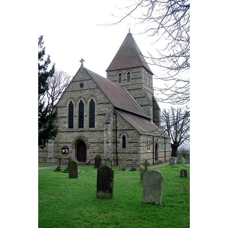
Image copyright © John Salmon, 2002
CC-BY-SA-2.0
Results: 3 records
view of church exterior - northeast view
Scene Description: the modern church
Copyright Statement: Image copyright © John Salmon, 2002
Image Source: digital photograph taken 1 February 2002 by John Salmon [www.geograph.org.uk/photo/329948] [accessed 16 September 2015]
Copyright Instructions: CC-BY-SA-2.0
view of church exterior - southeast view
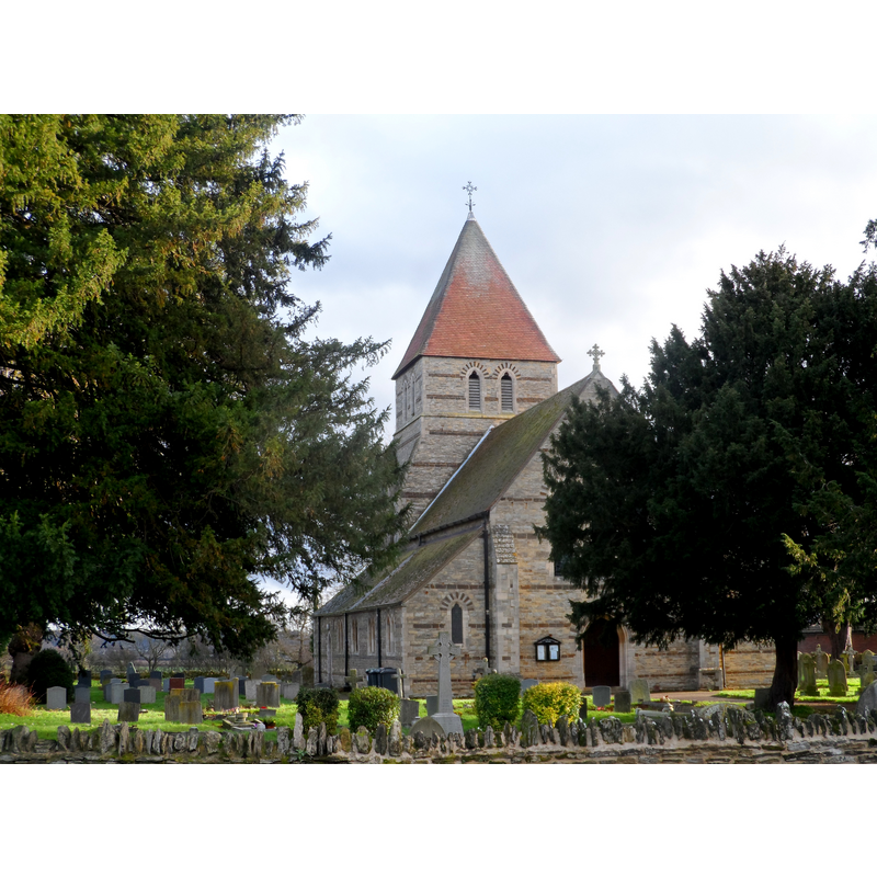
Scene Description: the modern church
Copyright Statement: Image copyright © Bikeboy, 2013
Image Source: digital photograph taken 22 December 2013 by Bikeboy [www.geograph.org.uk/photo/3788289] [accessed 16 September 2015]
Copyright Instructions: CC-BY-SA-2.0
view of church interior - nave - looking east
Scene Description: the modern church
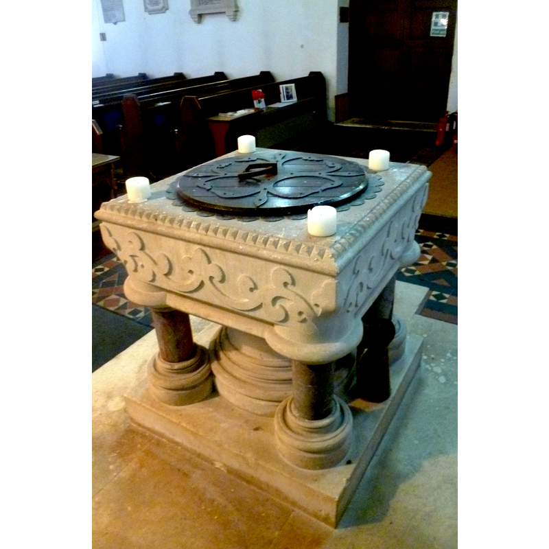
INFORMATION
Font ID: 20040MOG
Object Type: Baptismal Font1
Font Century and Period/Style: 19th century, Victorian
Church / Chapel Name: Parish Church of St. John the Baptist
Font Location in Church: Inside the church
Church Patron Saint(s): St. John the Baptist
Church Notes: present church of St. John the Evangelist built in 1860; no earlier church known here
Church Address: 6 Blunham Road, Mogerhanger, Central Bedfordshire MK44 3RD
Site Location: Bedfordshire, East, England, United Kingdom
Directions to Site: Located W of Sandy (dir. Bedford)
Ecclesiastic Region: Diocese of St. Albans
Historical Region: Hundred of Wixamtree
Additional Comments: [pronounced locally 'Morhanger']
Font Notes:
Click to view
No entry found for Moggerhanger in the Domesday survey. The Victoria County History (Bedfordshire, vol. 3, 1912) notes: "There is no mention of MOGGERHANGER MANOR in Domesday, and it was apparently included in the 10 hides belonging to Adeliza wife of Hugh de Grentmeisnil in Chalton. [...] Moggerhanger Church was built by Mrs. Dawkins as a memorial to her husband, the Rev. Edward Henry Dawkins of Moggerhanger House, who died in 1859." The round font raised on five columns is also modern.
COORDINATES
UTM: 30U 682581 5778965
Latitude & Longitude (Decimal): 52.131, -0.3324
Latitude & Longitude (DMS): 52° 7′ 51.6″ N, 0° 19′ 56.64″ W
MEDIUM AND MEASUREMENTS
Material: stone
Font Shape: round, mounted
Basin Interior Shape: round
Basin Exterior Shape: round