Smeeton Westerby / Esmeditone / Smetheton / Smitetone / Smitone
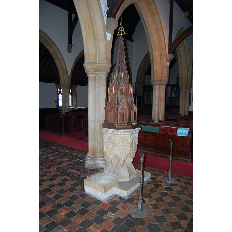
Image copyright © Andrew H Jackson, 2007
No known copyright restriction / Fair Dealing
Results: 3 records
view of font and cover
Scene Description: the modern font and cover in the modern church
Copyright Statement: Image copyright © Andrew H Jackson, 2007
Image Source: digital photograph taken March 2007 by Andrew H Jackson [www.britishlistedbuildings.co.uk/images/buildings/en/191/191391-43970-800.jpg] [accessed 25 August 2015]
Copyright Instructions: No known copyright restriction / Fair Dealing
view of church exterior - south view
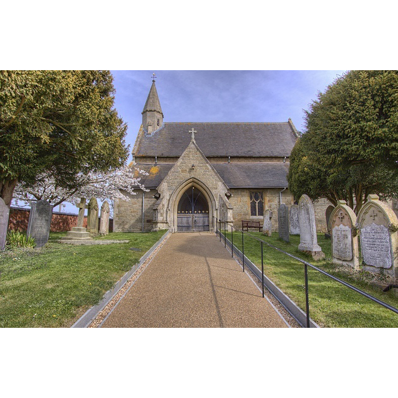
Scene Description: the modern church
Copyright Statement: Image copyright © Christopher Jones, 2015
Image Source: digital photograph taken by Christopher Jones [www.leicestershirechurches.co.uk/smeeton-westerby-christ-church/] [accessed 25 August 2015]
Copyright Instructions: Standing permission
view of church interior - nave - looking east
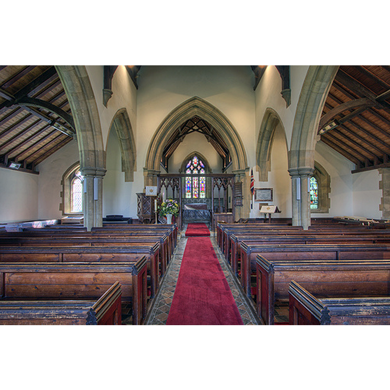
Scene Description: the new church
Copyright Statement: Image copyright © Christopher Jones, 2015
Image Source: digital photograph taken by Christopher Jones [www.leicestershirechurches.co.uk/smeeton-westerby-christ-church/] [accessed 25 August 2015]
Copyright Instructions: Standing permission
INFORMATION
Font ID: 20015SME
Object Type: Baptismal Font1?
Font Century and Period/Style: 16th century, Late Gothic
Church / Chapel Name: [disappeared chapel]
Church Address: address of the new church: Saddington Road, Smeeton Westerby, Leicestershire LE8 0QS
Site Location: Leicestershire, East Midlands, England, United Kingdom
Directions to Site: Located off (W) the A6, 15 km SSE of Leicester
Ecclesiastic Region: Diocese of Leicester
Historical Region: Hundred of Gartree
Additional Comments: disappeared font? (did the chapel documented in the 16thC have a font?)
Font Notes:
Click to view
There are four entries for Smeeton [Westerby] [variant spelling] in the Domesday survey [http://opendomesday.org/place/SP6792/smeeton-westerby/] [accessed 25 August 2015], none of which mention cleric or church in it. The Victoria County History (Leicestershire, vol. 5, 1964) notes: "In 1587 Elizabeth I granted the graveyard of a chapel at Smeeton to Edward Heron and John Nicholas. (fn. 492) Nothing further is known about the chapel, nor is it clear how the graveyard came into the queen's hands, but the grant seems to imply that the chapel was disused by 1587. [...] In 1851 a church was built at Smeeton Westerby, (fn. 501) and in 1852 the township was formed into a separate ecclesiastical parish." The present octagonal font with a Gothic-style cover are probably from this 19th-century church. [NB: we have no information of the font of the earlier chapel here, if it had one].
Credit and Acknowledgements: We are grateful to Christopher Jones, of Leicestershire Churches [www.leicestershirechurches.co.uk], for his photographs of the new church here
COORDINATES
UTM: 30U 635711 5821891
Latitude & Longitude (Decimal): 52.530187, -0.999333
Latitude & Longitude (DMS): 52° 31′ 48.67″ N, 0° 59′ 57.6″ W
REFERENCES
- Victoria County History [online], University of London, 1993-. URL: https://www.british-history.ac.uk.