Leire / Legre
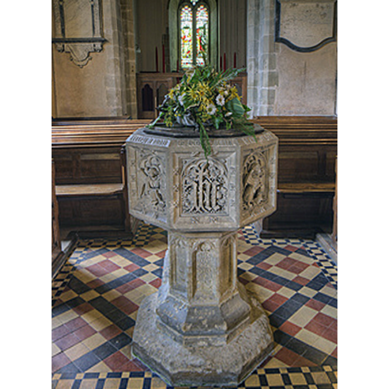
Image copyright © Christopher Jones, 2015
Standing permission
Results: 4 records
view of font and cover
Scene Description: the modern font of 1851
Copyright Statement: Image copyright © Christopher Jones, 2015
Image Source: edited detail of a digital photograph taken by Christopher Jones [www.leicestershirechurches.co.uk/leire-church-st-peter/] [accessed 18 August 2015]
Copyright Instructions: Standing permission
view of church exterior - south view
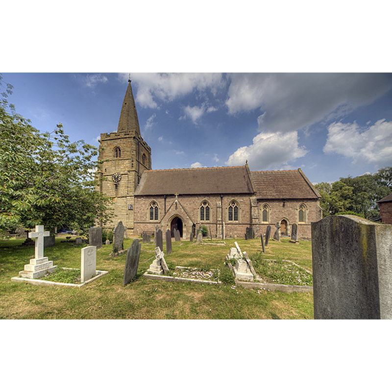
Scene Description: NéA
Copyright Statement: Image copyright © Christopher Jones, 2015
Image Source: digital photograph taken by Christopher Jones [www.leicestershirechurches.co.uk/leire-church-st-peter/] [accessed 18 August 2015]
Copyright Instructions: Standing permission
view of church interior - nave - looking west
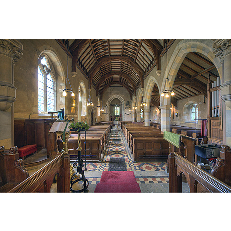
Scene Description: the modern font is visible at the far end
Copyright Statement: Image copyright © Christopher Jones, 2015
Image Source: digital photograph taken by Christopher Jones [www.leicestershirechurches.co.uk/leire-church-st-peter/] [accessed 18 August 2015]
Copyright Instructions: Standing permission
view of church interior - nave - looking east
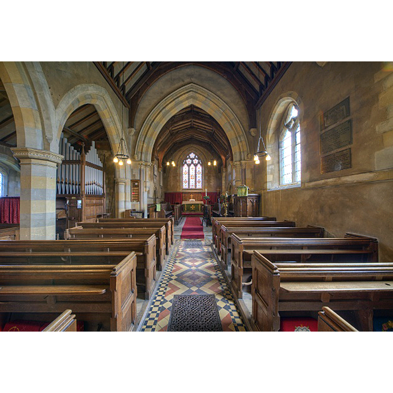
Copyright Statement: Image copyright © Christopher Jones, 2015
Image Source: digital photograph taken by Christopher Jones [www.leicestershirechurches.co.uk/leire-church-st-peter/] [accessed 18 August 2015]
Copyright Instructions: Standing permission
INFORMATION
Font ID: 20001LEI
Object Type: Baptismal Font1?
Font Century and Period/Style: 11th century, Pre-Conquest? / Norman
Church / Chapel Name: Parish Church of St. Peter
Church Patron Saint(s): St. Peter
Church Address: Main Street, Leire, Leicestershire LE17 5ES
Site Location: Leicestershire, East Midlands, England, United Kingdom
Directions to Site: Located between Frolesworth (W) and Dunton Basssett (E)
Ecclesiastic Region: Diocese of Chester
Historical Region: Hundred of Guthlaxton
Additional Comments: disappeared font? (the one from the Domesday-time church here)
Font Notes:
Click to view
There are three entries for Leire [variant spelling] in the Domesday survey [http://opendomesday.org/place/SP5290/leire/] [accessed 18 August 2015], one of which mentions a priest, but not a church in it, though there probably was one here. Noted in Pevsner (1984): "font of 1851". [NB: though the fabric of the church goes back to ca. 1300, we have no information on the earlier font of this church].
COORDINATES
UTM: 30U 620272 5818726
Latitude & Longitude (Decimal): 52.505377, -1.227963
Latitude & Longitude (DMS): 52° 30′ 19.36″ N, 1° 13′ 40.67″ W
REFERENCES
- Pevsner, Nikolaus, Leicestershire and Rutland, Harmondsworth: Penguin Books, 1984, p. 274