Ibstock / Ibestoche
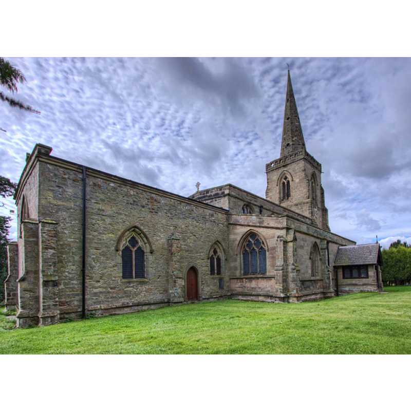
Image copyright © Christopher Jones, 2015
Standing permission
Results: 4 records
view of church exterior - northeast view
Copyright Statement: Image copyright © Christopher Jones, 2015
Image Source: digital photograph taken by Christopher Jones [www.leicestershirechurches.co.uk/ibstock-st-denys/] [accessed 13 August 2015]
Copyright Instructions: Standing permission
view of church exterior - north view
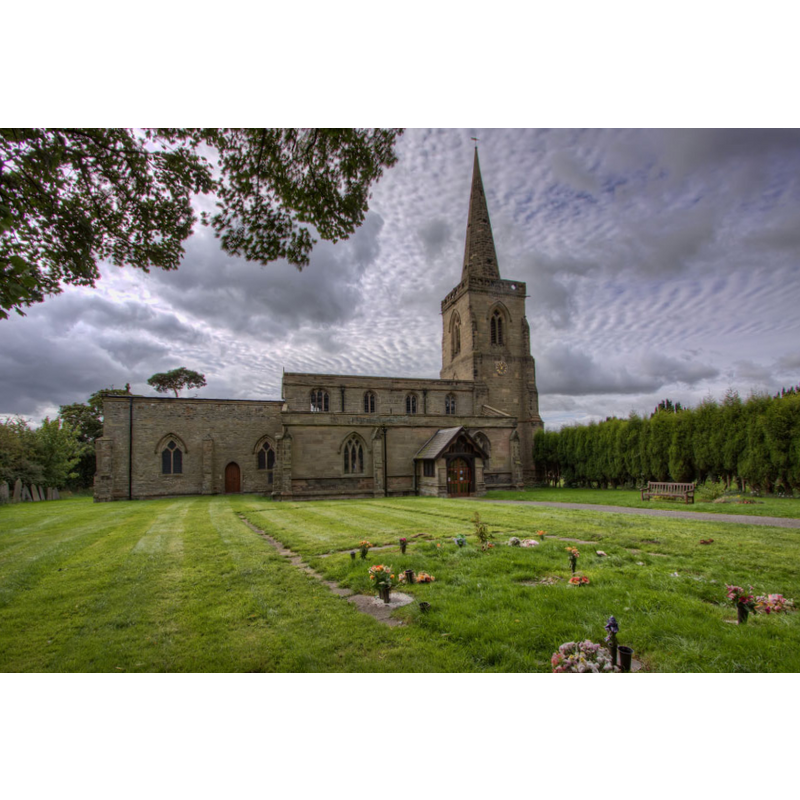
Copyright Statement: Image copyright © Christopher Jones, 2015
Image Source: digital photograph taken by Christopher Jones [www.leicestershirechurches.co.uk/ibstock-st-denys/] [accessed 13 August 2015]
Copyright Instructions: Standing permission
view of church interior - chancel
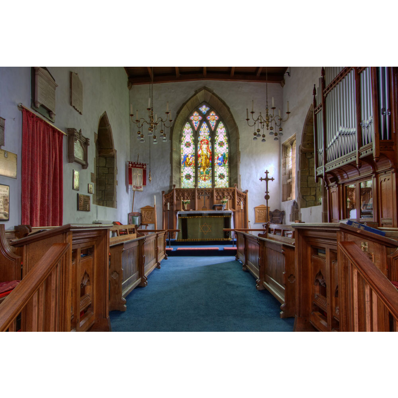
Copyright Statement: Image copyright © Christopher Jones, 2015
Image Source: digital photograph taken by Christopher Jones [www.leicestershirechurches.co.uk/ibstock-st-denys/] [accessed 13 August 2015]
Copyright Instructions: Standing permission
view of church interior - north aisle - looking east
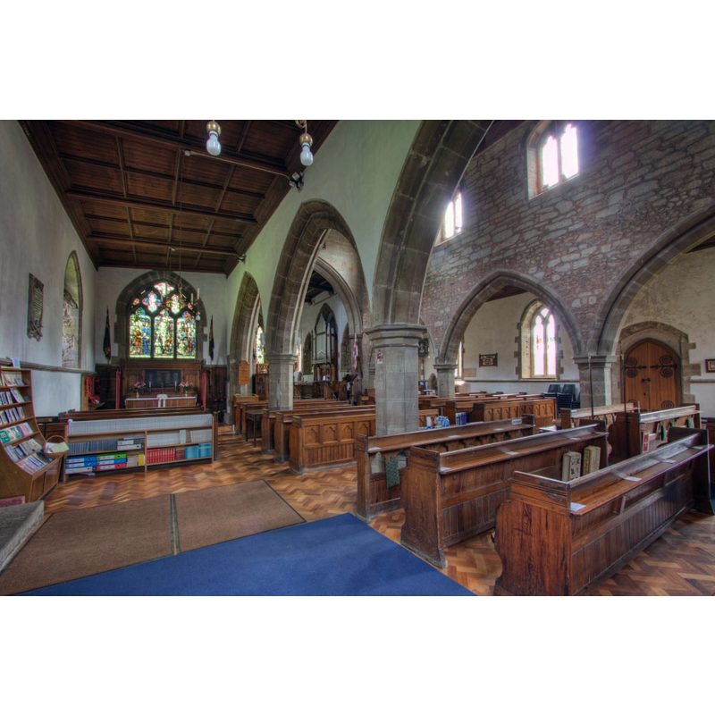
Scene Description: the view cuts across the nave and the two aisles
Copyright Statement: Image copyright © Christopher Jones, 2015
Image Source: digital photograph taken by Christopher Jones [www.leicestershirechurches.co.uk/ibstock-st-denys/] [accessed 13 August 2015]
Copyright Instructions: Standing permission
INFORMATION
Font ID: 19989IBS
Object Type: Baptismal Font1
Font Century and Period/Style: Medieval
Church / Chapel Name: Parish Church of St. Denys
Font Location in Church: Inside the church, at the W end of the nave
Church Patron Saint(s): St. Denys [aka Denis, Dennis, Dionis, Dyonisius]
Church Notes: an earlier church may have existed here
Church Address: Hinckley Road/High Street, Ibstock, Leicestershire LE67 6JQ
Site Location: Leicestershire, East Midlands, England, United Kingdom
Directions to Site: Located on the A447, 5 km SW of Coalville, 20 km NW of Leicester
Ecclesiastic Region: Diocese of Leicester
Historical Region: Hundred of Guthlaxton
Font Notes:
Click to view
There is an entry for Ibstock [variant spelling] in the Domesday survey [http://opendomesday.org/place/SK4010/ibstock/] [accessed 13 August 2015], but it mentions neither cleric nor church in it. The entry for Ibstock in English Heritage [Listing NGR: SK4045309562] (1966) dates the church to the early-14th century, and notes a "font which may pre-date the church". The present font is rather odd looking, consisting of a narrow octagonal basin with piping at the angles and a very tall underbowl chamfer, a very thin square stem, also with piping, and a lower base like an upturned version of the basin without the piping; on a two-step circular plinth.
Credit and Acknowledgements: We are grateful to Christopher Jones, of Leicestershire Churches [www.leicestershirechurches.co.uk], for his photographs of this church
COORDINATES
UTM: 30U 607930 5838109
Latitude & Longitude (Decimal): 52.682144, -1.403394
Latitude & Longitude (DMS): 52° 40′ 55.72″ N, 1° 24′ 12.22″ W
MEDIUM AND MEASUREMENTS
Material: stone
Font Shape: octagonal, mounted
Basin Interior Shape: round
Basin Exterior Shape: octagonal