Bagworth / Bageworde
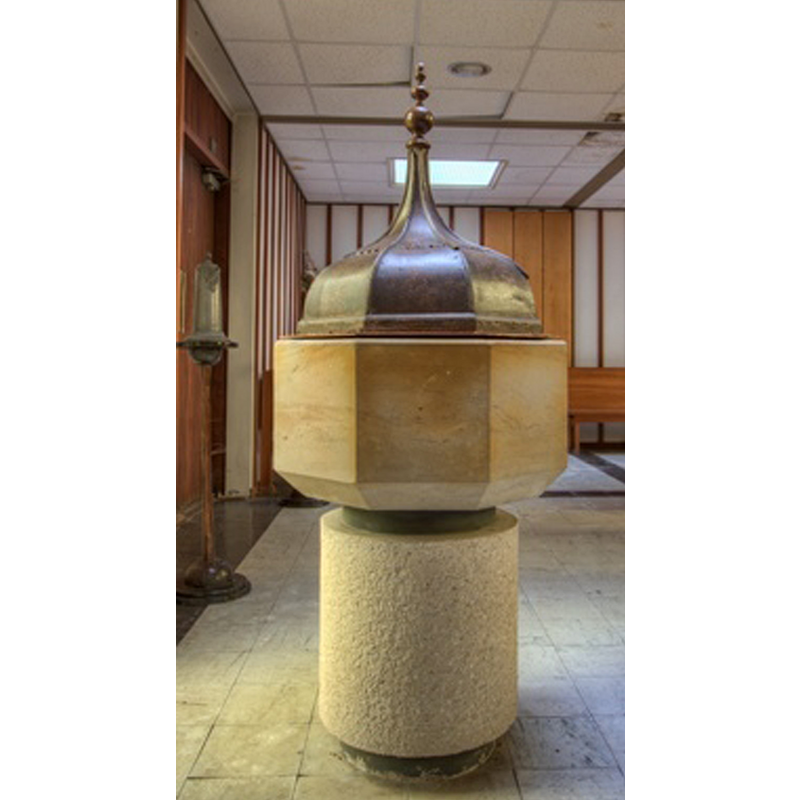
Image copyright © Chris Jones, 2015
Standing permission
Results: 7 records
view of font and cover
Scene Description: the modern font [is the cover 17thC? a replica?]
Copyright Statement: Image copyright © Chris Jones, 2015
Image Source: digital photogrph taken by Chris Jones in [www.leicestershirechurches.co.uk/bagworth-church-holy-rood/] [accessed 24 July 2015]
Copyright Instructions: Standing permission
view of church exterior
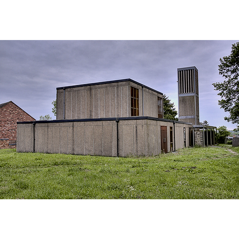
Copyright Statement: Image copyright © Chris Jones, 2015
Image Source: digital photogrph taken by Chris Jones in [www.leicestershirechurches.co.uk/bagworth-church-holy-rood/] [accessed 24 July 2015]
Copyright Instructions: Standing permission
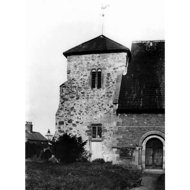
view of church exterior
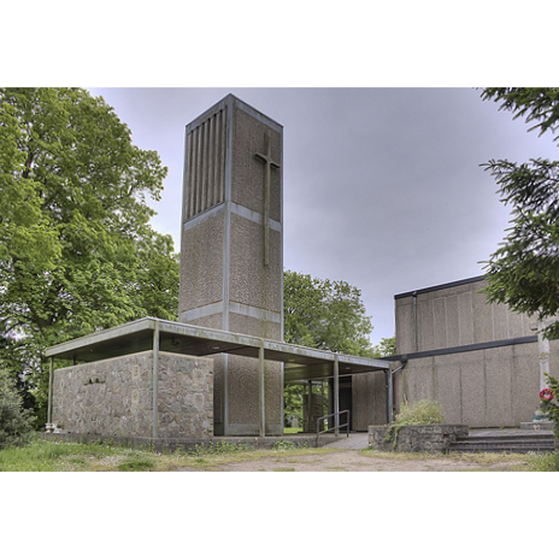
Scene Description: Source caption: "Some remains of the old church are built into the modern fabric." The remains are seen here to the left of the modern tower
Copyright Statement: Image copyright © Chris Jones, 2015
Image Source: digital photogrph taken by Chris Jones in [www.leicestershirechurches.co.uk/bagworth-church-holy-rood/] [accessed 24 July 2015]
Copyright Instructions: Standing permission
view of church exterior
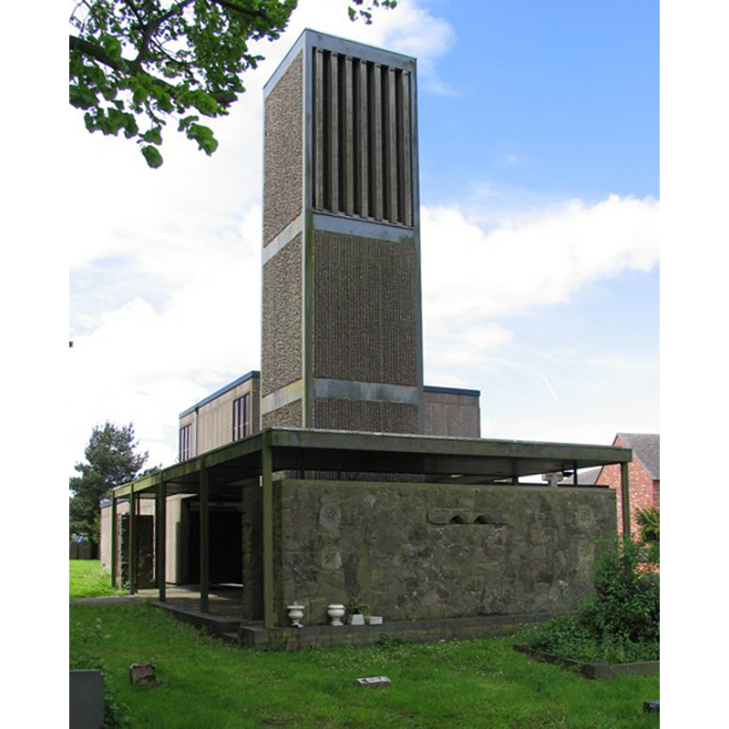
Copyright Statement: Image copyright © Andrew Tatlow, 2006
Image Source: digital photograph taken 24 May 2006 by Andrew Tatlow [www.geograph.org.uk/photo/174538] [accessed 24 July 2015]
Copyright Instructions: CC-BY-SA-2.0
view of church exterior - south view - west end
Scene Description: Source caption: "Earlier Church in 1960's before demolition."
Copyright Statement: Image copyright © [in the public domain]
Image Source: undated B&W photograph in [www.leicestershirechurches.co.uk/bagworth-church-holy-rood/] [accessed 24 July 2015]
Copyright Instructions: PD
view of church exterior - northeast view
![Source caption: "1793 Engraving of the original church from north-east".
NEW CHURCH OLD WALL + ARCH? digital photograph taken 24 May 2006 by Andrew Tatlow [www.geograph.org.uk/photo/174538] [accessed 24 July 2015]
OTHER PHOTOS digital photogrph taken by Chris Jones in [www.leicestershirechurches.co.uk/bagworth-church-holy-rood/] [accessed 24 July 2015]
THE PHOTO THAT SHOWS THE MOD CHURCH WITH OLD STONES HAS Source caption: "Some remains of the old church are built into the modern fabric."](/static-50478a99ec6f36a15d6234548c59f63da52304e5/compressed/0150804051_compressed.png)
Scene Description: Source caption: "1793 Engraving of the original church from north-east".
NEW CHURCH OLD WALL + ARCH? digital photograph taken 24 May 2006 by Andrew Tatlow [www.geograph.org.uk/photo/174538] [accessed 24 July 2015]
OTHER PHOTOS digital photogrph taken by Chris Jones in [www.leicestershirechurches.co.uk/bagworth-church-holy-rood/] [accessed 24 July 2015]
THE PHOTO THAT SHOWS THE MOD CHURCH WITH OLD STONES HAS Source caption: "Some remains of the old church are built into the modern fabric."
Copyright Statement: Image copyright © [in the public domain]
Image Source: 1793 drawing by J.P. Malcolm in [www.leicestershirechurches.co.uk/bagworth-church-holy-rood/] [accessed 24 July 2015]
Copyright Instructions: PD
view of church interior - nave - looking east
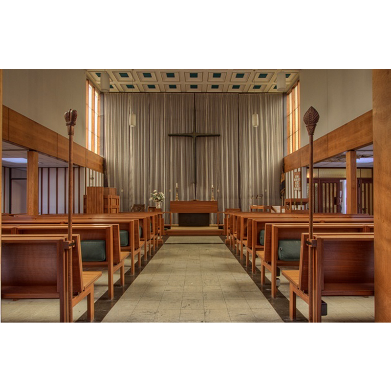
Copyright Statement: Image copyright © Chris Jones, 2015
Image Source: digital photogrph taken by Chris Jones in [www.leicestershirechurches.co.uk/bagworth-church-holy-rood/] [accessed 24 July 2015]
Copyright Instructions: Standing permission
INFORMATION
Font ID: 19952BAG
Object Type: Baptismal Font1
Font Century and Period/Style: 11th - 12th century, Norman
Church / Chapel Name: Chapel of the Holy Rood [re-built as Parish Church of the Holy Rood]
Church Patron Saint(s): The Holy Cross
Church Notes: old church affected by subsidience from the mining; demolished in 1968
Church Address: School Lane, Bagworth, Leics. LE67 1DN [the modern church]
Site Location: Leicestershire, East Midlands, England, United Kingdom
Directions to Site: Located 10 km W of Leicester
Ecclesiastic Region: Diocese of Leicester
Historical Region: Hundred of Guthlaxton
Additional Comments: disappeared font? (the one from the Norman church here)
Font Notes:
Click to view
There is an entry for Bagworth [variant spelling] in the Domesday survey [http://opendomesday.org/place/SK4408/bagworth/] [accessed 24 July 2015], but it mentions neither cleric nor church in it. A font in the new church at Bagworth is noted and illustrated in Chris Jones [www.leicestershirechurches.co.uk/bagworth-church-holy-rood/] [accessed 24 July 2015]: "The font is from the previous church (apart from the base)". The font consists of an octagonal basin with plain sides and a chamfered underbowl, raised on a cylindrical pedestal base; both parts appear totally modern; was the basin re-cut? re-tooled? The font cover, on the other hand, appears old, an octagonal dome in the style of 17th-century covers. The modern church incorporates some stone from the old church, including a Norman arch.
Credit and Acknowledgements: We are grateful to Christopher Jones, of Leicestershire Churches [www.leicestershirechurches.co.uk], for his photographs of this church and modern font
COORDINATES
UTM: 30U 612425 5836421
Latitude & Longitude (Decimal): 52.666062, -1.337516
Latitude & Longitude (DMS): 52° 39′ 57.82″ N, 1° 20′ 15.06″ W
LID INFORMATION
Date: 17th century? / modern replica?
Material: wood, oak?
Apparatus: no
Notes: [cf. FontNotes]