Empingham / Amplingeham / Empingeham / Epingeham / Epingham / Hempingham
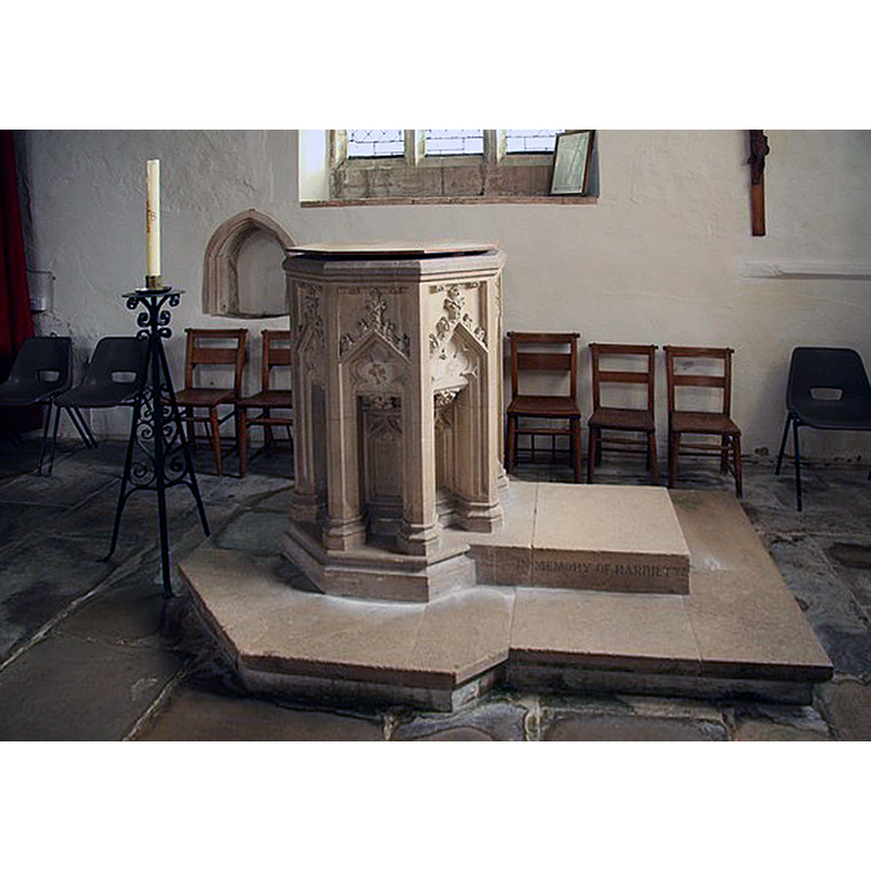
Image copyright © Richard Croft, 2009
CC-BY-SA-2.0
Results: 6 records
view of font and cover in context
Scene Description: the modern font
Copyright Statement: Image copyright © Richard Croft, 2009
Image Source: digital photograph taken 16 February 2009 by Richard Croft [www.geograph.org.uk/photo/1174914] [accessed 22 July 2015]
Copyright Instructions: CC-BY-SA-2.0
view of basin - detail

Scene Description: the modern font; notice inside the arch-heads: something was glued/cemented there but has been removed or fallen off
Copyright Statement: Image copyright © Michael Garlick, 2015
Image Source: digital photograph taken 29 May 2015 by Michael Garlick [www.geograph.org.uk/photo/1174914] [accessed 22 July 2015]
Copyright Instructions: CC-BY-SA-2.0
view of church exterior - south view
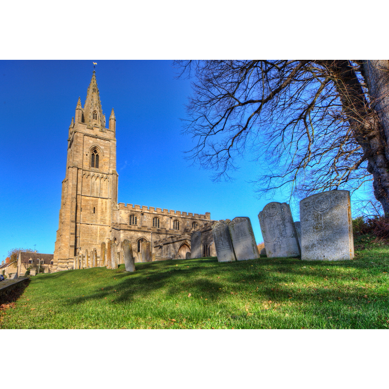
Copyright Statement: Image copyright © Christopher Jones, 2015
Image Source: digital photograph taken by Chris Jones [www.leicestershirechurches.co.uk/empingham-st-peter/] [accessed 22 July 2015]
Copyright Instructions: Standing permission
view of church interior - nave - looking west
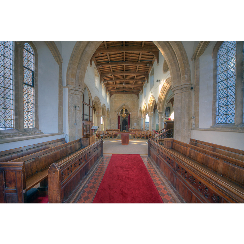
Copyright Statement: Image copyright © Christopher Jones, 2015
Image Source: digital photograph taken by Chris Jones [www.leicestershirechurches.co.uk/empingham-st-peter/] [accessed 22 July 2015]
Copyright Instructions: Standing permission
view of church interior - nave - looking east
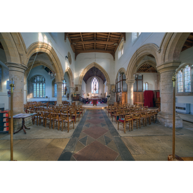
Copyright Statement: Image copyright © Christopher Jones, 2015
Image Source: digital photograph taken by Chris Jones [www.leicestershirechurches.co.uk/empingham-st-peter/] [accessed 22 July 2015]
Copyright Instructions: Standing permission
view of church interior - nave - looking southwest
![PHOTOS digital photograph taken by Chris Jones [www.leicestershirechurches.co.uk/empingham-st-peter/] [accessed 22 July 2015]
EXCEPT:
INT SW digital photograph taken 13 April 2015 by John Salmon [www.geograph.org.uk/photo/4470561] [accessed 22 July 2015]
MOD FONT digital photograph taken 16 February 2009 by Richard Croft [www.geograph.org.uk/photo/1174914] [accessed 22 July 2015] Source caption: "Victorian font in St.Peter's church"
MOD FONT DETAIL digital photograph taken 29 May 2015 by Michael Garlick [www.geograph.org.uk/photo/1174914] [accessed 22 July 2015] Source caption: "Empingham: St. Peter's Church: Detail of the 14th century style font. A Victorian font in actual fact."](/static-50478a99ec6f36a15d6234548c59f63da52304e5/compressed/1150830065_compressed.png)
Scene Description: PHOTOS digital photograph taken by Chris Jones [www.leicestershirechurches.co.uk/empingham-st-peter/] [accessed 22 July 2015]
EXCEPT:
INT SW digital photograph taken 13 April 2015 by John Salmon [www.geograph.org.uk/photo/4470561] [accessed 22 July 2015]
MOD FONT digital photograph taken 16 February 2009 by Richard Croft [www.geograph.org.uk/photo/1174914] [accessed 22 July 2015] Source caption: "Victorian font in St.Peter's church"
MOD FONT DETAIL digital photograph taken 29 May 2015 by Michael Garlick [www.geograph.org.uk/photo/1174914] [accessed 22 July 2015] Source caption: "Empingham: St. Peter's Church: Detail of the 14th century style font. A Victorian font in actual fact."
Copyright Statement: Image copyright © John Salmon, 2015
Image Source: digital photograph taken 13 April 2015 by John Salmon [www.geograph.org.uk/photo/4470561] [accessed 22 July 2015]
Copyright Instructions: CC-BY-SA-2.0
INFORMATION
Font ID: 19946EMP
Object Type: Baptismal Font1?
Font Century and Period/Style: 12th century, Late Norman
Church / Chapel Name: Parish Church of St. Peter
Church Patron Saint(s): St. Peter
Church Address: Church Street, Empingham, Rutland. LE15 8PN
Site Location: Rutland, East Midlands, England, United Kingdom
Directions to Site: Located off (N) the A606/Stamford Rd., WNW of Stamford
Ecclesiastic Region: Diocese of Peterborough
Historical Region: Hundred of Witchley [in Domesday] -- East Hundred
Additional Comments: disappeared font? (the font of the 12thC church here)
Font Notes:
Click to view
There are three entries for Empingham [variant spelling] in the Domesday survey [http://opendomesday.org/place/SK9508/empingham/] [accessed 22 July 2015], neither of which mentions cleric or church in it. The Victoria County History (Rutland, vol. 2, 1935) notes: "The church is mainly of 13th-century date, with additions and alterations in the 14th and 15th centuries, but has developed from an aisleless 12thcentury building the nave of which covered the same area as the present nave and of which the angles remain. [...] The font dates from 1895, and is in the style of the 14th century. [...] The original font had been replaced at some time unknown by 'a plain stone pillar with a small basin on the top.'" [NB: we have no information on either of the missing fonts; the present font is, as indicated above, of 14th-century design, octagonal and monolithic, with deeply carved crocketed arches or niches on the sides; it is located at the west end of the south aisle].
Credit and Acknowledgements: We are grateful to Christopher Jones, of Leicestershire Churches [www.leicestershirechurches.co.uk], for his photographs of this church
COORDINATES
UTM: 30U 662578 5837777
Latitude & Longitude (Decimal): 52.66553, -0.595806
Latitude & Longitude (DMS): 52° 39′ 55.91″ N, 0° 35′ 44.9″ W
REFERENCES
- Victoria County History [online], University of London, 1993-. URL: https://www.british-history.ac.uk.