Baarn No. 2 / Baerne / Barne
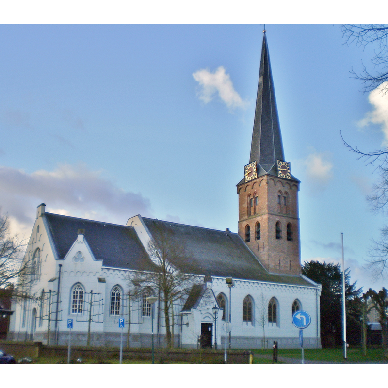
Image copyright © Atsje, 2014
CC-BY-SA-3.0
Results: 2 records
view of church exterior - northeast view
Copyright Statement: Image copyright © Atsje, 2014
Image Source: digital photograph [edited] taken 29 January 2014 by Atsje [https://commons.wikimedia.org/wiki/File:Baarn_Pauluskerk_2014_2.JPG] [accessed 3 July 2015)
Copyright Instructions: CC-BY-SA-3.0
view of church interior - nave - looking east
![notice the font at the far [east] end, in front of the pulpit [NB: this may be the interior of the Reformed church]](/static-50478a99ec6f36a15d6234548c59f63da52304e5/compressed/1150703040_compressed.png)
Scene Description: notice the font at the far [east] end, in front of the pulpit [NB: this may be the interior of the Reformed church]
Copyright Statement: Image copyright © Rijksdienst voor het Cultureel Erfgoed, 2015
Image Source: B&W photograph taken July 1965 by G.Th. Delemarre, in the Rijksdienst voor het Cultureel Erfgoed [https://commons.wikimedia.org/wiki/File:Interieur_met_preekstoel_-_Baarn_-_20027084_-_RCE.jpg] [accessed 3 July 2015]
Copyright Instructions: CC-BY-SA-3.0
INFORMATION
Font ID: 19922BAA
Object Type: Baptismal Font1?
Font Date: ca. 1395?
Font Century and Period/Style: 14th century (late?), Gothic
Church / Chapel Name: Nederlands Hervormde Kerk / Pauluskerk aan de Brink / Grote of de H. Pauluskerk
Church Patron Saint(s): St. Paul
Church Notes: original church ca.1395
Church Address: Brink, 3743 EC Baarn, Netherlands
Site Location: Utrecht, Netherlands, Europe
Directions to Site: Located W of the N221, S of the A1, 7-8 km SE of Eemnes, about 20 km NE of Utrecht
Additional Comments: disappeared font? (the one from the original ca.1395 church here)
Font Notes:
Click to view
[cf. BSI entry for Baarn No. 1]
COORDINATES
UTM: 31U 656591 5787026
Latitude & Longitude (Decimal): 52.211389, 5.291944
Latitude & Longitude (DMS): 52° 12′ 41″ N, 5° 17′ 31″ E