Dordrecht No. 3 / Dordt / Thuredrech / Thuredrecht / Thuredriht / Voorstraat
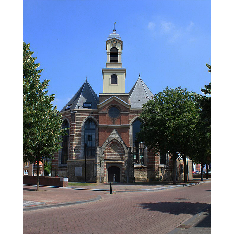
Image copyright © Johan Bakker, 2011
CC-BY-SA-3.0
Results: 3 records
view of church exterior - west view
Copyright Statement: Image copyright © Johan Bakker, 2011
Image Source: digital photograph taken 15 September 2011 by Johan Bakker [https://commons.wikimedia.org/wiki/File:Nieuwkerk,_Dordrecht.jpg] [accessed 27 June 2015]
Copyright Instructions: CC-BY-SA-3.0
view of church exterior
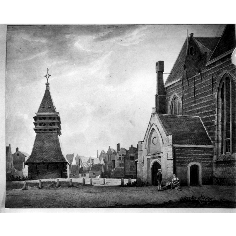
Scene Description: early view of Nieuwe Kerk
Copyright Statement: Image copyright © Rijksdienst voor het Cultureel Erfgoed, 2015
Image Source: photograph taken July 1960 by J. Rozema of an aquarel by J.Rutten [https://commons.wikimedia.org/wiki/File:Aquarel._J.Rutten_-_Dordrecht_-_20061333_-_RCE.jpg] [accessed 27 June 2015]
Copyright Instructions: CC-BY-SA-3.0
view of church exterior
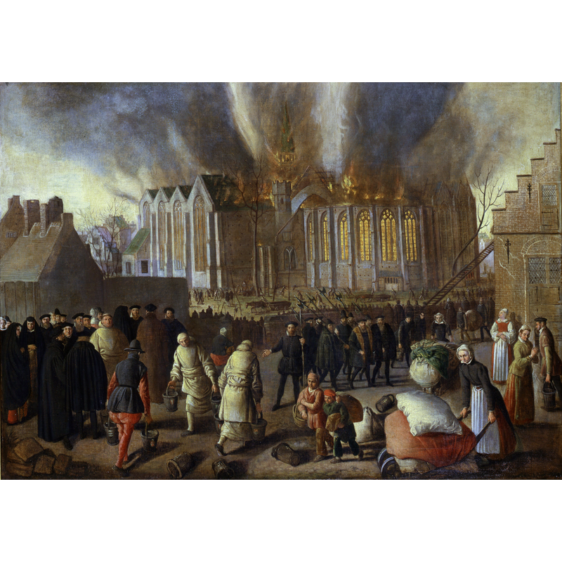
Scene Description: Source caption: "Nieuwkerk at Dordrecht on fire in 1568 " -- the church was re-built in 1592
Copyright Statement: Image copyright © [in the public domain]
Image Source: digital image of a 1568 painting by Jan Doudijn in the Dordrechts Museum [https://commons.wikimedia.org/wiki/File:Nieuwkerk_at_Dordrecht_on_fire_in_1568,_by_Jan_Doudijn.jpg] [accessed 27 June 2015]
Copyright Instructions: PD
INFORMATION
Font ID: 19902DOR
Object Type: Baptismal Font1?
Church / Chapel Name: Nieuwkerk / St. Nikolaaskapelle [redundant; re-purposed]
Font Location in Church: [destroyed]
Church Notes: original St. Nikolaaskapelle dated 1175, later parish church; expanded to "hallenkerk" in 1420; destroyed by fire 1567/1568; re-built by 1592; deconsecrated and abandoned 1960s; re-puposed for retail busiinesses -- "Standing at a sad big square just outside the centre, in a neighbourhood that fell victim to the destructive ambitions of local politicians decades ago, is the Nieuwkerk ('New Church')" [https://www.archimon.nl/zuidholland/dordrechtnieuwkerk.html] [accesed 29 September 2025]
Church Address: Nieuwkerksplein 99-100, 3311 TJ Dordrecht, Netherlands
Site Location: Zuid-Holland, Netherlands, Europe
Directions to Site: Located off the N3, on the S shore of the Beneden Merwede, a few blocks N of the Dordrecht Museum
Additional Comments: destroyed font [cf. FontNotes]
Font Notes:
Click to view
[NB: medieval font probably destroyed in 1568 fire]
COORDINATES
UTM: 31U 615332 5742119
Latitude & Longitude (Decimal): 51.817995, 4.673264
Latitude & Longitude (DMS): 51° 49′ 4.78″ N, 4° 40′ 23.75″ E