Anthee / Antêye / Anthée
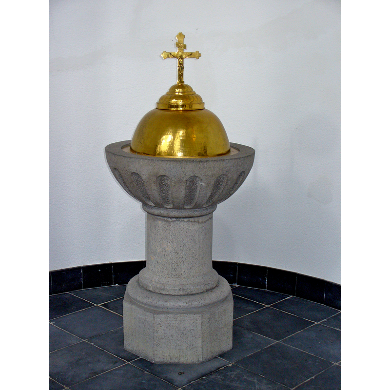
Image copyright © Colin Smith, 2015
Image and permission received (e-mail of 15 June 2015)
Results: 4 records
view of font and cover
Copyright Statement: Image copyright © Colin Smith, 2015
Image Source: digital photograph taken 26 May 2015 by Colin Smith
Copyright Instructions: Image and permission received (e-mail of 15 June 2015)
view of church exterior - northwest end
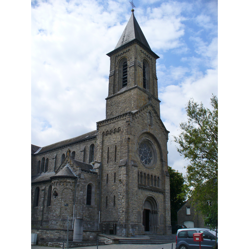
Copyright Statement: Image copyright © Colin Smith, 2015
Image Source: digital photograph taken 26 May 2015 by Colin Smith
Copyright Instructions: Image and permission received (e-mail of 15 June 2015)
view of church interior - chancel
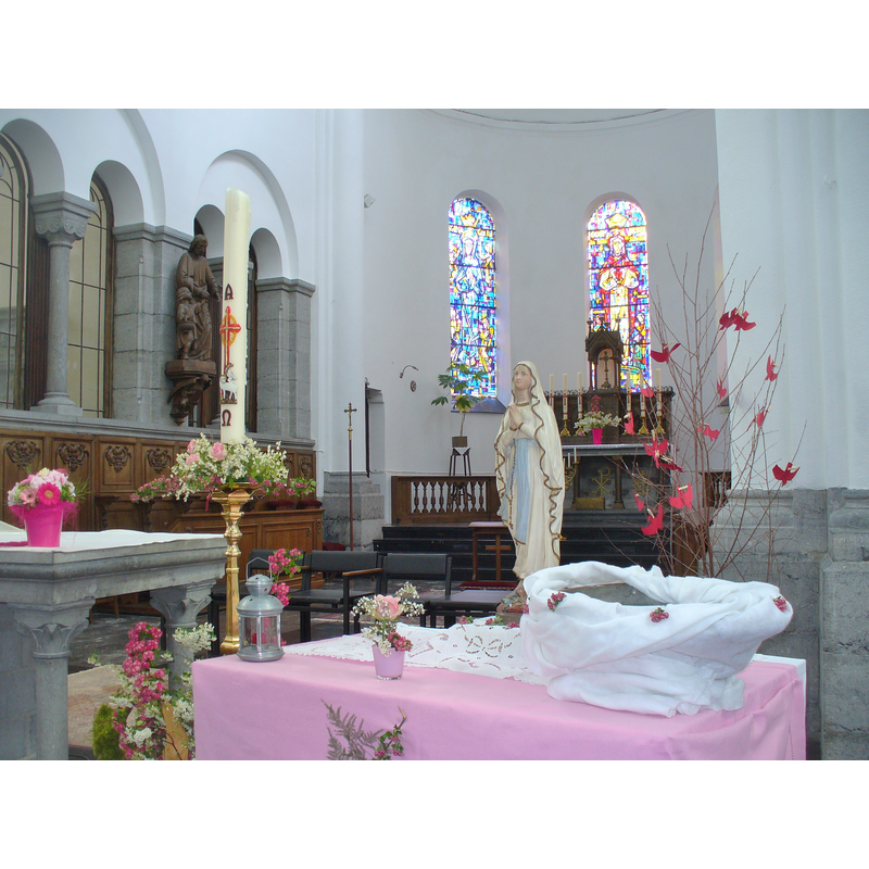
Copyright Statement: Image copyright © Colin Smith, 2015
Image Source: digital photograph taken 26 May 2015 by Colin Smith
Copyright Instructions: Image and permission received (e-mail of 15 June 2015)
view of church interior - nave - looking east
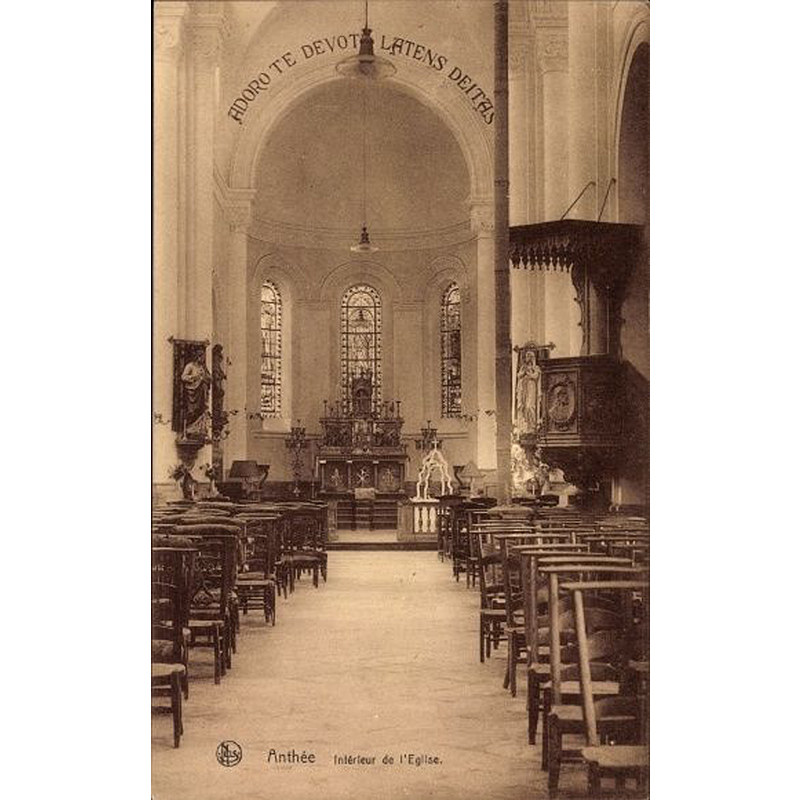
Scene Description: ca. 1933?
Copyright Statement: Image copyright © [in the public domain]
Image Source: undated [ca.1933?] postcard printed by Gustave Henry, Imprimeur, Anthée, on sale in e-Bay [http://i.ebayimg.com/00/s/NTgwWDM2Mg==/z/Q9MAAOSwNSxVdc~D/$_12.JPG] [acc essed 18 June 2015]
Copyright Instructions: PD
INFORMATION
Font ID: 19892ANT
Object Type: Baptismal Font1?
Font Century and Period/Style: Medieval
Church / Chapel Name: Église paroissiale Saint-Materne / Eglîje Sint-Matèrne / de Sint-Maternuskerk
Church Patron Saint(s): St. Maternus [aka Materianus]
Church Notes: medieval church re-built in 1864; damaged by fire in 1914 and bombing in 1940
Church Address: 5520 Anthée, Namur, Belgium
Site Location: Namur, Wallonie / Wallonne, Belgium, Europe
Directions to Site: Located on the N97, in the municipality of Onhaye, just W of Dinant, SE of Charleroi
Ecclesiastic Region: Diocèse de Namur
Additional Comments: disappeared font? (the original one from the old church here?)
Font Notes:
Click to view
Eug. del Marmol (1877) notes on the church here: "L'église d'Anthée était rangée autrefois au nombre des églises 'entières', c'est-à-dire existant dès l'origine, sans avoir été détachées d'aucune autre. Elle est dédiée à Saint Materne considéré comme le premier missionnaire du Christianisme dans nos contrées, patron également de l'ancienne église de Walcourt, et spécialement honoré autrefois dans l'antique église de Notre Dame, à Namur." The modern font here is listed and illustrated in the BALaT database [http://balat.kikirpa.be/photo.php?path=M225057&objnr=10003135&nr=23] [accessed 18 June 2015] as dated between 1901 and 1933, made of limestone and measuring 155 cm [presumaby the height of the cover is included in the measurement], but the font cover itself is described as "plus anc[ienne] prob[ablement] XVII ou XVIII?" [NB: we have no information on the font from the original church here].
Credit and Acknowledgements: We are grateful to Colin Smith for his photographs of this church and modern font
COORDINATES
Latitude & Longitude (DMS): 50° 14' 25.17" N, N 4° 45' 40.00" E
LID INFORMATION
Date: 17th - 18th century?
Material: metal
Apparatus: no
Notes: dome with Latin cross finial
REFERENCES
- Del Marmol, Eugene, "La villa d'Anthée", 14, Annales de la Société archéologique de Namur, 1877, pp. 163-192; p. 166