Appleton Wiske / Apletune
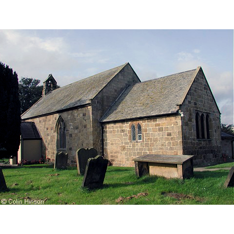
Image copyright © Colin Hinson, 2015
Standing permission
Results: 2 records
view of church exterior - southeast view
Copyright Statement: Image copyright © Colin Hinson, 2015
Image Source: digital phtograph taken by Colin Hinson [www.genuki.org.uk/big/eng/YKS/Churches/NRY/AppletonWiskeStMary_1.jpg] [accessed 28 May 2015]
Copyright Instructions: Standing permission
view of church interior - nave - looking east
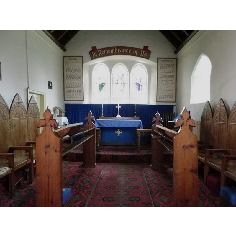
Copyright Statement: Image copyright © Colin Hinson, 2015
Image Source: digital photograph by Colin Hinson [www.genuki.org.uk/big/eng/YKS/PhotoFrames/NRY/AppletonWiskeStMaryInsideGeograph_TS.html] [accessed 28 May 2015]
Copyright Instructions: Standing permission
INFORMATION
Font ID: 19881APP
Object Type: Baptismal Font1?
Church / Chapel Name: Parish Church [formerly chapel of ease] of St. Mary the Virgin [aka Chapel of St Mary Magdalen]
Church Patron Saint(s): St. Mary the Virgin
Church Address: Baker St, Appleton Wiske, North Yorkshire, DL6 2AQ
Site Location: North Yorkshire, Yorkshire and the Humber, England, United Kingdom
Directions to Site: Located 12 km SSW of Yarm, 16 km N of Northallerton
Ecclesiastic Region: Diocese of West Yorkshire and the Dales
Historical Region: Hundred of Allerton [in Domesday]
Additional Comments: disappeared font? (the one from the 12thC church here)
Font Notes:
Click to view
There is an entry for Appleton [Wiske] [variant spelling] in the Domesday survey [http://opendomesday.org/place/NZ3804/appleton-wiske/] [accessed 28 May 2015], but it mentions neither cleric nor church in it. The entry for this parish in the Victoria County History (York North Riding, vol. 2, 1923) notes: "The church was a chapel of Great Smeaton [...] served by a perpetual curate [...] There is a turret containing one bell over the west gable. The chancel arch is of 12th-century date, and a great portion of the north and south walls may belong to the same period, but the building has been so much altered from time to time that the actual extent of the early masonry is difficult to determine. The width and beauty of the chancel arch, however, point to a church of some size and importance in the 12th century. [...] The interior of the nave is without interest and all the fittings are modern. The pulpit is of stone and the font of plaster."
Credit and Acknowledgements: We are grateful to Colin Hinson, of www.yorkshireCDbooks.com, for his photographs of this church
COORDINATES
UTM: 30U 603262 6033030
Latitude & Longitude (Decimal): 54.434467, -1.407983
Latitude & Longitude (DMS): 54° 26′ 4.08″ N, 1° 24′ 28.74″ W
REFERENCES
- Victoria County History [online], University of London, 1993-. URL: https://www.british-history.ac.uk.