Great Munden / Much Munden / Mundane / Munden Furnivall / Munden Magna / Mundene / Mundon / Mundun
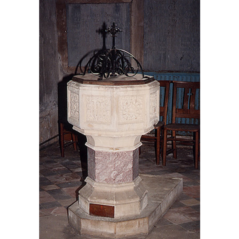
Image copyright © John Salmon, 2011
CC-BY-SA-2.0
Results: 3 records
view of font and cover
Scene Description: the late-19th century font [cf. FontNotes]
Copyright Statement: Image copyright © John Salmon, 2011
Image Source: digital photograph taken 21 June 2011 by John Salmon [www.stnicholascenter.org/galleries/gazetteer/1546/5/] [accessed 2 March 2014]
Copyright Instructions: CC-BY-SA-2.0
view of church exterior - west view
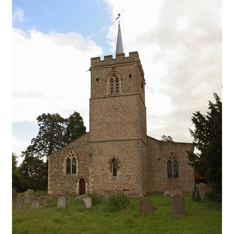
Copyright Statement: Image copyright © John Salmon, 2011
Image Source: digital photograph taken 21 June 2011 by John Salmon [www.geograph.org.uk/photo/2472272] [accessed 2 March 2014]
Copyright Instructions: CC-BY-SA-2.0
view of church exterior - southeast view
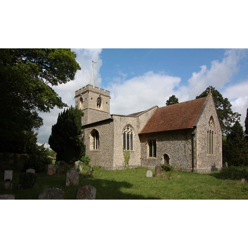
Copyright Statement: Image copyright © John Salmon, 2011
Image Source: digital photograph taken 21 June 2011 by John Salmon [www.geograph.org.uk/photo/2472268] [accessed 2 March 2014]
Copyright Instructions: CC-BY-SA-2.0
INFORMATION
Font ID: 19741MUN
Object Type: Baptismal Font1?
Font Date: ca. 1120?
Font Century and Period/Style: 12th century (early?), Late Norman
Church / Chapel Name: Parish Church of St. Nicholas
Church Patron Saint(s): St. Nicholas of Myra
Church Address: Great Munden, Hertfordshire SG11 1HG
Site Location: Hertfordshire, East, England, United Kingdom
Directions to Site: Located 10 km N of Ware
Ecclesiastic Region: Diocese of S. Albans
Historical Region: Hundred of Boroadwater [in Domesday] -- Hundred of Hitchin
Additional Comments: disappeared font? (the one from the early-12thC church here)
Font Notes:
Click to view
There are two entries for [Great and Little] Munden [variant spelling] in the Domesday survey [www.domesdaymap.co.uk/place/XX0000/great-and-little-munden/] [accessed 1 March 2015], one of which, in the lordship and tenancy of Walter of Flanders, mentions a priest, but not a church in it, though there probably was one there [NB: that church appears to be the one at Little Munden]. The Victoria County History (Hertford, vol. 3, 1912) notes: "The advowson of the church was from the earliest times in the possession of the lords of the manor. [...] The nave and chancel were built in the 12th century and the south aisle in the middle of the 14th century. The tower dates from the latter part of the 15th century [...] The registers are contained in four books: (i) all entries 1558 to 1682; (ii) baptisms 1678 to 1787[...]"; there is no mention of a font in it. English Heritage [Listing NGR: TL3551924185] (1967) reports an "octagonal font c1891 carved with floral panels and on an octagonal rose marble shaft with moulded stone base".
COORDINATES
UTM: 30U 704187 5754066
Latitude & Longitude (Decimal): 51.899877, -0.031999
Latitude & Longitude (DMS): 51° 53′ 59.56″ N, 0° 1′ 55.19″ W
REFERENCES
- Victoria County History [online], University of London, 1993-. URL: https://www.british-history.ac.uk.