Little Munden / Mundane / Munden Frevill / Munden Parva / Mundene
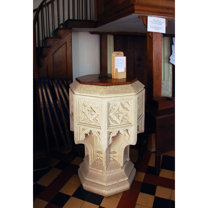
Image copyright © Timothy Marlow, 2015
Image and permission received (letter of 26 October 2013)
Results: 3 records
view of font and cover
Scene Description: the modern font [cf. FontNotes]
Copyright Statement: Image copyright © Timothy Marlow, 2015
Image Source: photograph taken 28 March 2012 by Timothy Marlow
Copyright Instructions: Image and permission received (letter of 26 October 2013)
view of church exterior - southeast view
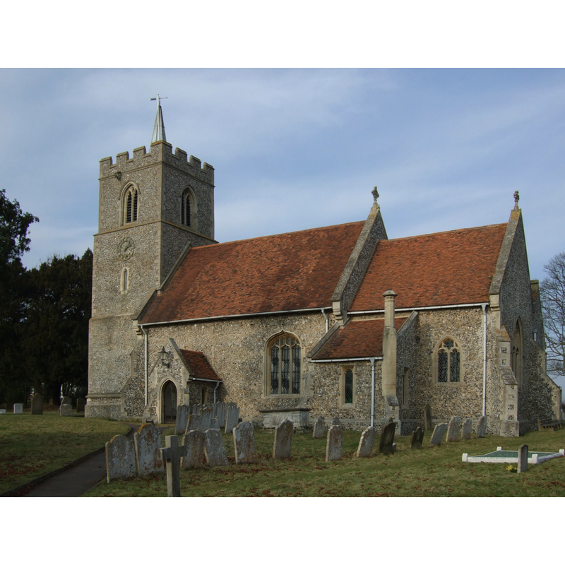
Copyright Statement: Image copyright © Dave Kelly, 2009
Image Source: digital photograph taken 31 January 2009 by Dave Kelly [www.geograph.org.uk/photo/3225597] [accessed 1 March 2015]
Copyright Instructions: CC-BY-SA-2.0
view of church interior - nave - looking east
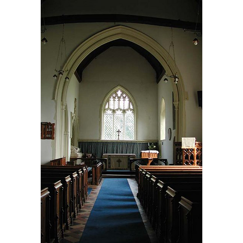
Copyright Statement: Image copyright © John Salmon, 2003
Image Source: digital photograph taken 16 June 2003 by John Salmon [www.geograph.org.uk/photo/355377] [accessed 1 March 2015]
Copyright Instructions: CC-BY-SA-2.0
INFORMATION
Font ID: 19740MUN
Object Type: Baptismal Font1?
Font Century and Period/Style: 11th century, Pre-Conquest? / Norman
Church / Chapel Name: Parish Church of All Saints
Church Patron Saint(s): All Saints
Church Address: Church Lane, Little Munden, Hertfordshire SG12 0NR
Site Location: Hertfordshire, East, England, United Kingdom
Ecclesiastic Region: Diocese of St. Albans
Historical Region: Hundred of Boroadwater [in Domesday] -- Hundred of Hitchin
Additional Comments: disappeared font? (the one from the Domesday-time church here)
Font Notes:
Click to view
There are two entries for [Great and Little] Munden [variant spelling] in the Domesday survey [www.domesdaymap.co.uk/place/XX0000/great-and-little-munden/] [accessed 1 March 2015], one of which, in the lordship and tenancy of Walter of Flanders, mentions a priest, but not a church in it, though there probably was one there. The Victoria County History (Hertford, vol. 3, 1912) notes: "Although the original 11th-century church has been almost wholly obscured by later alterations and additions, it seems certain that in the latter half of that century it consisted of a chancel, nave and north aisle, with an arcade of three bays. The 14th-century alterations consisted of building the western portion of the present north chapel about 1340, and about 1360 replacing the two eastern bays of the nave arcade by those now in existence [...] In the 15th century [...] the west tower was built. In the 19th century the church was restored"; there is no mention of a font in the VCH entry. English Heritage [Listing NGR: TL3345121887] (1967) mentions no font in this church but reports a nave and chancel originally of the 11th century. The present font consists of an octagonal basin with carved panels that overhang onto the stem of the base, also octagonal and carved, on a moulded lower base of the same shape. Plain and flat octagonal wooden cover with metal ring handle; modern. [NB: we have no information on the font of the Domesday-time church here].
COORDINATES
UTM: 30U 702179 5751737
Latitude & Longitude (Decimal): 51.879701, -0.06252
Latitude & Longitude (DMS): 51° 52′ 46.93″ N, 0° 3′ 45.07″ W
REFERENCES
- Victoria County History [online], University of London, 1993-. URL: https://www.british-history.ac.uk.