Withybrook
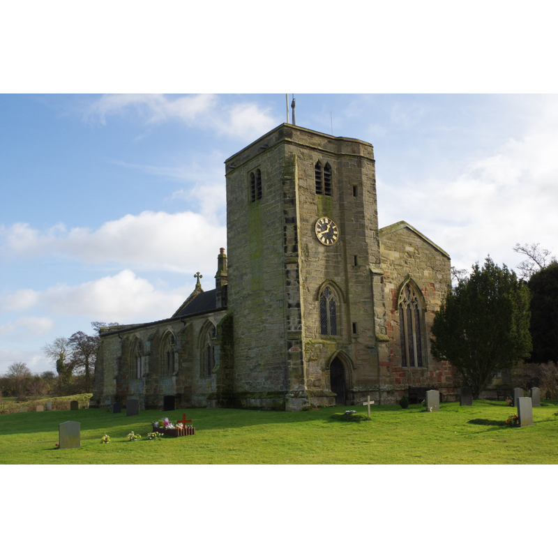
Image copyright © Stephen McKay, 2014
CC-BY-SA-2.0
Results: 1 records
view of church exterior - northwest view
Scene Description: Source caption: "Withybrook Church. All Saints' is the epitome of the country church; it is of 12th century origin (although rebuilt in the 14th century and the tower added in the 15th century) and is surrounded by an immaculately kept churchyard."
Copyright Statement: Image copyright © Stephen McKay, 2014
Image Source: digital photograph taken 2 February 2014 by Stephen McKay [www.geograph.org.uk/photo/3837042] [accessed 12 February 2015]
Copyright Instructions: CC-BY-SA-2.0
INFORMATION
Font ID: 19722WIT
Object Type: Baptismal Font1
Font Century and Period/Style: 12th century (late?) [basin and lower base only] [composite font], Medieval [composite]
Church / Chapel Name: Parish Church of All Saints [aka St. George's]
Font Location in Church: Inside the church, at the W end of the S aisle
Church Patron Saint(s): All Saints [and/or St. George?]
Church Address: Church Lane, Withybrook, Warwickshire CV7 9LS
Site Location: Warwickshire, West Midlands, England, United Kingdom
Directions to Site: Located 12 km NW of Rugby, 13 km NE of Coventry
Ecclesiastic Region: Diocese of Coventry [formerly in the Diocese of Worcester]
Historical Region: Hundred of Knightlow
Additional Comments: damaged font? (stem is modern replacement)
Font Notes:
Click to view
No entry found for Withybrook in the Domesday survey. The Victoria County History (Warwick, vol. 6, 1951) notes: "Withybrook is said to have originally ranked as a chapelry of Monks Kirby, [...] though in 1205 Nicholas son of Liulf was, at least temporarily, successful in his claim to present to the church. [...] The church [...] was rebuilt in the 14th century when the aisles were added. The only evidence of an earlier church is a late-12thcentury font. Late in the 15th century the tower was built, the aisle being widened to accommodate it, the chapel and clearstory added, and the chancel partly rebuilt. It was restored in 1821 and again in 1890. [...] at the western end [of the south aisle] a badly mutilated late12th-century stone font with a circular basin on a shaft with a moulded base standing on a square pedestal; the shaft is modern." English Heritage [Listing NGR: SP4369584136] (1960) reports: "font, possibly late C12, has round basin, moulded foot and square base."
COORDINATES
UTM: 30U 611453 5812703
Latitude & Longitude (Decimal): 52.453122, -1.359844
Latitude & Longitude (DMS): 52° 27′ 11.24″ N, 1° 21′ 35.44″ W
MEDIUM AND MEASUREMENTS
Material: stone
Font Shape: round, mounted
Basin Interior Shape: round
Basin Exterior Shape: round
REFERENCES
- Victoria County History [online], University of London, 1993-. URL: https://www.british-history.ac.uk.