Willey nr. Much Wenlock / Wilit
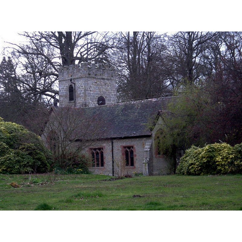
Image copyright © Row17, 2008
CC-BY-SA-2.0
Results: 1 records
view of church exterior - southeast view
Copyright Statement: Image copyright © Row17, 2008
Image Source: digital photograph taken 11 April 2008 by Row17 [www.geograph.org.uk/photo/760066] [accessed 12 February 2015]
Copyright Instructions: CC-BY-SA-2.0
INFORMATION
Font ID: 19721WIL
Object Type: Baptismal Font1
Font Century and Period/Style: 12th century, Late Norman
Church / Chapel Name: Parish Church of St. John the Baptist
Font Location in Church: [reported in the churchyard ca. 1998]
Church Patron Saint(s): St. John the Baptist
Church Address: 3 Church Road, Barrow, Shropshire TF12 5JJ
Site Location: Shropshire, West Midlands, England, United Kingdom
Directions to Site: Located between the A458 (W) and the A442 (E), adjoined to Broseley, SW of Madeley, 4 Km E of Much Wenlock, NNW of Bridgnorth
Ecclesiastic Region: Diocese of Hereford
Historical Region: Hundred of Alnodestreu [in Domesday] -- Hundred of Munslow, Liberty and Borough of Wenlock
Additional Comments: damaged font? / disused font? (broken basin reported in the churchyard ca. 1998)
Font Notes:
Click to view
There is an entry for this Willey [variant spelling] in the Domesday survey [http://domesdaymap.co.uk/place/SO6799/willey/] [accessed 12 February 2015], but it mentions neither cleric nor church in it. English Heritage (1950) notes: "Estate church of C12 with C18 and C19 additions, the latter of 1880 by A.W. Blomfield. [...] The C12 tub font is plain." The Victoria County History (Shropshire, vol. 10, 1998) notes: "Willey church's earliest fabric appears to be 12th-century [...] The broken bowl of a possibly Norman font lies in the churchyard. [...] In the sill of a mullioned two-light window in the western part of the south wall of the nave is an oval bowl hollowed out as a font or piscina; it has a wooden cover, possibly 18th-century. There is another font, perhaps an 18th-century composition of medieval fragments."
COORDINATES
UTM: 30U 534849 5826743
Latitude & Longitude (Decimal): 52.589604, -2.485589
Latitude & Longitude (DMS): 52° 35′ 22.57″ N, 2° 29′ 8.12″ W
MEDIUM AND MEASUREMENTS
Material: stone
Font Shape: tub-shaped
Basin Interior Shape: round
Basin Exterior Shape: round
REFERENCES
- Victoria County History [online], University of London, 1993-. URL: https://www.british-history.ac.uk.