Wibtoft / Wibetot
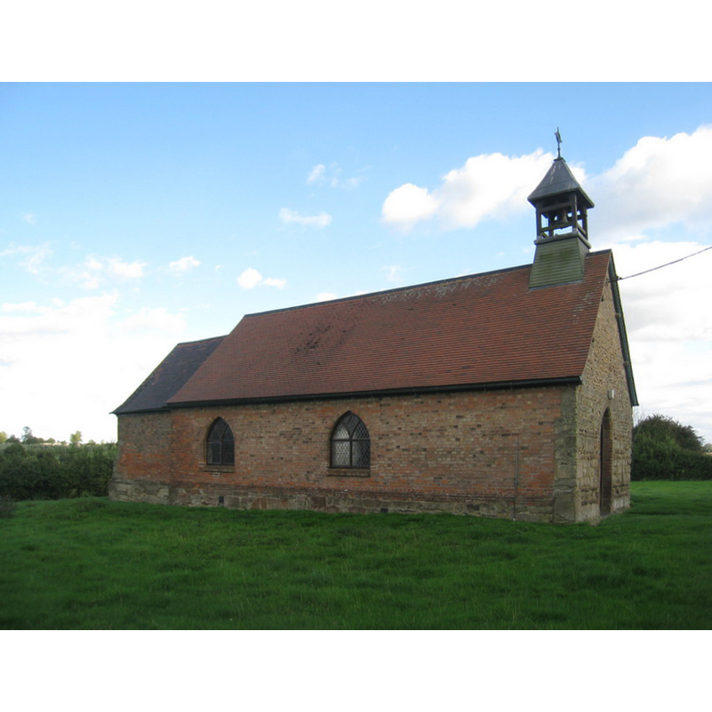
Image copyright © Jonathan Thacker, 2010
CC-BY-SA-2.0
Results: 4 records
view of church exterior - northwest view
Copyright Statement: Image copyright © Jonathan Thacker, 2010
Image Source: digital photograph taken 29 August 2010 by Jonathan Thacker [www.geograph.org.uk/photo/2040082] [accessed 11 February 2015]
Copyright Instructions: CC-BY-SA-2.0
view of church exterior - southwest view
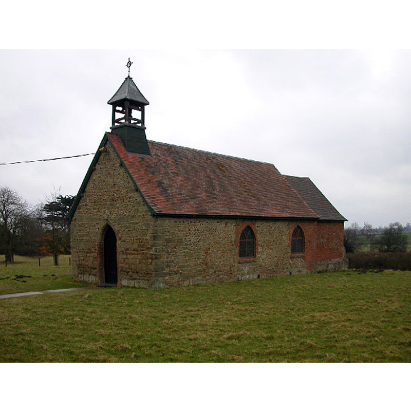
Copyright Statement: Image copyright © Ian Rob, 2006
Image Source: digital photograph taken 22 February 2006 by Ian Rob [www.geograph.org.uk/photo/126472] [accessed 11 February 2015]
Copyright Instructions: CC-BY-SA-2.0
view of church interior - nave - looking west
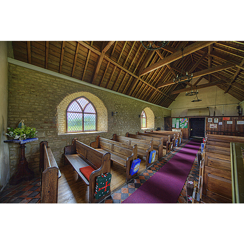
Scene Description: the present font, probably Victorian, partially visible at the southwest corner, by the south doorway
Copyright Statement: Image copyright © Christopher Jones, 2015
Image Source: digital photograph taken by Christopher Jones [www.leicestershirechurches.co.uk/wibtoft-assumption-of-our-lady/] [accessed 28 August 2015]
Copyright Instructions: Standing permission
view of church interior - nave - looking east
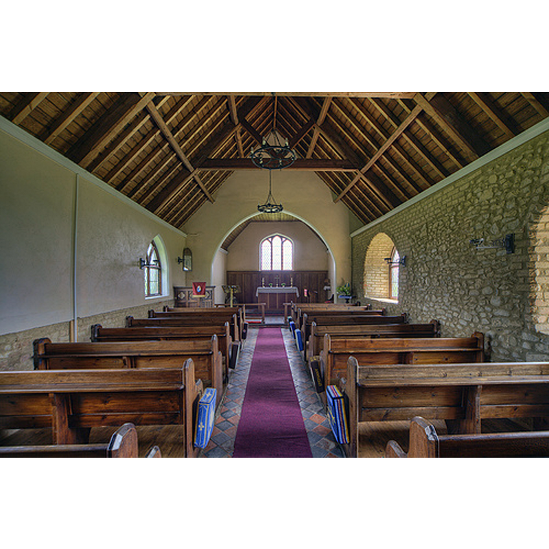
Copyright Statement: Image copyright © Christopher Jones, 2015
Image Source: digital photograph taken by Christopher Jones [www.leicestershirechurches.co.uk/wibtoft-assumption-of-our-lady/] [accessed 28 August 2015]
Copyright Instructions: Standing permission
INFORMATION
Font ID: 19719WIB
Object Type: Baptismal Font1
Font Century and Period/Style: 15th - 16th century/ 19th century, Late Medieval? / Victorian?
Church / Chapel Name: Parish Church of the Assumption of Our Lady / Chapel of St. Mary
Font Location in Church: [cf. FontNotes]
Church Patron Saint(s): The Assumption of St. Mary
Church Address: Green Lane, Wibtoft, Warwickshire LE17 5BB
Site Location: Warwickshire, West Midlands, England, United Kingdom
Directions to Site: Located off the A5 [aka Watling Street], 16 km N of Rugby; it is W across from Claybrooke Magna, Leics., which was its mother church [NB: part of the village is in Leics.; the church is in Warwks.]
Ecclesiastic Region: Diocese of Leicester
Historical Region: Hundred of Bumbelowe [in Domesday] -- Hundred of Knighlow
Font Notes:
Click to view
There are two entries for Wibtoft [variant spelling] in the Domesday survey [http://domesdaymap.co.uk/place/SP4787/wibtoft/] [accessed 11 February 2015], neither of which mentions cleric or church in it. The Victoria County History (Warwick, vol. 6, 1951) notes: "The chapel of Wibtoft dates back to medieval times; it has always been served from the mother church of Claybrooke (Leics.), the advowson of which was in the hands of Nuneaton Priory up to the Reformation [...] The church of ST. MARY [...] is small, consisting of a chancel (15 ft. 3 in. by 13 ft.) and nave (40 ft. by 17 ft. 10 in.) with tiled roofs. In the 19th century it was rebuilt in red brick on the sandstone plinth of the earlier church [...] except at the west end, where the lower half of the original wall, of alternate courses of ashlar and rubble, has been retained. The arch of the original pointed doorway which was in the south wall has been rebuilt into the west wall on red brick jambs"; no font mentioned in the VCH entry. English Heritage [Listing NGR: SP4798887637] (1960) reports: "Octagonal stone font, chamfered to square base, has blind quatrefoils to alternate sides." [NB: not known whether this font is late-medieval or, more likely, Victorian].
Credit and Acknowledgements: We are grateful to Christopher Jones, of Leicestershire Churches [www.leicestershirechurches.co.uk], for his photographs of this church
COORDINATES
UTM: 30U 615705 5816262
Latitude & Longitude (Decimal): 52.484226, -1.296072
Latitude & Longitude (DMS): 52° 29′ 3.22″ N, 1° 17′ 45.86″ W
MEDIUM AND MEASUREMENTS
Material: stone
Font Shape: octagonal, mounted
Basin Interior Shape: round
Basin Exterior Shape: octagonal
REFERENCES
- Victoria County History [online], University of London, 1993-. URL: https://www.british-history.ac.uk.