Wappenbury / Wapeberie
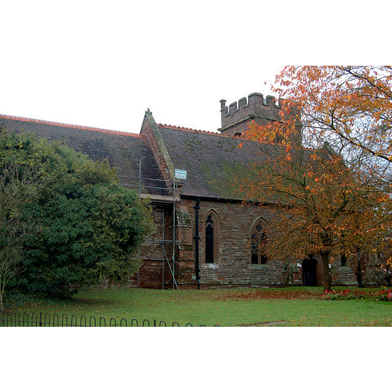
Image copyright © Andy F, 2009
CC-BY-SA-2.0
Results: 4 records
view of church exterior - north view
Copyright Statement: Image copyright © Andy F, 2009
Image Source: digital photograph taken 27 October 2009 by Andy F [www.geograph.org.uk/photo/1557036] [accessed 11 February 2015]
Copyright Instructions: CC-BY-SA-2.0
view of church exterior - south view
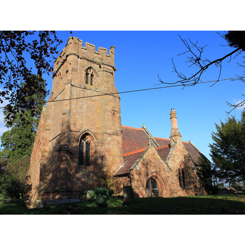
Copyright Statement: Image copyright © David P Howard, 2011
Image Source: digital photograph taken 6 November 2011 by David P Howard [www.geograph.org.uk/photo/2682188] [accessed 11 February 2015]
Copyright Instructions: CC-BY-SA-2.0
view of church interior - nave - looking west
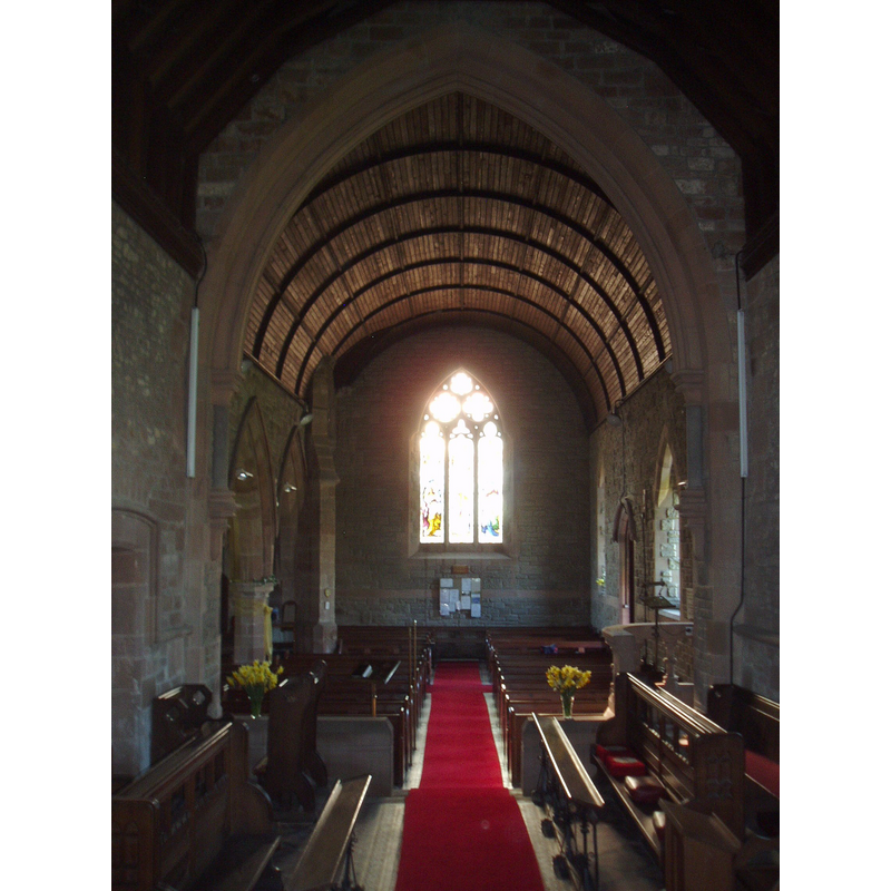
Copyright Statement: Image copyright © Aidan McRae Thomson, 2010
Image Source: digital photograph taken 17 April 2010 by Aidan McRae Thomson [www.flickr.com/photos/amthomson/4625061628/in/set-72157604534203453/] [accessed 11 February 2015]
Copyright Instructions: Standing permission
view of church interior - nave - looking east
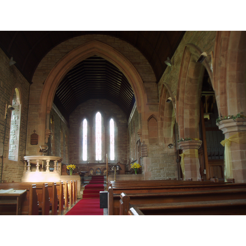
Copyright Statement: Image copyright © Aidan McRae Thomson, 2010
Image Source: digital photograph taken 17 April 2010 by Aidan McRae Thomson [www.flickr.com/photos/amthomson/4624453111/in/set-72157604534203453/] [accessed 11 February 2015]
Copyright Instructions: Standing permission
INFORMATION
Font ID: 19717WAP
Object Type: Baptismal Font1?
Font Century and Period/Style: 13th century, Early English
Church / Chapel Name: Parish Church of St. John the Baptist
Church Patron Saint(s): St. John the Baptist
Church Address: Wappenbury, Warwickshire, CV33 9DW
Site Location: Warwickshire, West Midlands, England, United Kingdom
Directions to Site: Located off (W) the A423, 7-8 km NE of Leamington Spa
Ecclesiastic Region: Diocese of Coventry
Historical Region: Hundred of Marton [in Domesday] -- Hundred of Knightlow
Additional Comments: disappeared font? (the one from the 13thC church here)
Font Notes:
Click to view
There is an entry for Wappenbury [variant spelling] in the Domesday survey [http://domesdaymap.co.uk/place/SP3769/wappenbury/] [accessed 11 February 2015], but it mentions neither cleric nor church here. The Victoria County History (Warwick, vol. 6, 1951) notes: "The church was built in the 13th century and then consisted of chancel and nave. Early in the 14th century a west tower was built on the south side of the nave, together with a south aisle and porch. The nave and south aisle were completely 'restored' c. 1825 (fn. 61) but were pulled down in 1886 and rebuilt in the character of 14th-century work, and at the same time a south porch and transept were added and the whole church re-roofed. [...] The tower [,,,] has a modern tiled floor with three steps down into the aisle. Placed on the top step is a modern plain tapered circular stone font." The font is not mentioned in the English Heritage listing. There is no church or chapel recorded in Eathorpe in the sources consulted.
Credit and Acknowledgements: We are grateful to Aidan McRae Thomson, of Warwickshire Churches [warwickshirechurches.weebly.com/], for his photographs of this church
COORDINATES
Latitude & Longitude (DMS): 52° 19′ 13.19″ N, 1° 26′ 51.32″ W
REFERENCES
- Victoria County History [online], University of London, 1993-. URL: https://www.british-history.ac.uk.