Newnham Regis No. 1 / King's Newnham
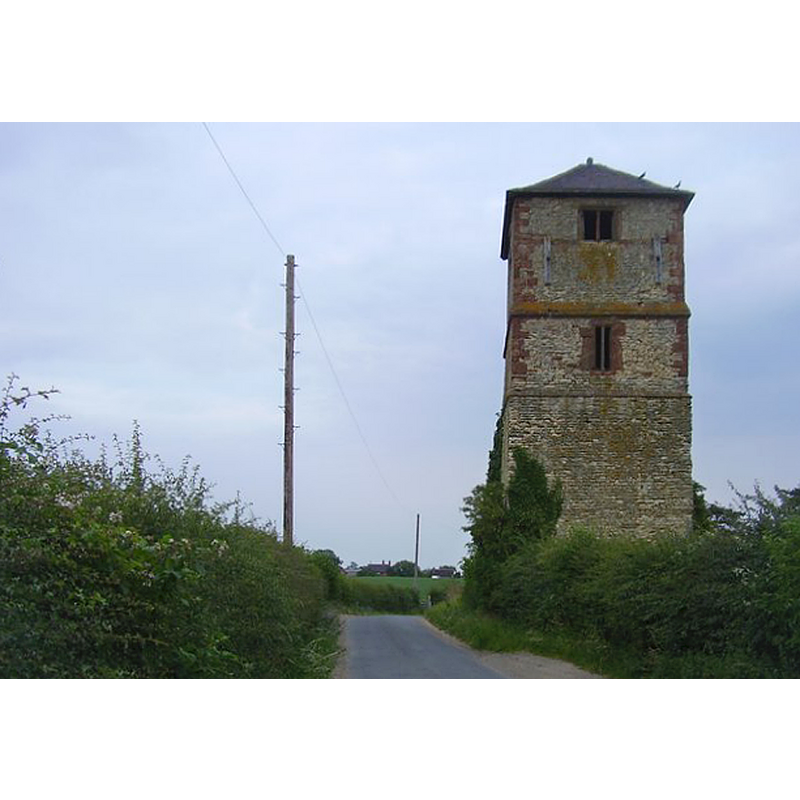
Image copyright © Ian Rob, 2011
CC-BY-SA-2.0
Results: 3 records
view of church exterior - tower - west side
Scene Description: Source caption: "Kings Newnham Tower. The west side of the old Tower, looking from Kings Newnham Lane."
Copyright Statement: Image copyright © Ian Rob, 2011
Image Source: digital photograph taken 4 July 2011 by Ian Rob [www.geograph.org.uk/photo/2515642] [accessed 5 February 2015]
Copyright Instructions: CC-BY-SA-2.0
view of church exterior - east view
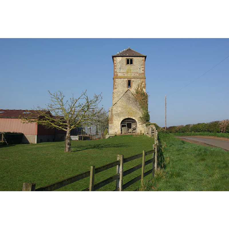
Scene Description: Source caption: "King's Newnham Tower. A curious edifice - all that remains of an old church - now surrounded by farm buildings." -- the road on the right is Kings Newnham Lane
Copyright Statement: Image copyright © Stephen McKay, 2008
Image Source: digital photograph taken 15 April 2008 by Stephen McKay [www.geograph.org.uk/photo/777778] [accessed 5 February 2015]
Copyright Instructions: CC-BY-SA-2.0
view of church exterior - east view
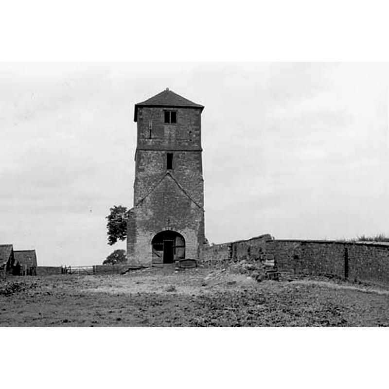
Scene Description: behind the wall on the right is Kings Newnham Lane
Copyright Statement: Image copyright © Warwickshire County Council, 1955
Image Source: B&W photograph taken in 1955, in Take the Timetrail with Warwickshire Museum [http://timetrail.warwickshire.gov.uk/detail.aspx?monuid=WA3448] [accessed 5 February 2015]
Copyright Instructions: No known copyright restriction – Fair Dealing
INFORMATION
Font ID: 19702NEW
Object Type: Baptismal Font1
Font Century and Period/Style: Medieval
Church / Chapel Name: Parish Church of St. Lawrence [aka St. Laurence's] [disused; only the tower left]
Font Location in Church: [cf. FontNotes]
Church Patron Saint(s): St. Lawrence [aka Laurence]
Church Address: Kings Newnham Lane, Kings Newnham, Warwickshire CV23 0JT
Site Location: Warwickshire, West Midlands, England, United Kingdom
Directions to Site: Located 4 km WNW of Rugby, 7 km E of Coventry. The site of the old church is located 300m S of Chapel Wood
Ecclesiastic Region: [Diocese of Coventry]
Historical Region: Hundred of Marton [in Domesday] -- Hundred of Knightlow
Font Notes:
Click to view
We found no separate entry for Newnham Regis, or King's Newnham, in the Domesday survey, where it may have been lumped together with Church Lawford. The Victoria County History (Warwick, vol. 6, 1951) notes: "The church was probably given to Kenilworth Priory along with the manor by Geoffrey de Clinton, being appropriated to the priory by Bishop William (1215–24) 'for the support of the poor and of hospitality'. [...] The rectory and advowson descended with the manor, an arrangement that lasted after the union of the living with that of Church Lawford in 1595. [...] The church which stood about a quarter of a mile west of the village was still in use in 1730 [...] It was, however, with the exception of the tower, entirely demolished about the middle of the 18th century. The tower now stands in the rick-yard of Hall Farm, the ground floor being used as a chicken house. [...] In the farm-house garden there is a font, pillar piscina, and stoop. The font is octagonal with plain sides and a square base, splayed at the angles; the stem is missing. The piscina has a circular shaft with moulded capital and base on a half-octagon pedestal, shaped to fit into an angle. The stoop has a square rim with a circular bowl splayed below to an octagon." English Heritage [Listing NGR: SP4481177220] (1960) lists this as "The Remains of the Church of St Laurence, King's Newnham [...] Shown on Ordnance Survey map as Church (remains of). Church tower and fragment of nave north wall. Late C12 origins; upper stages rebuilt, possibly in C16. Later alterations"; no font mentioned.
COORDINATES
UTM: 30U 612738 5805839
Latitude & Longitude (Decimal): 52.391179, -1.343254
Latitude & Longitude (DMS): 52° 23′ 28.24″ N, 1° 20′ 35.71″ W
REFERENCES
- Victoria County History [online], University of London, 1993-. URL: https://www.british-history.ac.uk.