Church Lawford / Ledleford / Leileforde
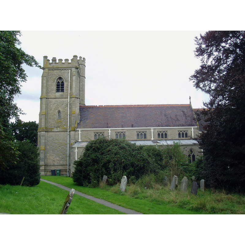
Image copyright © Aidan McRae Thomson, 2013
Standing permission
Results: 1 records
view of church exterior - south view
Scene Description: Source caption: "St Peter's at Church Lawford is a mostly Victorian structure by Slater & Carpenter 1872 and quite a handsome building. The only medieval part is the north arcade inside and a plain blocked Norman south door."
Copyright Statement: Image copyright © Aidan McRae Thomson, 2013
Image Source: digital photograph taken 18 eptember 2013 by Aidan McRae Thomson [www.flickr.com/photos/amthomson/10733026516/in/photostream/] [accessed 29 January 2015]
Copyright Instructions: Standing permission
INFORMATION
Font ID: 19692LAW
Object Type: Baptismal Font1
Font Century and Period/Style: 14th century, Decorated
Church / Chapel Name: Parish Church of St. Peter
Font Location in Church: Inside the church, in the SW corner
Church Patron Saint(s): St. Peter
Church Address: Church Road, Church Lawford, West Midlands, CV23 9EG
Site Location: Warwickshire, West Midlands, England, United Kingdom
Directions to Site: Located off (S) the A428, W of Long Lawford, WNW of Rugby
Ecclesiastic Region: Diocese of Coventry
Historical Region: Hundred of Marton [in Domesday] -- Hundred of Knightlow
Font Notes:
Click to view
There is an entry for [Church] Lawford [variant spelling] in the Domesday survey [http://domesdaymap.co.uk/place/SP4476/church-lawford/] [accessed 29 January 2015], but it mentions neither cleric nor church in it. The Victoria County History (Warwick, vol. 6, 1951) notes: "At some date between 1086 and 1094 Hugh Baldran and Aeliz his wife gave to the Norman abbey of St. Pierre-sur-Dives the churches of Wolston and of St. Peter of Lawford ('Ledleford') [...] The church [...] was rebuilt in the gothic style in hammer-dressed sandstone ashlar in 1874, and all that has been retained of the previous church is three bays of the 14th-century north arcade, two piscinas, the font, and some fragments of tracery and early-14th-century slabs with foliated crosses built into the tower walls. [...] The font in the south-west corner is octagonal, of red sandstone with a moulded basin on an octagonal stem splayed to a square base. It dates from the 14th century and has a deep lead-lined basin."
COORDINATES
UTM: 30U 613341 5804967
Latitude & Longitude (Decimal): 52.38322, -1.334704
Latitude & Longitude (DMS): 52° 22′ 59.59″ N, 1° 20′ 4.93″ W
MEDIUM AND MEASUREMENTS
Material: stone, sandstone (red)
Font Shape: octagonal, mounted
Basin Interior Shape: round
Basin Exterior Shape: octagonal
Drainage Notes: lead-lined
REFERENCES
- Victoria County History [online], University of London, 1993-. URL: https://www.british-history.ac.uk.