Ladbroke / Lodbroc / Lodbroch
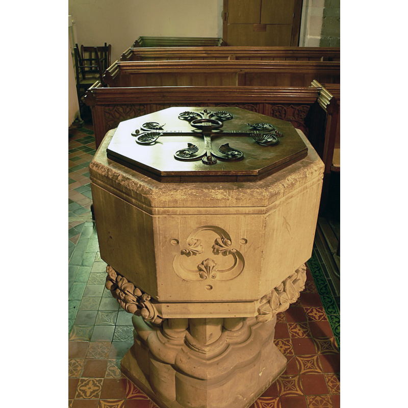
Image copyright © Walwyn, 2008
Standing permission + Creative Commons Licence [http://creativecommons.org/licenses/by-nc-sa/2.0/] [accessed 27 March 2009]
Results: 3 records
view of font and cover
Scene Description: the modern font [cf. FontNotes]
Copyright Statement: Image copyright © Walwyn, 2008
Image Source: digital photograph taken 23 November 2008 by Walwyn [http://professor-moriarty.com/moriarties/midland_churches/2008/12/20/ladbroke-all-saints/] [accessed 29 January 2015]
Copyright Instructions: Standing permission + Creative Commons Licence [http://creativecommons.org/licenses/by-nc-sa/2.0/] [accessed 27 March 2009]
view of church exterior in context - south view
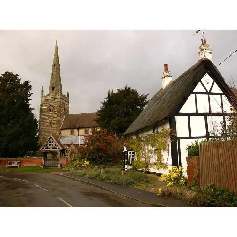
Copyright Statement: Image copyright © Walwyn, 2008
Image Source: digital photograph taken 23 November 2008 by Walwyn [http://professor-moriarty.com/moriarties/midland_churches/2008/12/20/ladbroke-all-saints/] [accessed 29 January 2015]
Copyright Instructions: Standing permission + Creative Commons Licence [http://creativecommons.org/licenses/by-nc-sa/2.0/] [accessed 27 March 2009]
view of church interior - nave - looking east
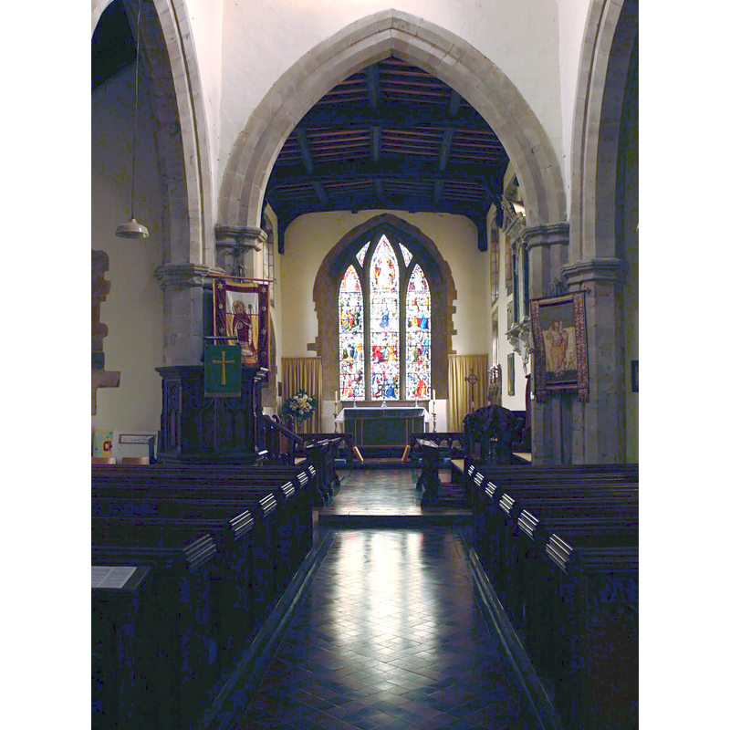
Copyright Statement: Image copyright © Walwyn, 2008
Image Source: digital photograph taken 23 November 2008 by Walwyn [http://professor-moriarty.com/moriarties/midland_churches/2008/12/20/ladbroke-all-saints/] [accessed 29 January 2015]
Copyright Instructions: Standing permission + Creative Commons Licence [http://creativecommons.org/licenses/by-nc-sa/2.0/] [accessed 27 March 2009]
INFORMATION
Font ID: 19690LAD
Object Type: Baptismal Font1?
Font Century and Period/Style: 11th century, Pre-Conquest? / Norman
Church / Chapel Name: Parish Church of All Saints
Church Patron Saint(s): All Saints
Church Address: Church Road, Ladbroke, Warwickshire CV47 2DF
Site Location: Warwickshire, West Midlands, England, United Kingdom
Directions to Site: Located off (W) the A423, 3 km S of Southam
Ecclesiastic Region: Diocese of Coventry
Historical Region: Hundred of Marton [in Domesday] -- Hundred of Knightlow
Additional Comments: disappeared font ? (the one from the Domesday-time church here)
Font Notes:
Click to view
There are seven entries [variant spelling] for Ladbroke in the Domesday survey [http://domesdaymap.co.uk/place/SP4158/ladbroke/] [accessed 29 January 2015], one of which, in the lordship of William Lovet, and Hugh of Grandmesnil its tenant in chief, mentions a priest, but not a church in it, though there probably was one there; another entry appears in the lordship of a priest at the time of the survey, with Thorkil of Warwick as its tenant in chief. The Victoria County History (Warwick, vol. 6, 1951) notes; "In 1086 there was 'a priest' among the tenants on Hugh de Grentemaisnil's estate, [...] and 'a priest', possibly identical, held 1 virgate under Turchil [cf. supra] The 13th-century church, which probably consisted of a chancel and nave, was entirely rebuilt in the 14th-century with north and south aisles and west tower. All that remains of the earlier church is the lower portion of the chancel. Late in the 15th century the nave and chancel were raised and clearstory windows inserted. It was restored and reroofed in 1876 by Sir Gilbert Scott. [...] The font, placed near the south door, is modern." English Heritage [Listing NGR: SP4134658897] (1967) reports a 19th-century font here. [NB: we have no information on the font from the Domesday-time church here].
COORDINATES
UTM: 30U 609581 5787492
Latitude & Longitude (Decimal): 52.226935, -1.395603
Latitude & Longitude (DMS): 52° 13′ 36.97″ N, 1° 23′ 44.17″ W
REFERENCES
- Victoria County History [online], University of London, 1993-. URL: https://www.british-history.ac.uk.