Long Itchington / Icentone
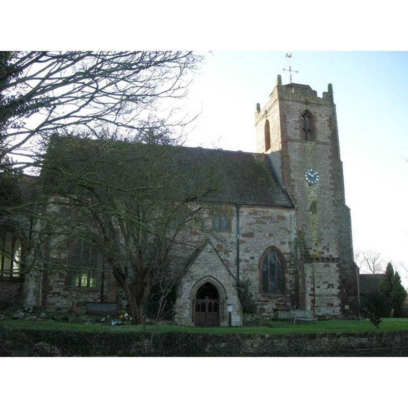
Image copyright © Ian Rob, 2008
CC-BY-SA-2.0
Results: 2 records
view of church exterior - north view
Copyright Statement: Image copyright © Ian Rob, 2008
Image Source: digital photograph taken 12 January 2008 by Ian Rob [www.geograph.org.uk/photo/659068] [accessed 28 January 2015]
Copyright Instructions: CC-BY-SA-2.0
view of church exterior in context
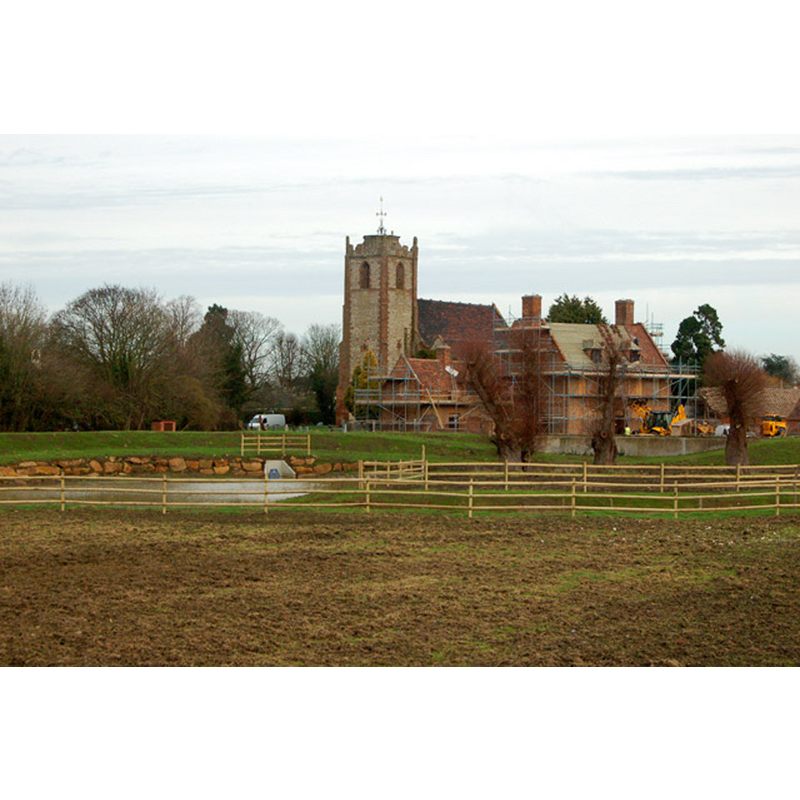
Copyright Statement: Image copyright © Andy F, 2009
Image Source: digital photograph taken 8 December 2009 by Andy F [www.geograph.org.uk/photo/1610810] [accessed 28 January 2015]
Copyright Instructions: CC-BY-SA-2.0
INFORMATION
Font ID: 19689ITC
Object Type: Baptismal Font1?
Font Century and Period/Style: 11th century, Pre-Conquest? / Norman
Church / Chapel Name: Parish Church of the Holy Trinity
Church Patron Saint(s): The Holy Trinity
Church Address: Church Road, Long Itchington, Warwickshire, CV47 9PN
Site Location: Warwickshire, West Midlands, England, United Kingdom
Directions to Site: Located off (W) the A423, 3 km NNW of Southam
Ecclesiastic Region: Diocese of Coventry
Historical Region: Hundred of Marton [in Domesday] -- Hundred of Knightlow
Additional Comments: disappeared font? (the one from the Domesday-time church here) -- famous person font? (Wulfstan, Bishop of Worcester, was born about 1008 at Long Itchington; was he also baptised in its church font?)
Font Notes:
Click to view
There is an entry for [Long] Itchington [variant spelling] in the Domesday survey [http://domesdaymap.co.uk/place/SP4165/long-itchington/] [accessed 28 January 2015], and it mentions two priests, but not a church in it, though there probably was one there. The Victoria County History (Warwick, vol. 6, 1951) notes: "The oldest part of the building is the south aisle, dating from early in the 13th century; the chancel, nave, and tower were built early in the 14th century, a clearstory was added to the nave in the 15th century and at the same time the nave arcade was rebuilt; the porch and vestry are modern. The church was restored in 1928 [...] the font, which stands at the west end of the nave, is also modern, with a plain octagonal basin on a coloured marble shaft with a moulded capital and base." [NB: we have no information on the font of the Domesday-time church here; the present one is probably dated to the 1866 restoration of the church].
COORDINATES
UTM: 30U 609296 5793669
Latitude & Longitude (Decimal): 52.282507, -1.397779
Latitude & Longitude (DMS): 52° 16′ 57.02″ N, 1° 23′ 52″ W
REFERENCES
- Victoria County History [online], University of London, 1993-. URL: https://www.british-history.ac.uk.