Ashow / Asceshot
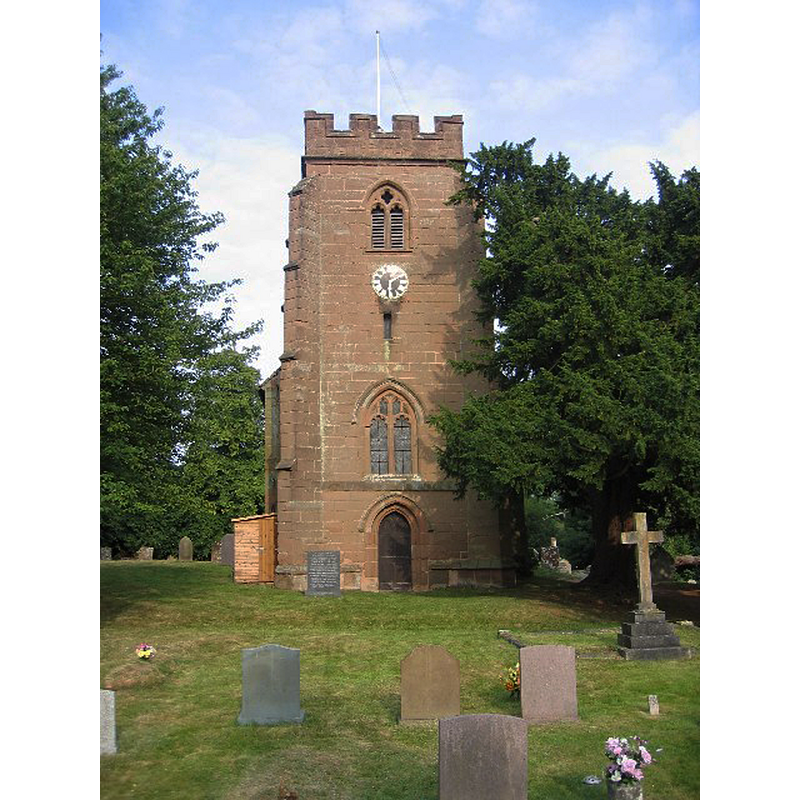
Image copyright © David Stowell, 2005
CC-BY-SA-2.0
Results: 1 records
view of church exterior - west view
Copyright Statement: Image copyright © David Stowell, 2005
Image Source: digital photograph 23 July 2005 by David Stowell [www.geograph.org.uk/photo/30052] [accessed 20 January 2015]
Copyright Instructions: CC-BY-SA-2.0
INFORMATION
Font ID: 19672ASH
Object Type: Baptismal Font1?
Font Century and Period/Style: 12th century (early?), Norman
Church / Chapel Name: Parish Church of the Assumption of Our Lady
Church Patron Saint(s): The Assumption of St. Mary
Church Address: Ashow, Warwickshire CV8 2LE
Site Location: Warwickshire, West Midlands, England, United Kingdom
Directions to Site: Located off the B4115, 4 km SE of Kenilworth
Ecclesiastic Region: Diocese of Coventry
Historical Region: Hundred of Stoneleigh [in Domesady] -- Hundred of Knightlow
Additional Comments: disappeared font? (the one from the early-12thC church here)
Font Notes:
Click to view
There is an entry for Ashow [variant spelling] in the Domesday survey [http://domesdaymap.co.uk/place/SP3170/ashow/] [accessed 20 January 2015], but it mentions neither cleric nor church in it. The Victoria County History (Warwick, vol. 6, 1951) notes: "The church of Ashow was originally a chapel of Leek Wotton [...], which church had been given to Kenilworth Priory at its foundation by Geoffrey de Clinton. It became independent in the time of Bishop Geoffrey (1198–1215) [...] The chancel and nave are early-12th-century [...] The font is modern, of gothic design. It is placed near the west end on the south side."
COORDINATES
UTM: 30U 599246 5798631
Latitude & Longitude (Decimal): 52.32901, -1.543595
Latitude & Longitude (DMS): 52° 19′ 44.44″ N, 1° 32′ 36.94″ W
REFERENCES
- Victoria County History [online], University of London, 1993-. URL: https://www.british-history.ac.uk.