Arley / Arlei / Old Arley
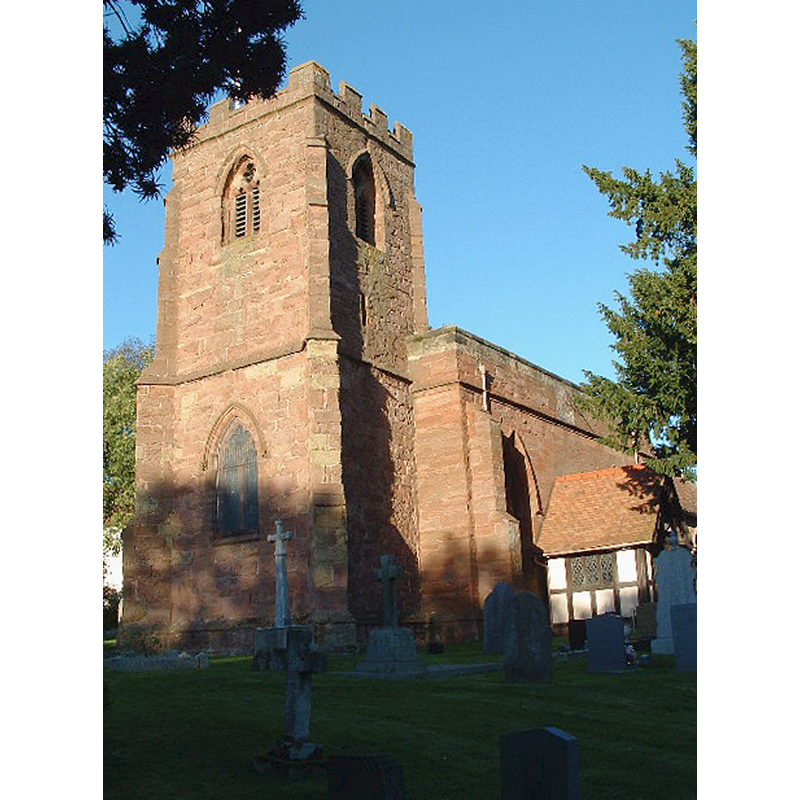
Image copyright © Richard Harrison, 2004
CC-BY-SA-2.0
Results: 1 records
view of church exterior - southwest view
Copyright Statement: Image copyright © Richard Harrison, 2004
Image Source: digital photograph taken 4 October 2004 by Richard Harrison [www.geograph.org.uk/photo/69035] [accessed 20 January 2015]
Copyright Instructions: CC-BY-SA-2.0
INFORMATION
Font ID: 19671ARL
Object Type: Baptismal Font1
Font Century and Period/Style: 12th - 13th century, Medieval
Church / Chapel Name: Parish Church of St. Wilfrid [aka Wilfred]
Church Patron Saint(s): St. Wilfrid [aka Wilfred, Wilfrith]
Church Address: 110 Rectory Road, Arley, Warwickshire CV7 8NT
Site Location: Warwickshire, West Midlands, England, United Kingdom
Directions to Site: Located S of Ansley, 10 km W of Nuneaton, 18 km NW of Coventry
Ecclesiastic Region: Diocese of Coventry
Historical Region: Hundred of Coleshill [in Domesday] -- Hundred of Knightlow
Additional Comments: disappeared font? (the one from the 12th-13thC church here)
Font Notes:
Click to view
There is an entry for [Old] Arley [variant spelling] in the Domesday survey [http://domesdaymap.co.uk/place/SP2890/old-arley/] [accessed 20 January 2015], but it mentions neither cleric nor church in it. The Victoria County History (Warwick, vol. 6, 1951) notes: "The first mention of a church at Arley is in 1282, when the rector was exempted from purveyance for the army in Wales. [...] The whole of the existing building appears to be of 14th-century construction, except portions of the north wall of the nave, which may be of 12th- or 13th-century date, and the modern porch [...] The whole church was restored in 1873. [...] The furnishings, including the sandstone font, are modern."
COORDINATES
UTM: 30U 596063 5818991
Latitude & Longitude (Decimal): 52.512559, -1.584429
Latitude & Longitude (DMS): 52° 30′ 45.21″ N, 1° 35′ 3.94″ W
REFERENCES
- Victoria County History [online], University of London, 1993-. URL: https://www.british-history.ac.uk.