Wormleighton / Wimelestone / Wimenestone / Wimerestone
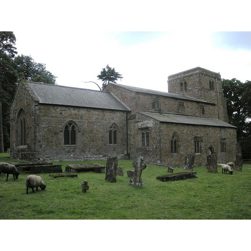
Image copyright © Ian Rob, 2009
CC-BY-SA-2.0
Results: 3 records
view of church exterior - northeast view
Copyright Statement: Image copyright © Ian Rob, 2009
Image Source: digital photograph taken 7 August 2009 by Ian Rob [www.geograph.org.uk/photo/1433164] [accessed 20 January 2015]
Copyright Instructions: CC-BY-SA-2.0
view of church exterior - southeast view
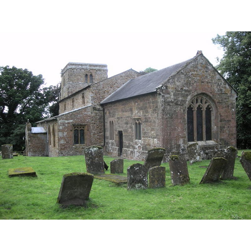
Copyright Statement: Image copyright © Ian Rob, 2009
Image Source: digital photograph taken 7 August 2009 by Ian Rob [www.geograph.org.uk/photo/1443904] [accessed 20 January 2015]
Copyright Instructions: CC-BY-SA-2.0
view of font and cover

Copyright Statement: Image copyright © Rex Harris, 2014
Image Source: digital photograph taken 4 February 2014 by Rex Harris [www.flickr.com/photos/sheepdog_rex/12320190324/] [accessed 20 January 2015]
Copyright Instructions: PERMISSION NOT AVAILABLE -- IMAGE NOT FOR PUBLIC USE
INFORMATION
Font ID: 19669WOR
Object Type: Baptismal Font1
Font Century and Period/Style: 13th century [re-cut], Early English [altered]
Church / Chapel Name: Parish Church of St. Peter
Font Location in Church: Inside the church
Church Patron Saint(s): St. Peter
Church Address: Wormleighton, Warwickshire, CV47 2XH
Site Location: Warwickshire, West Midlands, England, United Kingdom
Directions to Site: Located between Fenny Compton (W) and Upper Boddington (E)
Ecclesiastic Region: Diocese of Coventry
Historical Region: Hundred of Hunesberi [in Domesday] -- Hundred og Kington
Additional Comments: disappeared font? (the one from the Domesday-time church here)
Font Notes:
Click to view
There are three entries for Wormleighton [variant spelling] in the Domesday survey [http://domesdaymap.co.uk/place/SP4453/wormleighton/] [accessed 20 January 2015], one of which, in the lordship of the Count of Meulan, mentions a priest, but not a church in it, though there probably was one there. The Victoria County History (Warwick, vol. 5, 1949) notes: "The church was presumably in existence in 1086, as a priest is mentioned in the survey of the Count of Meulan's estate at Wormleighton. [...] There was an early-12th-century church on the site, as indicated by the surviving angles of the original nave [...] The font has a circular tapering bowl with a chamfered lower edge, round stem, and simply moulded base. It has been retooled but is probably of the 13th century, as it bears marks of former staples for the lid." English Heritage [Listing NGR: SP4476853915] (1967) reports a "Re-cut C13 font on moulded stem" in this church.
COORDINATES
UTM: 30U 612972 5782418
Latitude & Longitude (Decimal): 52.180648, -1.347674
Latitude & Longitude (DMS): 52° 10′ 50.33″ N, 1° 20′ 51.62″ W
MEDIUM AND MEASUREMENTS
Material: stone
Font Shape: bucket-shaped, mounted
Basin Interior Shape: round
Basin Exterior Shape: round
LID INFORMATION
Date: Victorian?
Material: wood, oak?
Apparatus: no
Notes: tallish polygonal pyramid shape; decorated with crenellation around the base and crockets on the arrises; fluron finial
REFERENCES
- Victoria County History [online], University of London, 1993-. URL: https://www.british-history.ac.uk.