Weston-on-Avon / Weston-upon-Avon / Westone / Westune
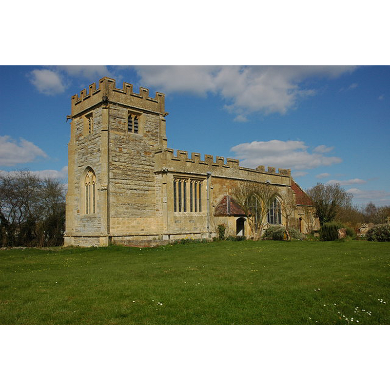
Image copyright © Philip Halling, 2009
CC-BY-SA-2.0
Results: 4 records
view of church exterior - southwest view
Copyright Statement: Image copyright © Philip Halling, 2009
Image Source: digital photograph taken 29 March 2009 by Philip Halling [www.geograph.org.uk/photo/1227240] [accessed 15 January 2015]
Copyright Instructions: CC-BY-SA-2.0
view of church exterior - southeast view
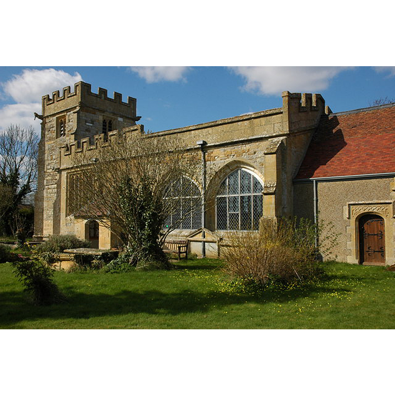
Copyright Statement: Image copyright © Philip Halling, 2009
Image Source: digital photograph taken 29 March 2009 by Philip Halling [www.geograph.org.uk/photo/1228075] [accessed 15 January 2015]
Copyright Instructions: CC-BY-SA-2.0
view of church interior - nave - looking west
![the modern font and cover are visible at the back, right [north] side](/static-50478a99ec6f36a15d6234548c59f63da52304e5/compressed/1150208022_compressed.png)
Scene Description: the modern font and cover are visible at the back, right [north] side
Copyright Statement: Image copyright © Philip Halling, 2009
Image Source: digital photograph taken 29 March 2009 by Philip Halling [www.geograph.org.uk/photo/1228134] [accessed 15 January 2015]
Copyright Instructions: CC-BY-SA-2.0
view of church interior - nave - looking east
![the modern font and cover are visible in the foreground, left [north] side](/static-50478a99ec6f36a15d6234548c59f63da52304e5/compressed/1150208021_compressed.png)
Scene Description: the modern font and cover are visible in the foreground, left [north] side
Copyright Statement: Image copyright © Philip Halling, 2009
Image Source: digital photograph taken 29 March 2009 by Philip Halling [www.geograph.org.uk/photo/1228096] [accessed 15 January 2015]
Copyright Instructions: CC-BY-SA-2.0
INFORMATION
Font ID: 19664WES
Object Type: Baptismal Font1?
Font Century and Period/Style: 13th century, Early English
Church / Chapel Name: Parish Church of All Saints
Church Patron Saint(s): All Saints
Church Address: Weston-on-Avon, Warwickshire, CV37 8JY
Site Location: Warwickshire, West Midlands, England, United Kingdom
Directions to Site: Located near Welford-on-Avon and Luddington, 5 km SW of Stratford-upon-Avon
Ecclesiastic Region: Diocese of Gloucester
Historical Region: formerly in Gloucestershire
Additional Comments: disappeared font? (the one from the 13thC church here?)
Font Notes:
Click to view
Weston[-on-Avon] appears in the Domesday survey [variant spelling] [www.domesdaybook.co.uk/warwickshire3.html#westononavon] [accessed 15 January 2015]. The Vicvtoria County History (Warwick, vol. 5, 1949) notes: "The early history of the church of Weston-upon-Avon does not appear to be recorded; but by 1290 it was in the gift of the Bishop of Worcester, who in that year tried to make it a prebend of the Collegiate Church of Westbury. [...] The church dates from the late 15th century but the chancel is not of one build with the nave and may be a little later. [...] The church was restored in 1899. [...] The font is modern." The octagonal font, located at the southwest corner of the nave, is probably dated to the late-19th century re-building of the church.
COORDINATES
UTM: 30U 583804 5779715
Latitude & Longitude (Decimal): 52.16156, -1.77483
Latitude & Longitude (DMS): 52° 9′ 41.62″ N, 1° 46′ 29.39″ W
REFERENCES
- Victoria County History [online], University of London, 1993-. URL: https://www.british-history.ac.uk.