Newbold Pacey / Niwebola
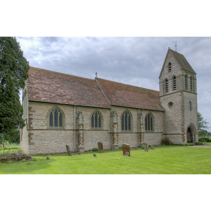
Image copyright © David P Howard, 2014
CC-BY-SA-2.0
Results: 3 records
view of church exterior - northeast view
Copyright Statement: Image copyright © David P Howard, 2014
Image Source: digital photograph taken 6 June 2014 by David P Howard [www.geograph.org.uk/photo/4017812] [accessed 12 January 2015]
Copyright Instructions: CC-BY-SA-2.0
view of church exterior - northwest view
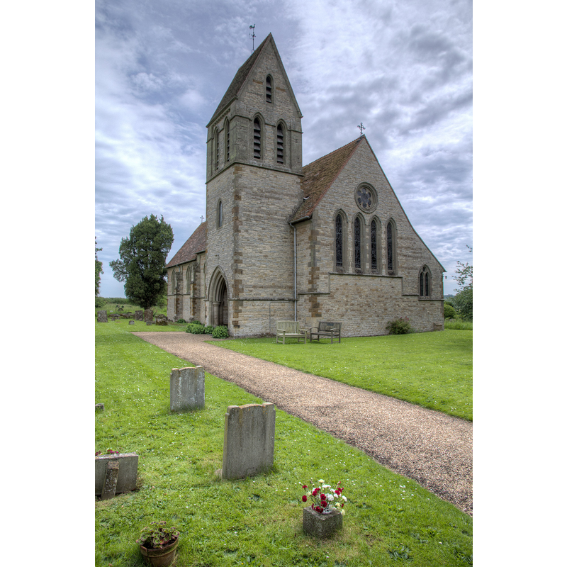
Copyright Statement: Image copyright © David P Howard, 2014
Image Source: digital photograph taken 6 June 2014 by David P Howard [www.geograph.org.uk/photo/4017851] [accessed 12 January 2015]
Copyright Instructions: CC-BY-SA-2.0
view of font and cover

Scene Description: the modern font and cover
Copyright Statement: Image copyright © Mike Cox, 2011
Image Source: digital photograph taken 26 June 2011 by Mike Cox [www.flickr.com/photos/24130425@N07/5885661365/] [accessed 12 January 2015]
Copyright Instructions: PERMISSION NOT AVAILABLE -- IMAGE NOT FOR PUBLIC USE
INFORMATION
Font ID: 19659PAC
Object Type: Baptismal Font1
Font Century and Period/Style: 11th - 12th century, Norman
Church / Chapel Name: Parish Church of St. George the Martyr
Church Patron Saint(s): St. George
Church Address: Newbold Pacey, Warwickshire CV35 9DP
Site Location: Warwickshire, West Midlands, England, United Kingdom
Directions to Site: Located off the A429
Ecclesiastic Region: Diocese of Coventry
Historical Region: Hundred of Tremlowe [in Domesday]
Additional Comments: disappeared font? (the one from the soon-after-Domesday church here)
Font Notes:
Click to view
There is an entry for Newbold [Pacey] [variant spelling] in the Domesday survey [http://domesdaymap.co.uk/place/SP2957/newbold-pacey/] [accessed 12 January 2015], but it mentions neither cleric nor church in it. The Victoria County History (Warwick, vol. 5, 1949) notes: "The church of Newbold was given to the Yorkshire Priory of St. Oswald of Nostell by Eytrop, son of the Domesday tenant Humphrey [i.e., Humphrey Hastang], and confirmed by his son Eytrop. [...] The church was entirely rebuilt in 1881–2 in the 13th-century style by Mr. J. L. Pearson, who, however, saved two late-12th-century doorways and reset them. The former south and more elaborate doorway is now on the north side [...] The south doorway is a much plainer feature but unusually treated. [...] The font and other furniture are modern." English Heritage [Listing NGR: SP2989157138] (1967) described the modern font here: "font has octagonal bowl on stop-chamfered square pier with 4 squat free-standing shafts".
COORDINATES
UTM: 30U 598096 5785553
Latitude & Longitude (Decimal): 52.211675, -1.564263
Latitude & Longitude (DMS): 52° 12′ 42.03″ N, 1° 33′ 51.35″ W
REFERENCES
- Victoria County History [online], University of London, 1993-. URL: https://www.british-history.ac.uk.