Moreton Morrell / Mortone
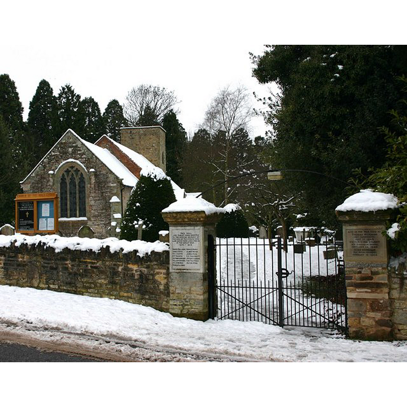
Image copyright © David P Howard, 2010
CC-BY-SA-2.0
Results: 1 records
view of church exterior - northeast view
Copyright Statement: Image copyright © David P Howard, 2010
Image Source: digital photograph taken 10 January 2010 by David P Howard [www.geograph.org.uk/photo/1656980] [accessed 8 January 2015]
Copyright Instructions: CC-BY-SA-2.0
INFORMATION
Font ID: 19635MOR
Object Type: Baptismal Font1?
Font Century and Period/Style: 11th century, Pre-Conquest? / Norman
Church / Chapel Name: Parish Church of the Holy Cross
Church Patron Saint(s): The Holy Cross
Church Address: Moreton Morrell, Warwickshire CV35 9AL
Site Location: Warwickshire, West Midlands, England, United Kingdom
Directions to Site: Located 5 km W of Keniton
Ecclesiastic Region: Diocese of Coventry
Historical Region: Hundred of Tremlowe [in Domesday] -- Hundred of Kington
Additional Comments: disappeared font? (the one from the Domesday-time church here)
Font Notes:
Click to view
There is an entry for Moreton [Morrell] [variant spelling] in the Domesday survey [http://domesdaymap.co.uk/place/SP3155/moreton-morrell/] [accessed 8 January 2015]; it mentions a priest, but not a church in it, though there probably was one there. The Victoria County History (Warwick, vol. 5, 1949) notes; "There was a priest, and therefore a church, at Moreton in 1086, [...] and when the vill was divided between the Earls of Warwick and Leicester the church was also divided, so that in 1291 it was said to be worth £10, equally divided between two rectors. [...] The parish church [...] dates from the 13th century, but it is possible that the nave, from its proportions and thick walls (over 3 ft.), is of the 12th century. No details of this date remain, but reset in the north wall of the tower is the head of a small 12th-century window which may have been moved from the west wall of the nave. [...] The font is modern." English Heritage [[Listing NGR: SP3105555612] (1967) reports a "C19 font on panelled octagonal shaft" in this church. The modern font consists of a ridiculously small basin with moulded sides raised on a slender pedestal base, a moulded splaying lower base and a plinth; all parts octagonal. Wooden cover probably of the same period.
COORDINATES
UTM: 30U 599317 5784050
Latitude & Longitude (Decimal): 52.197944, -1.54684
Latitude & Longitude (DMS): 52° 11′ 52.6″ N, 1° 32′ 48.62″ W
REFERENCES
- Victoria County History [online], University of London, 1993-. URL: https://www.british-history.ac.uk.