Avon Dassett / Derceto
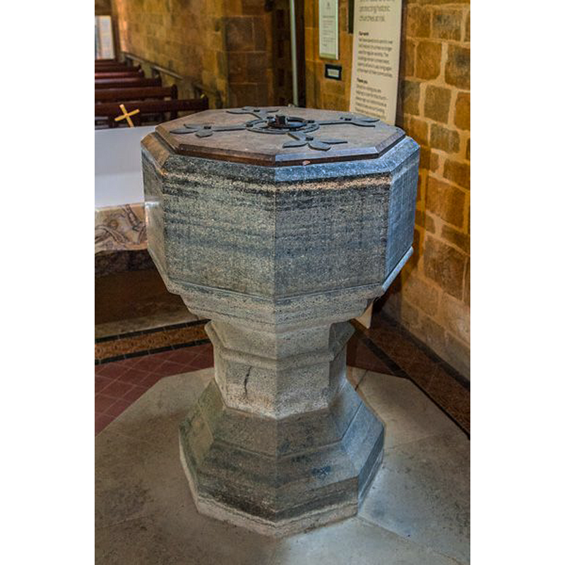
Image copyright © David Ross & Britain Express Ltd, 2015
Standing permission
Results: 3 records
view of font and cover
Scene Description: the modern font and cover; mid-19thC?
Copyright Statement: Image copyright © David Ross & Britain Express Ltd, 2015
Image Source: digital photograph taken by David Ross [www.britainexpress.com/attractions.htm?attraction=4190] [accessed 7 January 2015]
Copyright Instructions: Standing permission
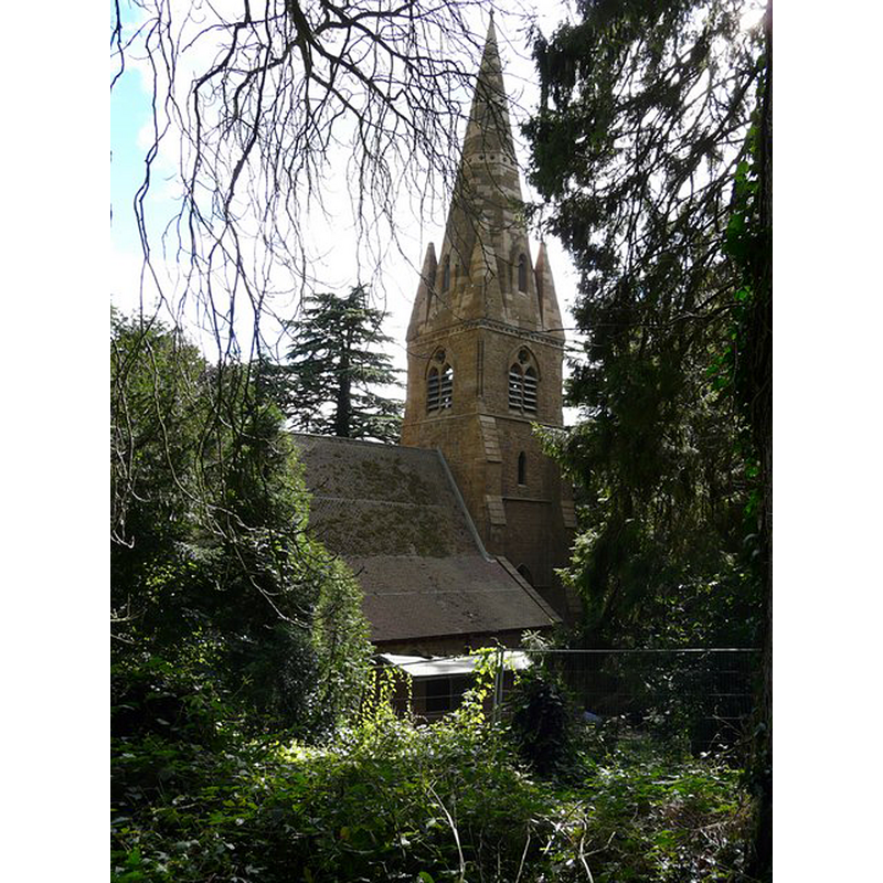
view of church exterior in context
Copyright Statement: Image copyright © Graham Taylor, 2008
Image Source: digital photograph taken 2 August 2008 by Graham Taylor [www.geograph.org.uk/photo/908789] [accessed 7 January 2015]
Copyright Instructions: CC-BY-SA-2.0
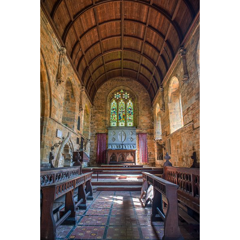
view of church interior - chancel and east end
Copyright Statement: Image copyright © David Ross & Britain Express Ltd, 2015
Image Source: digital photograph taken by David Ross [www.britainexpress.com/attractions.htm?attraction=4190] [accessed 7 January 2015]
Copyright Instructions: Standing permission
INFORMATION
Font ID: 19628DAS
Object Type: Baptismal Font1?
Font Century and Period/Style: 11th century, Pre-Conquest? / Norman
Church / Chapel Name: Parish Church of St. John the Baptist [redundant]
Font Location in Church: [disappeared]
Church Patron Saint(s): St. John the Baptist
Church Notes: original church here by 1086; Norman building replaced 1868; church made redundant May 1983; in the care of the Churches Conservation Trust
Church Address: Avon Dassett, Warwickshire CV47 2AP
Site Location: Warwickshire, West Midlands, England, United Kingdom
Directions to Site: Located off the B4100, 20 km NW of Banbury
Historical Region: Hundred of Hunesberi [in Domesday] -- Hundred of Kington
Additional Comments: disappeared font? (the one from the Domesday-time church here)
Font Notes:
Click to view
There is an entry for [Avon] Dassett [variant spelling] in the Domesday survey [http://domesdaymap.co.uk/place/SP4150/avon-dassett/] [accessed 7 January 2015], and it reports a priest, but not a church in it, though there probably was one there. The Victoria County History (Warwick, vol. 5, 1949) notes: "The Domesday Survey mentions a priest, implying a church, at Avon Dassett [...] The old church having become dilapidated was pulled down and rebuilt in 1868. Only a small portion of the ancient material was re-used. [...] The font, of grey marble, and other furniture are modern." The present font appears to be made of 'Purbeck marble', a type of limestone; it consists of an octagonal basin with chamfered top and moulded underbowl, raised on a moulded pedestal base, also octagonal, and a splaying lower base of the same shape. Wooden font cover, probably contemporary [i.e., mid-19thC], octagonal and flat, with metal decoration and ring handle.
Credit and Acknowledgements: We are grateful to David Ross [www.britainexpress.com] for his photographs of church and modern font
COORDINATES
UTM: 30U 609348 5778537
Latitude & Longitude (Decimal): 52.1465, -1.4019
Latitude & Longitude (DMS): 52° 8′ 47.4″ N, 1° 24′ 6.84″ W
REFERENCES
- Victoria County History [online], University of London, 1993-. URL: https://www.british-history.ac.uk.